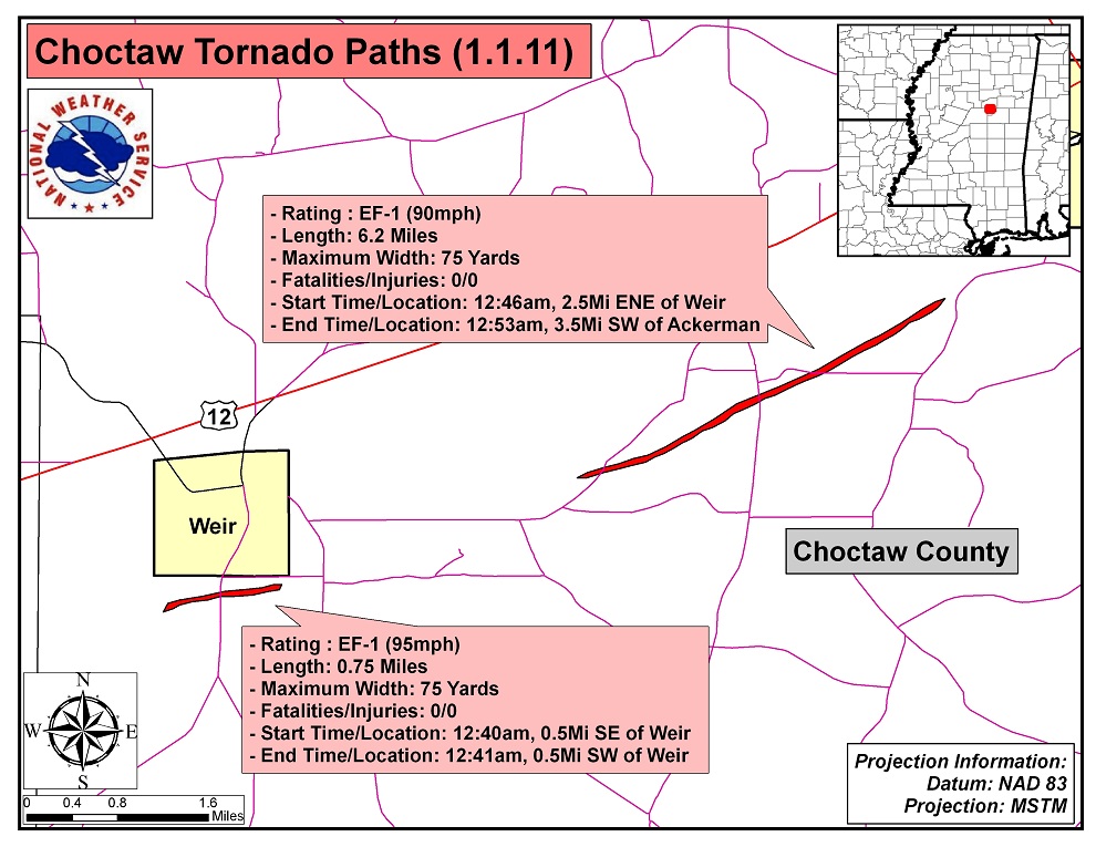
New Year's Day 2011 Choctaw County Tornadoes

|
Event Summary for Tornado Number 1 The tornado developed just southwest of Weir and impacted the south parts of the community. The first observed damage was several large pines snapped in the yard of a house. A tree fell on the house and significant roof damage occurred. The tornado continued northeast, snapping and uprooting several more pine trees. As it crossed Main Street, along with tree damage it also blew the skirting off a mobile home, and caused shingle and other minor roof damage to a church. The tornado then crossed Highway 407, and just east of the highway it caused shingle, skirting, and other minor wind damage to a mobile home, blew the roof off a shed, and snapped several hardwood trees. The tornado dissipated just northeast of this location. |
|
|
Event Summary for Tornado Number 2 This tornado snapped and uprooted a number of pine trees along a narrow path. A couple of small outbuildings also had some roof damage. |
|