Jackson, Mississippi
Weather Forecast Office
Damage Survey from Jones Counties
 |
Location: Jones County
Time of Event: 2:43 to 2:56 am, 03/26/09
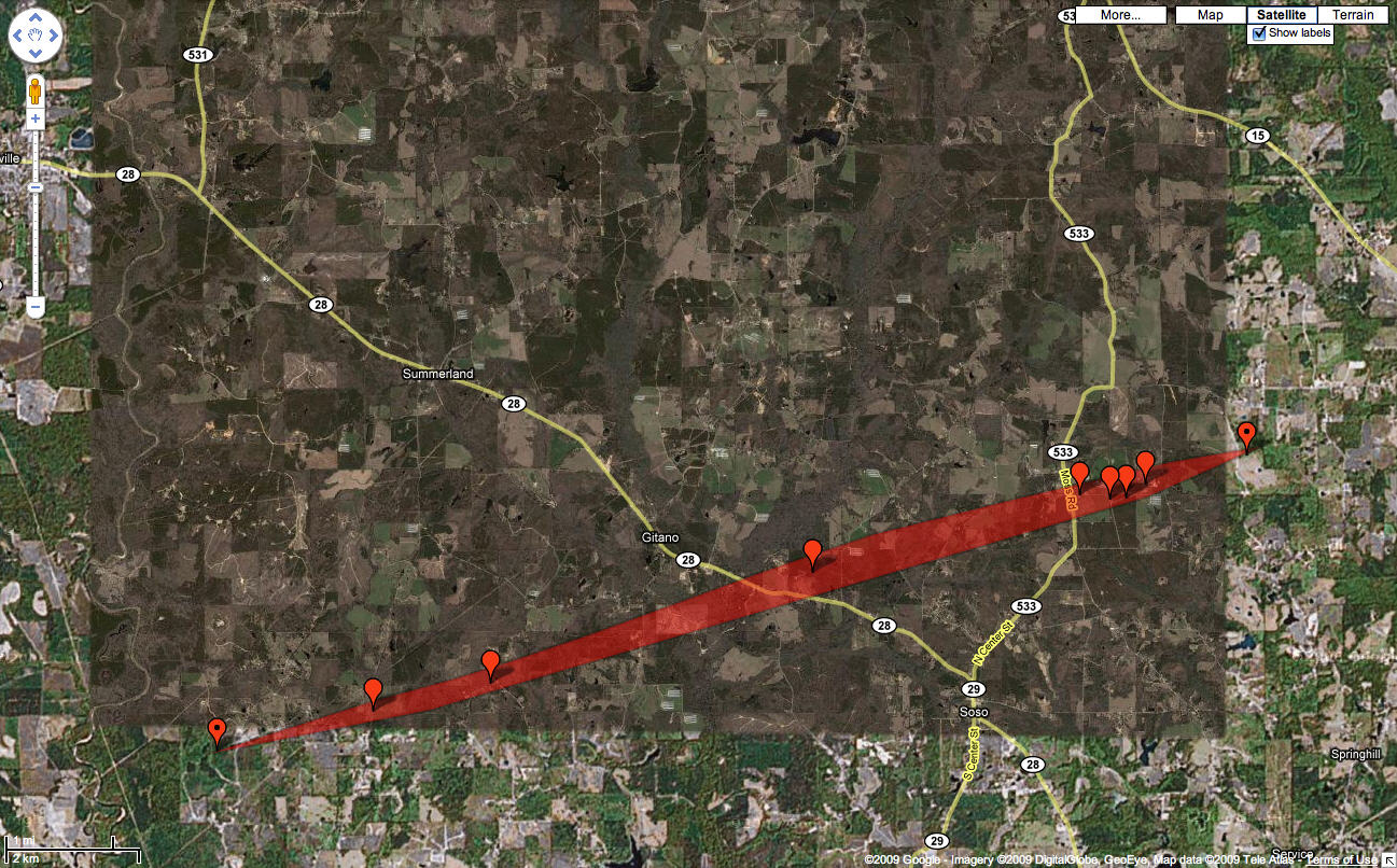
Beginning Point: 6.1 W of Soso
Ending Point: 3 NE of Soso
Rating: EF2, maximum winds of 125 mph
Path Length: 9 miles
Maximum Width: 500 yards
Fatalities: 0
Injuries: 1
Summary of Damages: This tornado touched down along Mason Creek Rd about 6 miles W of Soso. Several trees were snapped and uprooted and some minor roof damage occurred to a few homes. The tornado intensified as it crossed Summerland Rd. Here the tornado widened to 500 yds and reached peak intensity, especially within a narrow corridor which lasted about ¾ of a mile. One well constructed home suffered major damage with half of the roof torn off and other wall sections of that side the house ripped out and thrown into the back yard. Two well built storage buildings were destroyed with the contents thrown into a field. Additionally, a weekly built bard was destroyed with tin thrown along the path. Numerous trees were snapped/uprooted in this area with splintered trees within the most intense core. One large tree in this location was uprooted and actually thrown and rolled a small distance. The tornado continued to track just E of N across several more roads, including Hwy 28 and 503, uprooting and snapping numerous trees. On the E side of Hwy 28, a mobile home was pushed off its foundation and the person inside was injured. The tornado continued to weaken as it crossed Hwy 503 and damaged more trees and caused minor damage to several mobile homes and heavily damaged a couple sheds.
US Dept of Commerce
National Oceanic and Atmospheric Administration
National Weather Service
Jackson, Mississippi
234 Weather Service Dr.
Flowood, MS 39232
601-936-2189
Comments? Questions? Please Contact Us.

