Jackson, Mississippi
Weather Forecast Office
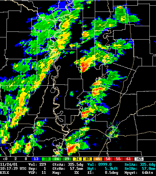
This is an image of a supercell thunderstorm that produced a short-lived F3 tornado in Humphreys County. The storm initiated over northeast Louisiana. The storm tracked northeast and dissipated shortly after producing the tornado. This is a base reflectivity image from the WSR-88D Jackson(KJAN).
US Dept of Commerce
National Oceanic and Atmospheric Administration
National Weather Service
Jackson, Mississippi
234 Weather Service Dr.
Flowood, MS 39232
601-936-2189
Comments? Questions? Please Contact Us.

