Jackson, Mississippi
Weather Forecast Office
|
Humphreys County MS |
|
|
|
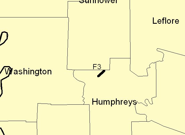
THIS TORNADO DEVELOPED ABOUT 3 MILES SOUTHWEST OF ISOLA IN NORTHERN HUMPHREYS COUNTY AT ABOUT 415 AM. THE TORNADO TRAVELED NORTHEAST... MOVING THROUGH THE TOWN OF ISOLA. SEVERAL HOMES AND BUSINESSES WERE NEARLY DESTROYED...AND MANY OTHER BUILDINGS HAD MAJOR DAMAGE. THE TORNADO THEN DISSIPATED JUST NORTHEAST OF ISOLA AT THE HUMPHREYS... SUNFLOWER COUNTY LINE ABOUT 425 AM. THIS TORNADO WAS ON THE GROUND FOR APPROXIMATELY 5 MILES AND HAD A MAXIMUM PATH WIDTH OF 400 YARDS. THE DAMAGE WAS RATED AS F3 ON THE FUJITA SCALE. |
|
|
Click on map to enlarge
|
|
US Dept of Commerce
National Oceanic and Atmospheric Administration
National Weather Service
Jackson, Mississippi
234 Weather Service Dr.
Flowood, MS 39232
601-936-2189
Comments? Questions? Please Contact Us.