Green Bay, WI
Weather Forecast Office
NOAA Weather Radio-All Hazards
Stations in Northeast and North-Central Wisconsin
(Click towers for specific listening-area information.)
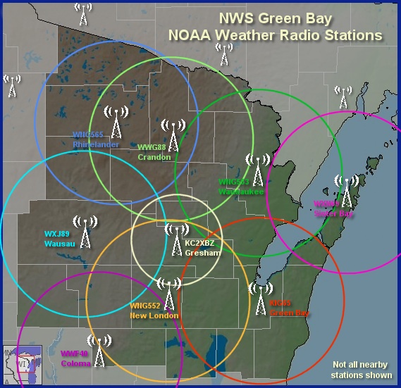
Note: Broadcast range (in circles) is approximate and can vary depending on terrain and weather conditions.
| Area | Station ID | Frequency (MHz) |
| Coloma | WWF40 | 162.400 |
| Crandon | WWG88 | 162.450 |
| Green Bay | KIG65 | 162.550 |
| New London | WNG552 | 162.525 |
| Gresham | KC2XBZ | 162.500 |
| Rhinelander | WNG565 | 162.400 |
| Sister Bay/Door County | WXN69 | 162.425 |
| Wausau | WXJ89 | 162.475 |
| Wausaukee | WNG553 | 162.400 |
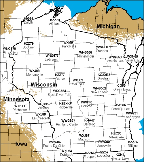
Stations Elsewhere in Wisconsin and Nearby States
(Click map for large view)
US Dept of Commerce
National Oceanic and Atmospheric Administration
National Weather Service
Green Bay, WI
2485 South Point Road
Green Bay, WI 54313-5522
920-494-2363
Comments? Questions? Please Contact Us.

