|
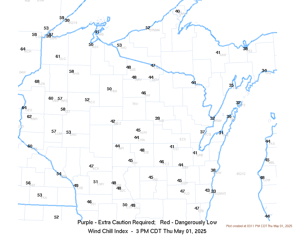
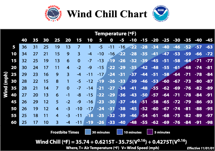
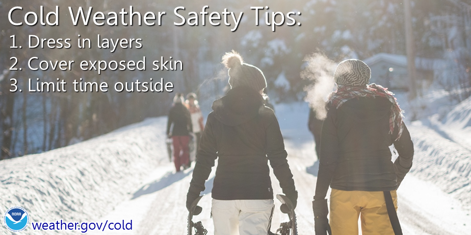
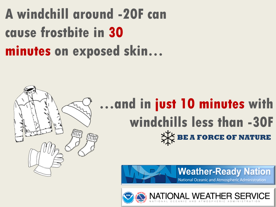
Very Cold Wind Chills Continue Through This Morning When: Through this morning. What: Wind chills between -15 to -30 degrees. Where: All of central and northeast Wisconsin. Impacts: Frost bite can occur in as little as 30 minutes. Actions: Cover exposed skin. Wear several layers of clothing, hat, and gloves. Protect pets from the cold, make sure they have fresh water. Limit time outdoors if possible. Be sure to prepare and dress appropriately for the cold temperatures when headed outside! See tabs below for more information. Click on any image for a larger view. |
|
|
Current Advisories and Warnings |
 |
Temperature / Wind Chill
 |
 |
 |
|
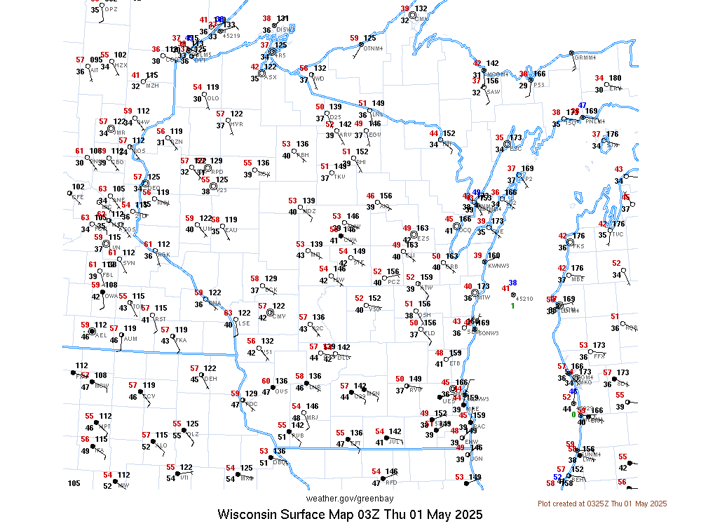
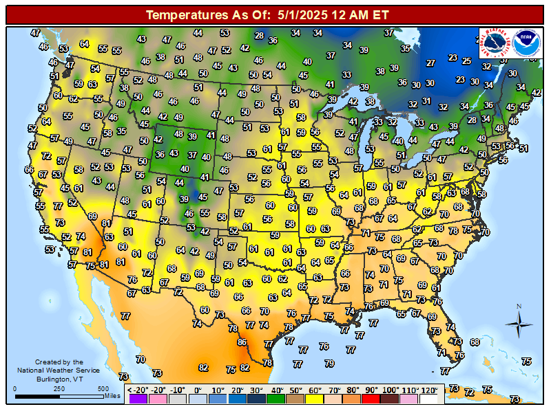
| Current Surface Map | Current Wind Chills | Current Temps Across The U.S. | |
 |
 |
 |
|
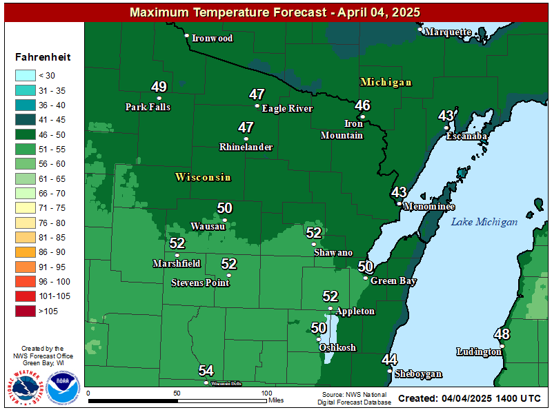
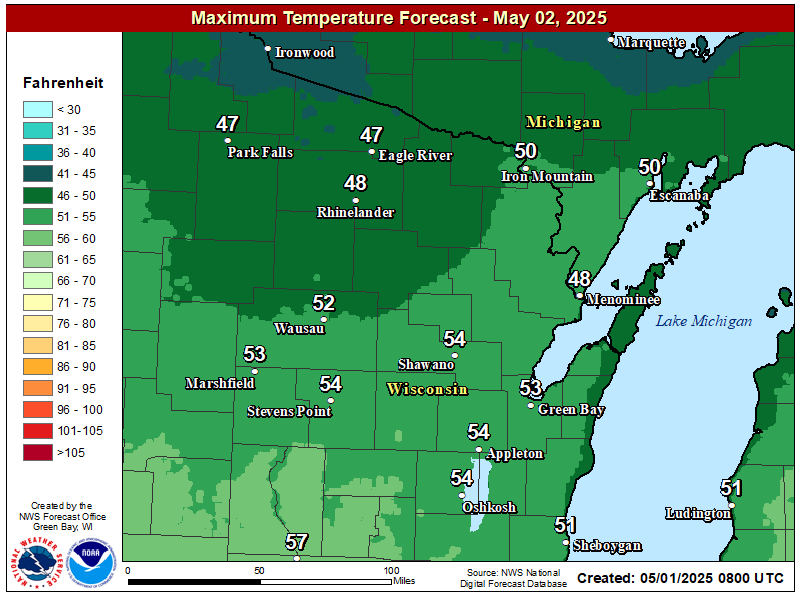
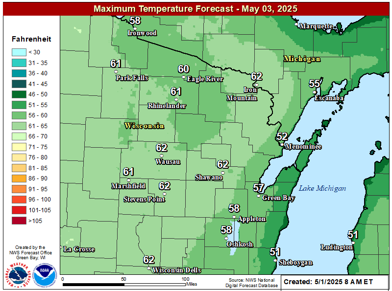
| High Temperature Forecast Day 1 | High Temperature Forecast Day 2 | High Temperature Forecast Day 3 | |
 |
 |
 |
|
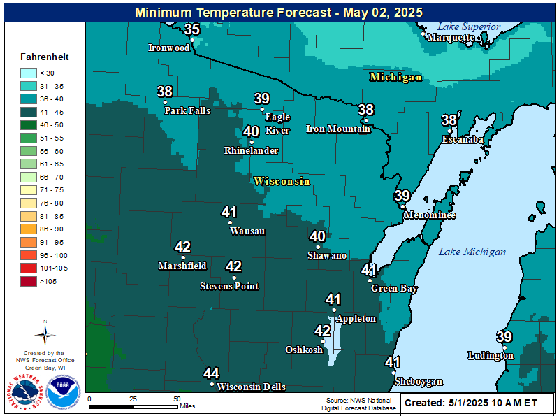
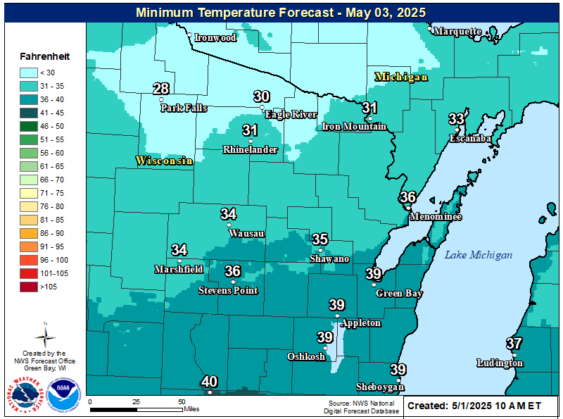
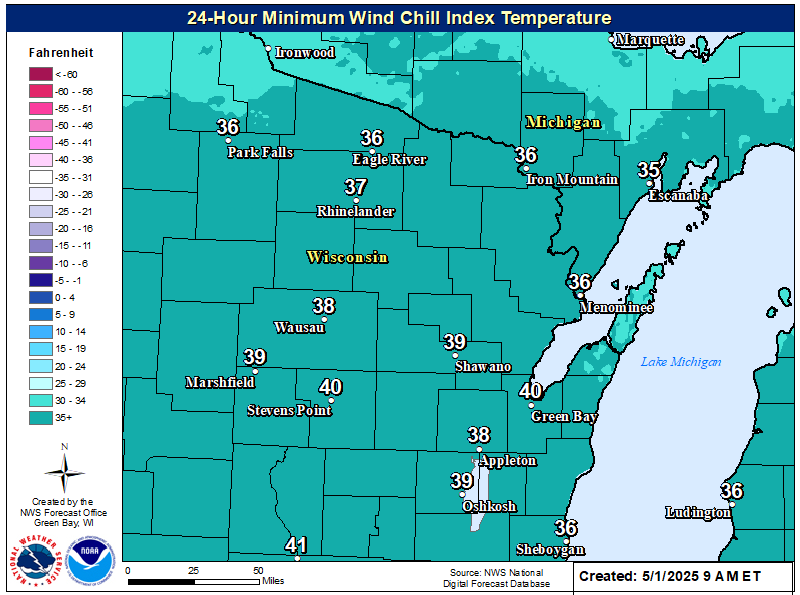
| Low Temperature Forecast Day 1 | Low Temperature Forecast Day 2 | 24-Hour Coldest Wind Chill Forecast |
Wind Chill Chart
Cold Weather Safety Information
| Cold Weather | ||
|
Cold Weather Safety Tips |
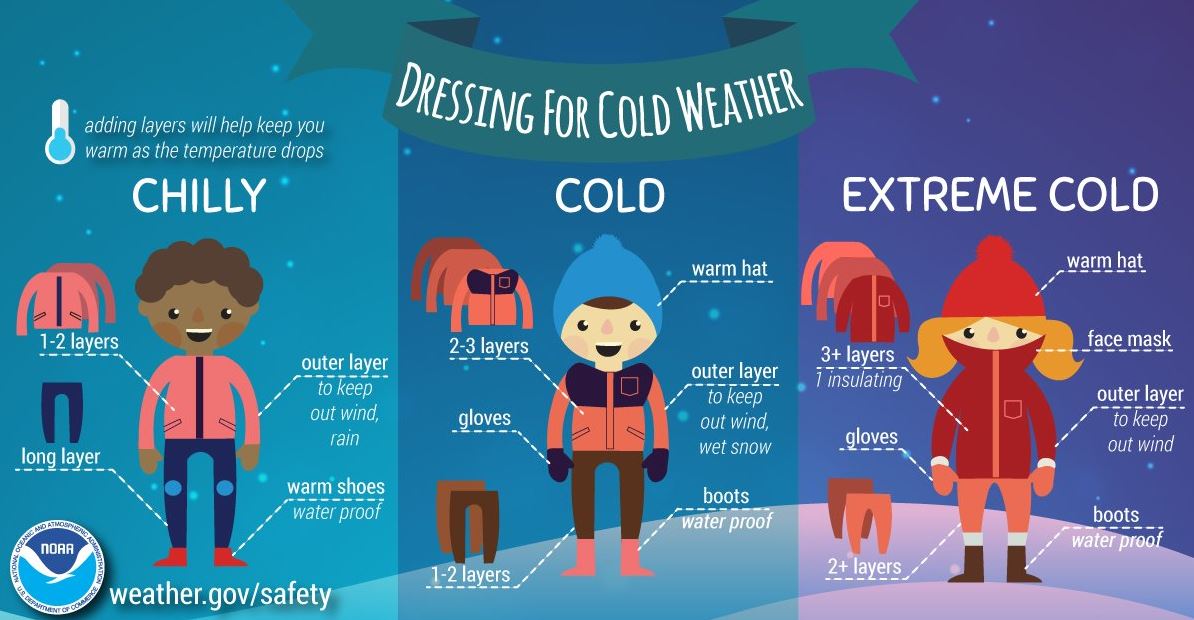
Dressing For Cold Weather |
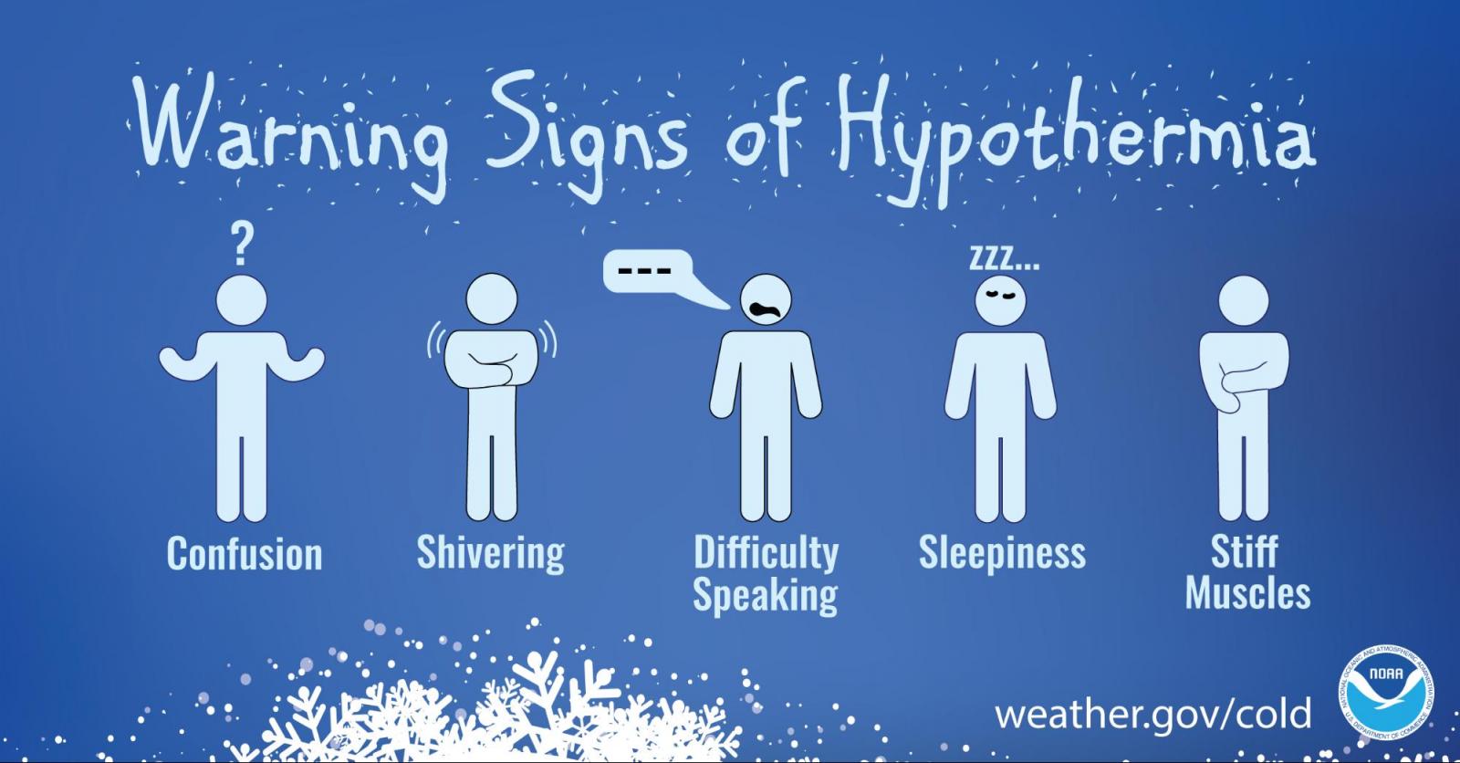
Hypothermia Info |
|
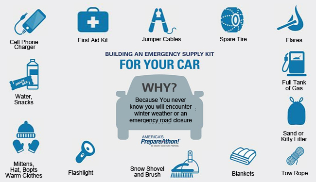
Supply Kit for Your Car |
Wind Chills Facts |
Safety Tips for Your Pets |
 |
Media use of NWS Web News Stories is encouraged! Please acknowledge the NWS as the source of any news information accessed from this site. |
|


.png)