|
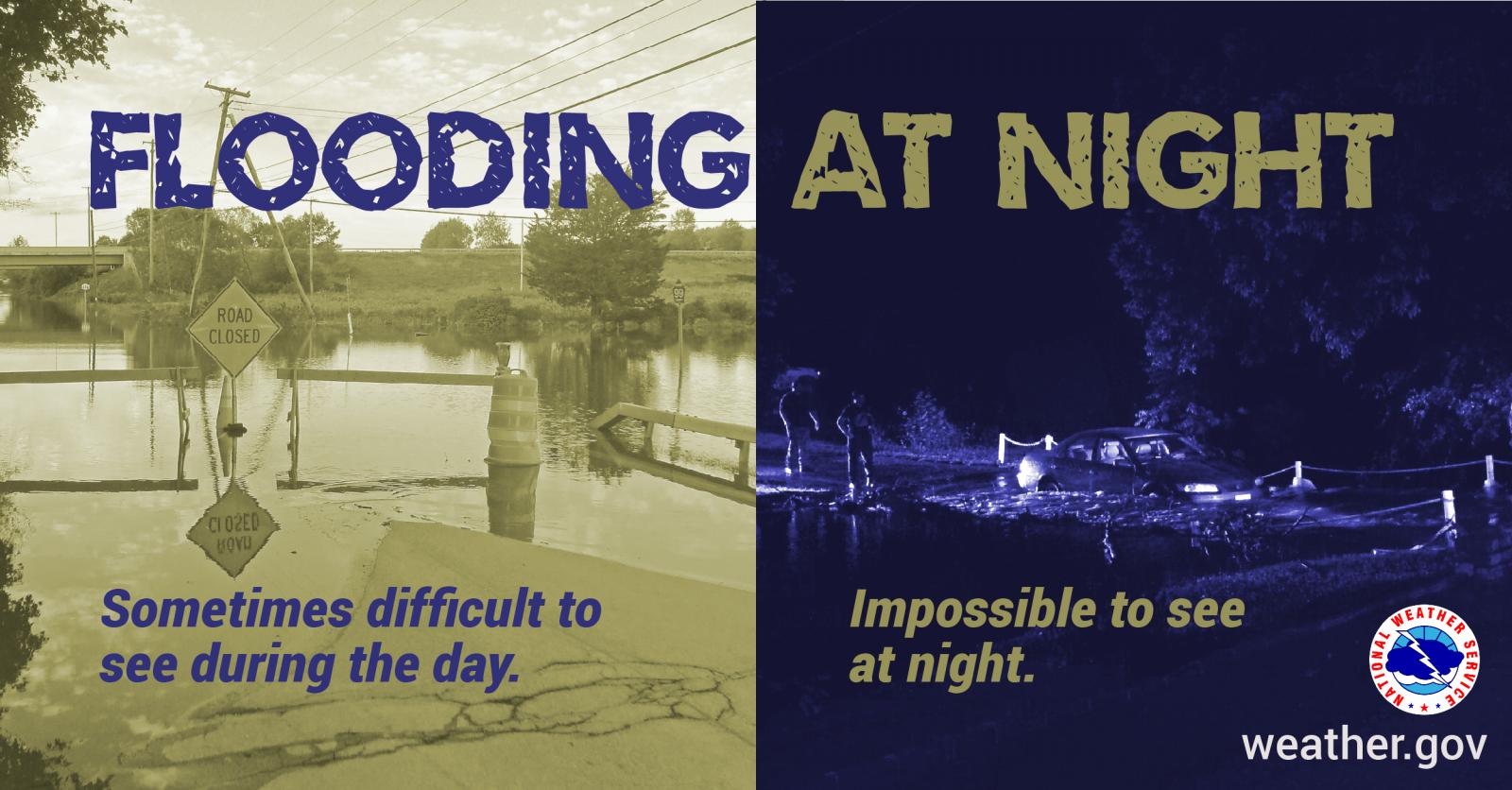
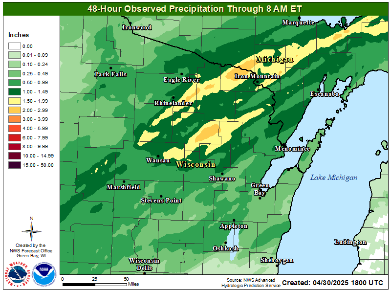
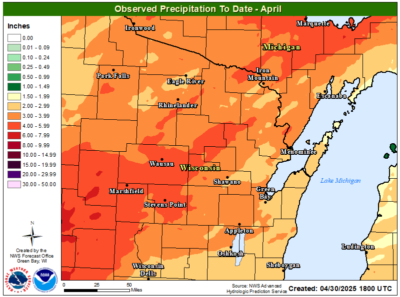
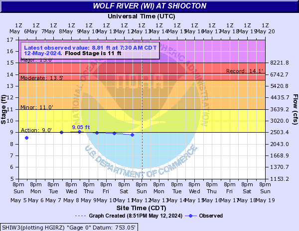
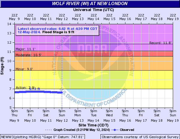
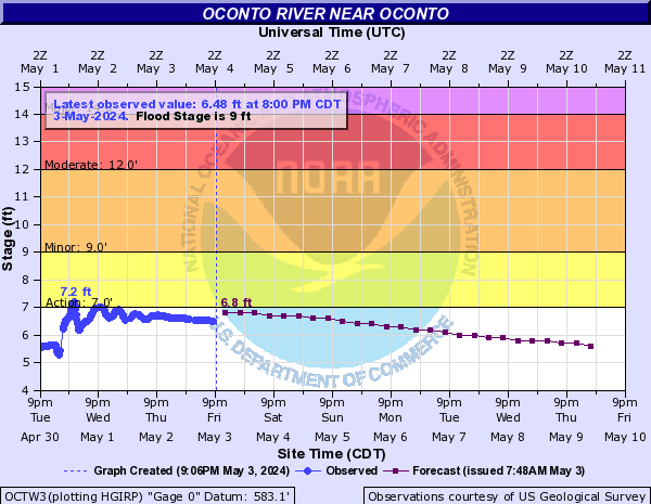
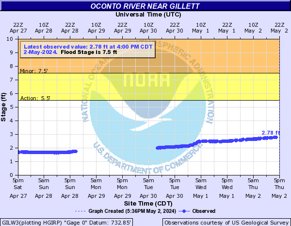
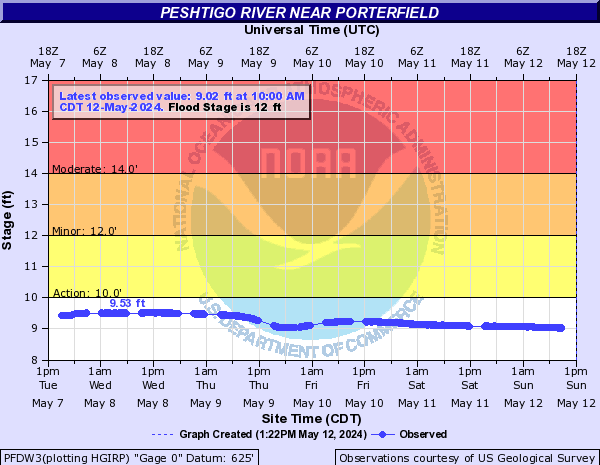
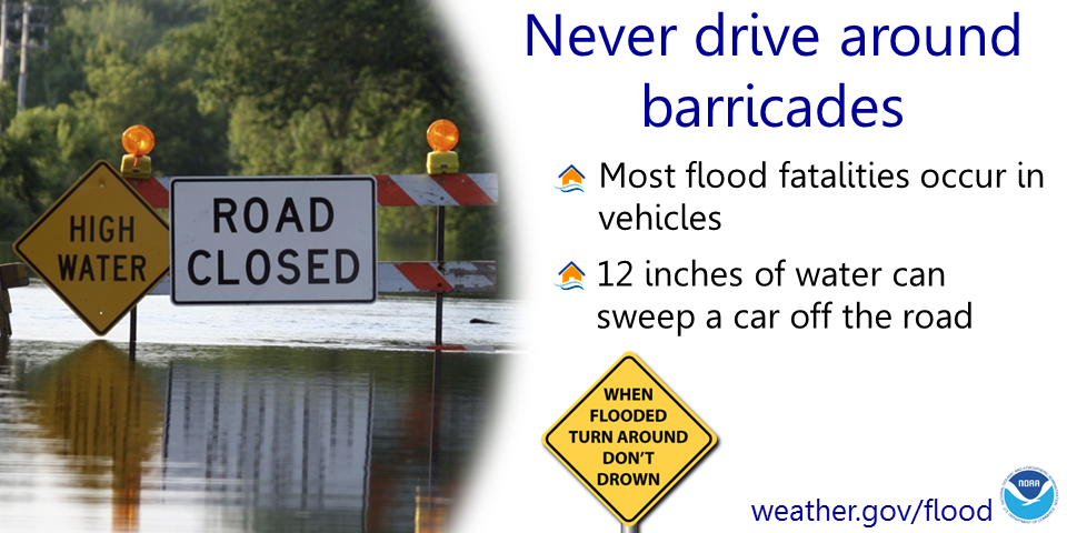
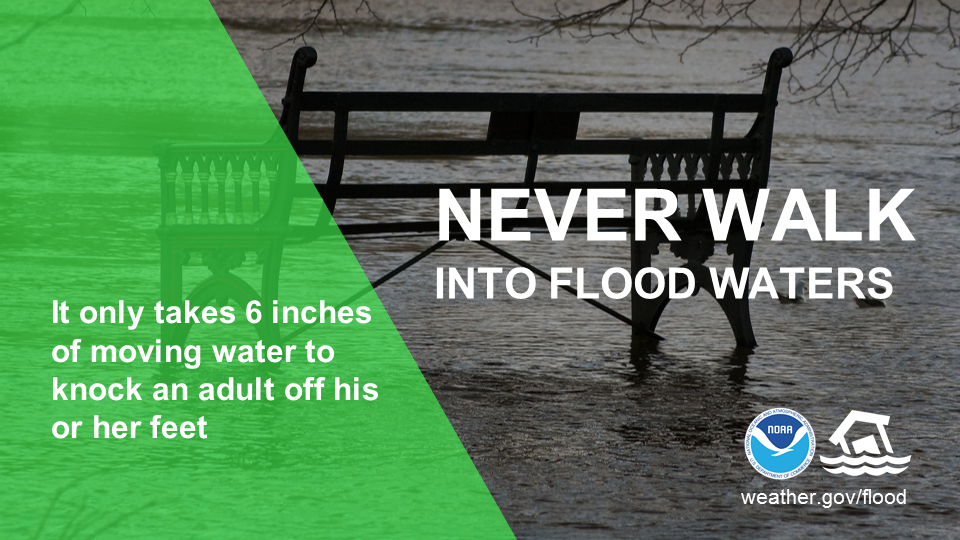
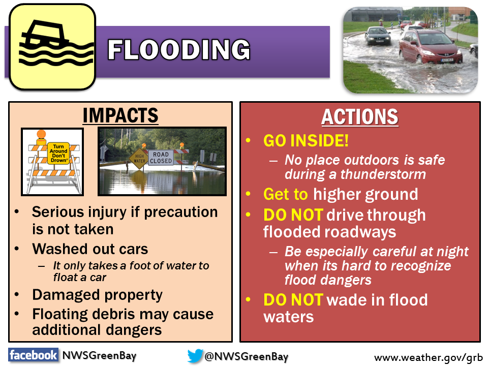
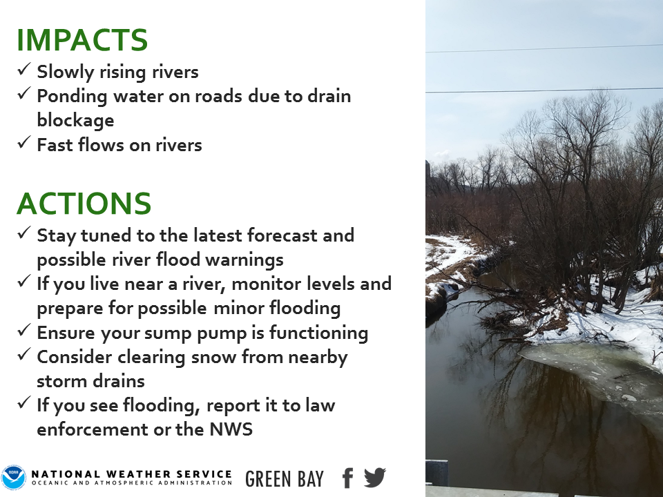
Minor River Flooding, Fast Flows & Low-Land Flooding Continues Rivers and streams in the region are maintaining high levels with fast flows due to recent rain and snow melt. Other low-land flooding is also occurring across much the area. Minor river flooding will continue this weekend and into next week for many locations on the Wisconsin, Wolf, and Menominee rivers. Some other rivers remain above bank full across central and northeast Wisconsin as well. Boaters and fishermen should be aware of hazardous currents on fast-moving rivers. Persons living near rivers and streams should monitor the latest river forecasts and hydrologic statements. Remember to NEVER drive into flooded roadways. Turn around, don't drown! For more information about the current river flood warning locations, click here. Please click on the tabs below for additional information. Click on any image for a larger view. For additional river forecasts, stages, impacts, crests, and other information, please visit our AHPS Website. |
Precipitation
|
|
|
|
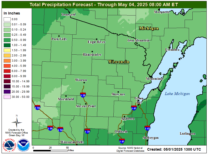 Detailed 3-Day Precipitation Forecast Detailed 3-Day Precipitation Forecast |
 National Day 7-Day Precipitation Outlook National Day 7-Day Precipitation Outlook |
Wolf / Embarrass Rivers
Click on "more info" for information on the river location, flooding impacts, historic crests, and other information.
|
|
|
 Wolf River @ Langlade (more info) Wolf River @ Langlade (more info) |
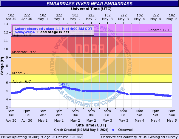 Embarrass River @ Embarrass (more info) Embarrass River @ Embarrass (more info) |
Oconto / Menominee / Peshtigo Rivers
Click on "more info" for information on the river location, flooding impacts, historic crests, and other information.
|
|
|
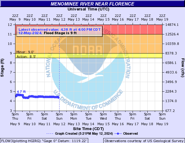 Menominee River @ Florence (more info) Menominee River @ Florence (more info) |
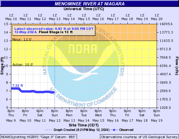 Menominee River @ Niagara (more info) Menominee River @ Niagara (more info) |
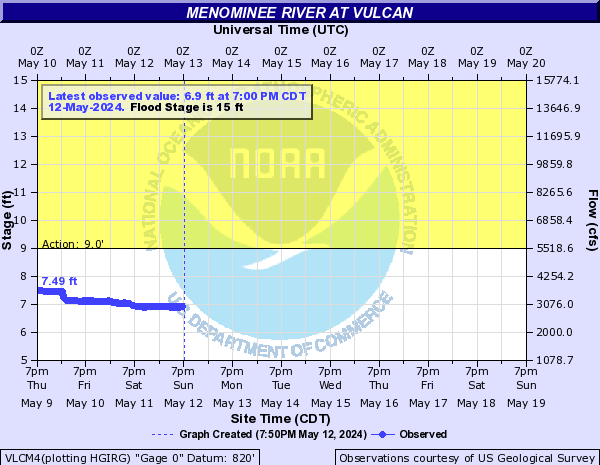 Menominee River @ Vulcan (more info) Menominee River @ Vulcan (more info) |
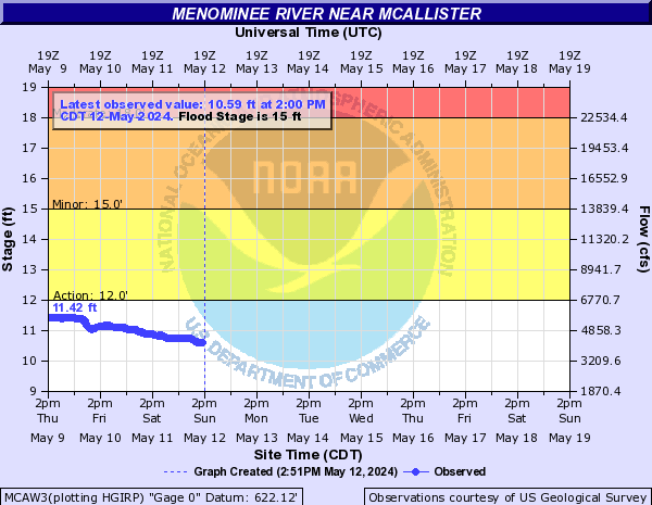 Menominee River @ McAllister (more info) Menominee River @ McAllister (more info) |
|
|
Yellow / Big Eau Pleine Rivers
Click on "more info" for information on the river location, flooding impacts, historic crests, and other information.
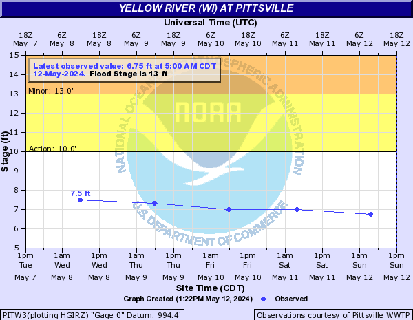 Yellow River @ Pittsville (more info) Yellow River @ Pittsville (more info) |
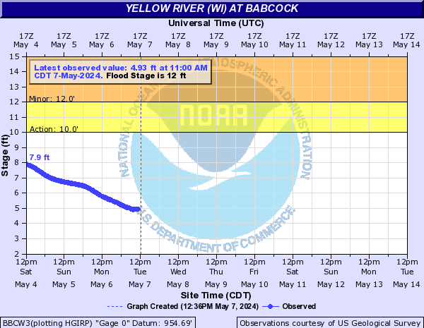 Yellow River @ Babcock (more info) Yellow River @ Babcock (more info) |
Wisconsin River
Click on "more info" for information on the river location, flooding impacts, historic crests, and other information.
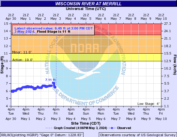 Wisconsin River @ Merrill (more info) Wisconsin River @ Merrill (more info) |
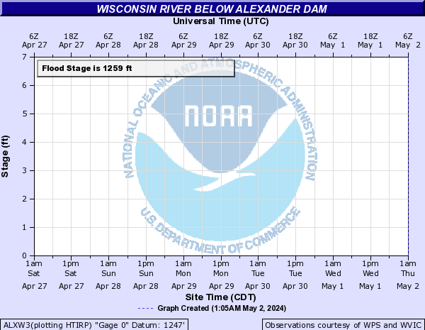 Wisconsin River below Alexander Dam (more info) Wisconsin River below Alexander Dam (more info) |
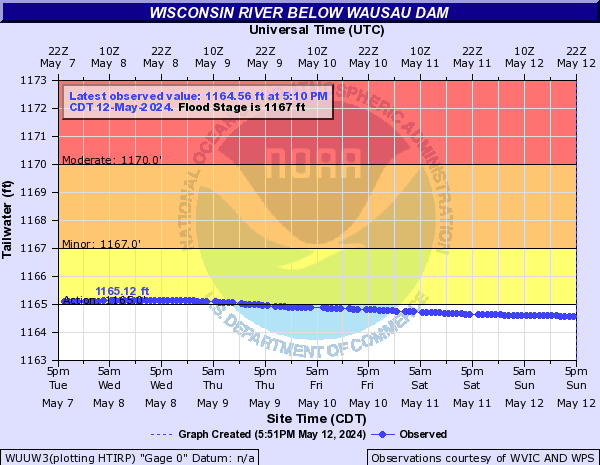 Wisconsin River below Wausau Dam (more info) Wisconsin River below Wausau Dam (more info) |
|
 Wisconsin River below Stevens Point Dam (more info) Wisconsin River below Stevens Point Dam (more info) |
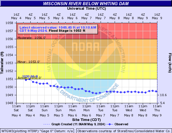 Wisconsin River below Whiting Dam (more info) Wisconsin River below Whiting Dam (more info) |
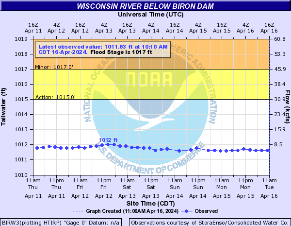 Wisconsin River below Biron Dam (more info) Wisconsin River below Biron Dam (more info) |
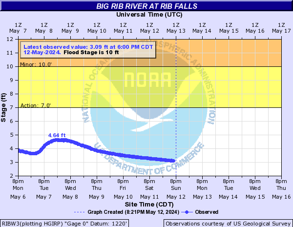 Big Rib River @ Rib Falls (more info) Big Rib River @ Rib Falls (more info) |
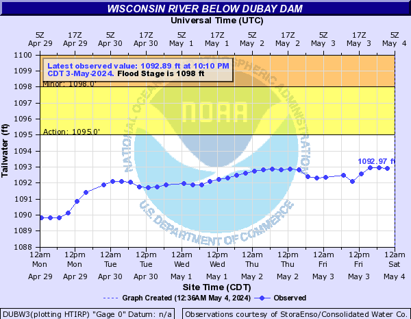 Wisconsin River below Du Bay Dam (more info) Wisconsin River below Du Bay Dam (more info) |
 |
Media use of NWS Web News Stories is encouraged! Please acknowledge the NWS as the source of any news information accessed from this site. |
|