The Blizzard and Winter Storm of December 11-12, 2010
Last updated 12/14/10 1 pm
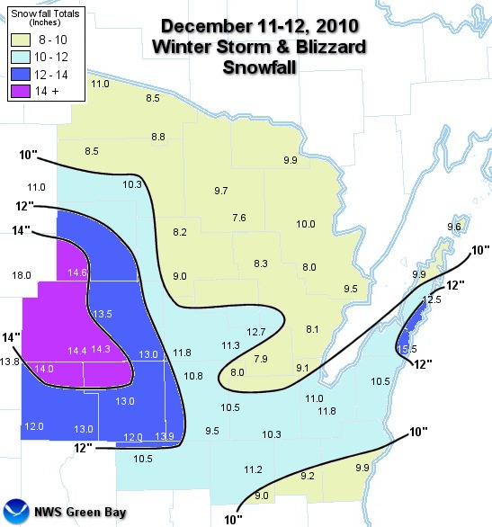
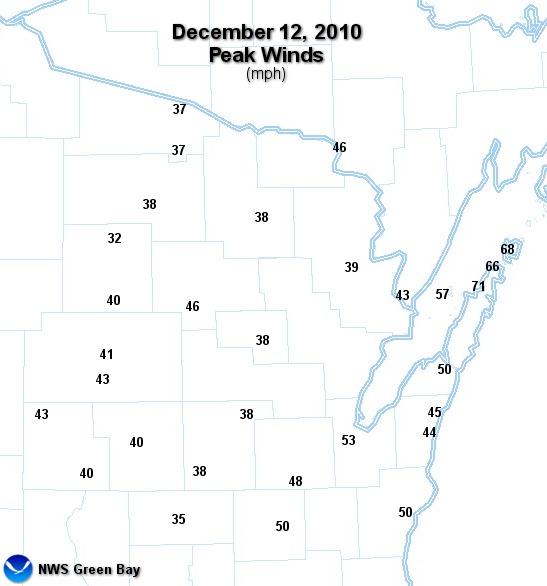
A strong winter storm produced heavy snow and blizzard conditions across parts of Wisconsin and Minnesota on December 11-12, 2010. A widespread snowfall of 8 to 14 inches along with frequent wind gusts over 40 mph affected much of northeast and central Wisconsin. Thundersnow was even reported at several location in east-central Wisconsin at the height of the storm. Click here for a list of snowfall reports across the area.
At least one death was attributed to the storm in the area. A male died of hypothermia near Marshfield early on December 12 after leaving his stuck vehicle to get help.
The snow developed as low pressure moved from Wyoming to southern Lake Michigan. Strong winds, in response to the pressure difference between Arctic high pressure over southern Canada and the low pressure storm system, created severe blowing snow and blizzard conditions across Green Bay, the Fox Valley, and the lake shore counties. The strong winds blew down trees and limbs, resulting in power outages to thousands of homes. Winds gusted well over 60 mph in northern Door County.
The 13.5 inches of snow measured in Wausau places this storm as the biggest December snowstorm ever in that city.
Snowfall and wind gusts (Click image for larger view):
 |
 |
Satellite, Radar, and Weather Maps (Large files--may take a moment to load. Click image for larger view):
Photos from northeast Wisconsin (Click image for larger view):
.
 |
Media use of NWS Web News Stories is encouraged. Please acknowledge the NWS as the source of any news information accessed from this site.
|