The Blizzard of December 08-09, 2009
Last updated 12/20/09 4 pm
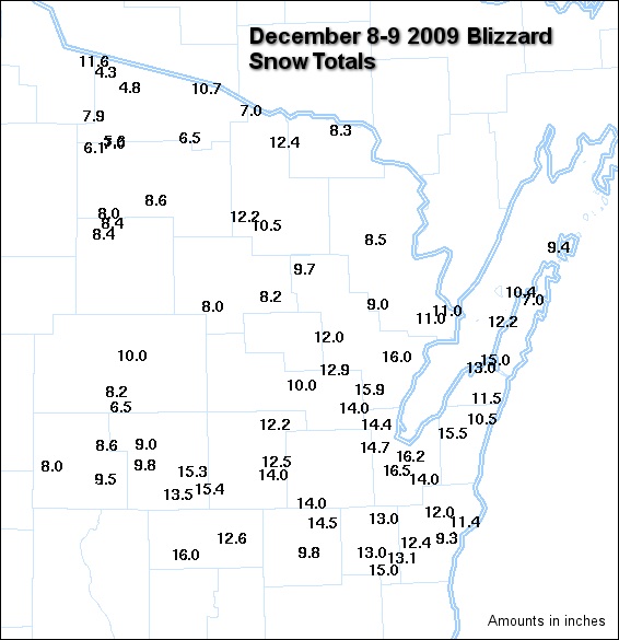
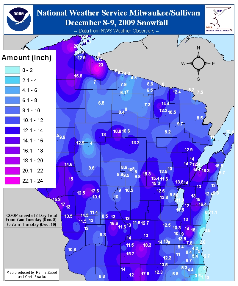
One of the biggest winter storms in years pounded much of Wisconsin, including the northeast part of the state. Widespread snowfalls of 8 to 16 inches were reported across much of northeast, east-central and central Wisconsin. Some of the highest totals included 16.5" in Allouez and Ledgeview (east of De Pere), 16.2" on Green Bay's east side and 15.5" at St. Nazianz in Manitowoc County. Officially, 14.7" fell in Green Bay (NWS office). Click here for a list of snowfall reports across northeast and north-central Wisconsin.
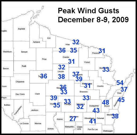
The snow developed as low pressure rapidly deepened as it moved across Illinois into Lake Michigan. Strong winds in response to the deepening low created blowing snow and near blizzard conditions very early Wednesday morning (Dec 9) across parts of northeast Wisconsin. Winds gusted to over 50 mph in Door County, and to 48 mph at the NWS Green Bay office. During the height of the storm, lightning and thunder were reported in the Green Bay area and in central Wisconsin.
The 14.7 inches in Green Bay places this storm in the top 6 biggest snowstorms in Green Bay weather history (observations since 1886), and is the biggest December snowstorm ever.
Snowfall and wind gusts (click image for larger view):
 |
 |
 |
Weather maps and data (may take a moment to load -- click image for larger view):
Satellite image: Before and after (click image for larger view):
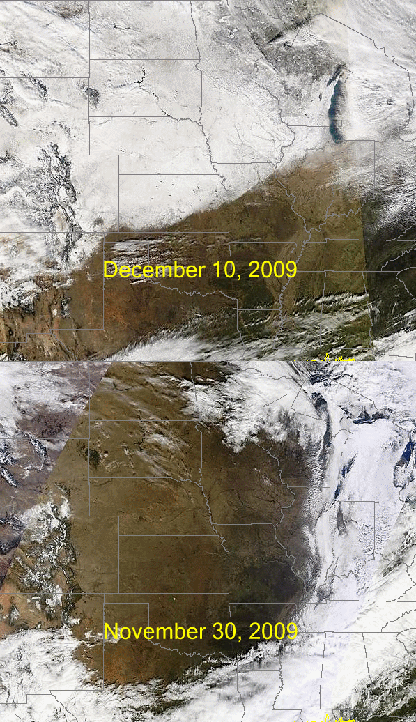 Satellite images showing the extent of the snow pack after the blizzard. The snow-covered ground, extending from Kansas to Wisc., can be easily seen in the Dec 10 image. |
Photos from northeast Wisconsin (click image for larger view):
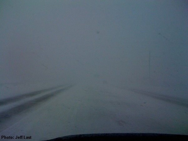 Highway 172 in Green Bay. |
Moving snow in De Pere.
|
|
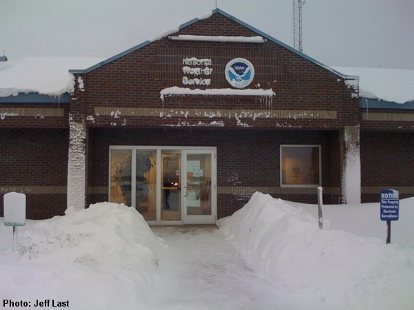 NWS Office in Green Bay. |
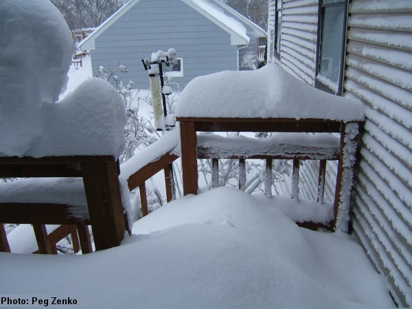 Snowfall in Green Bay. |
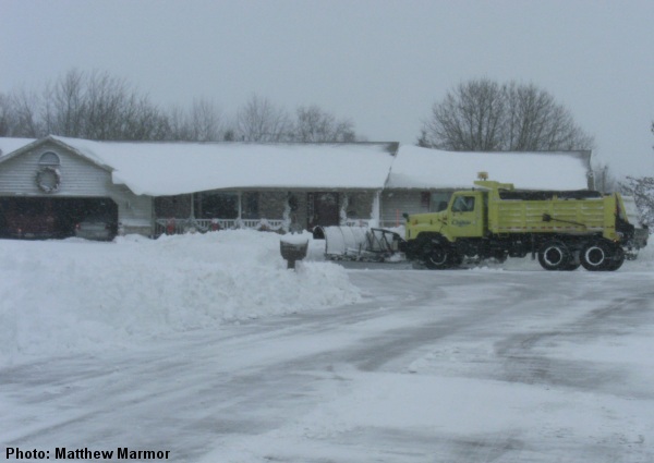 Snow removal near Chilton. |