Green Bay, WI
Weather Forecast Office
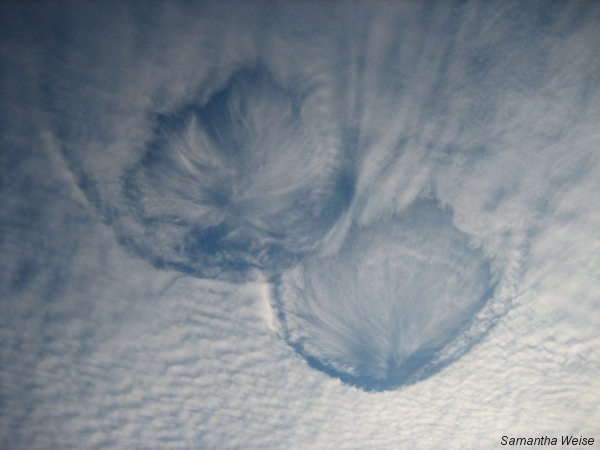
During the afternoon of November 15, 2006, an unusual cloud formation was seen across central Wisconsin. Known as "hole punch clouds," the holes develop as ice crystals above the main cloud layer fall through the clouds, causing the super-cooled water droplets to evaporate. The result is a circular form void of clouds, with a mass of crystals in the center.
The photo below was taken by Samantha Weise in Stevens Point.
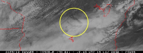
The source of the ice crystals was exhaust from jets. Visible satellite imagery on November 15 (below) showed aircraft dissipation trails (distrails) above central and south-central Wisconsin. Particles in the aircraft exhaust acted as ice nuclei, causing the ice crystals to grow and then fall, creating the punch holes and streaks in the main cloud layer.
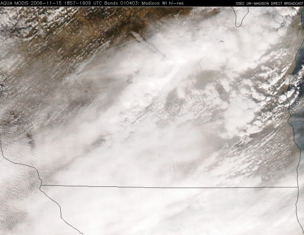
The image below is a high resolution Aqua MODIS true color image centered on Madison, which clearly shows the northwest-southeast oriented distrails. Satellite images courtesy of the SSEC, University of Wisconsin.
US Dept of Commerce
National Oceanic and Atmospheric Administration
National Weather Service
Green Bay, WI
2485 South Point Road
Green Bay, WI 54313-5522
920-494-2363
Comments? Questions? Please Contact Us.

