The October 26-27, 2010 Record Extratropical Cyclone
Last updated 10/28/10
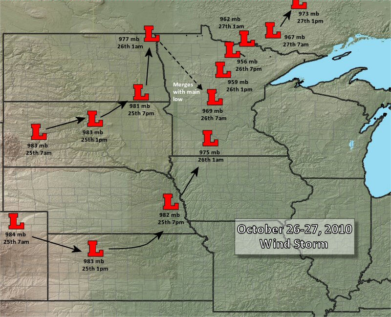
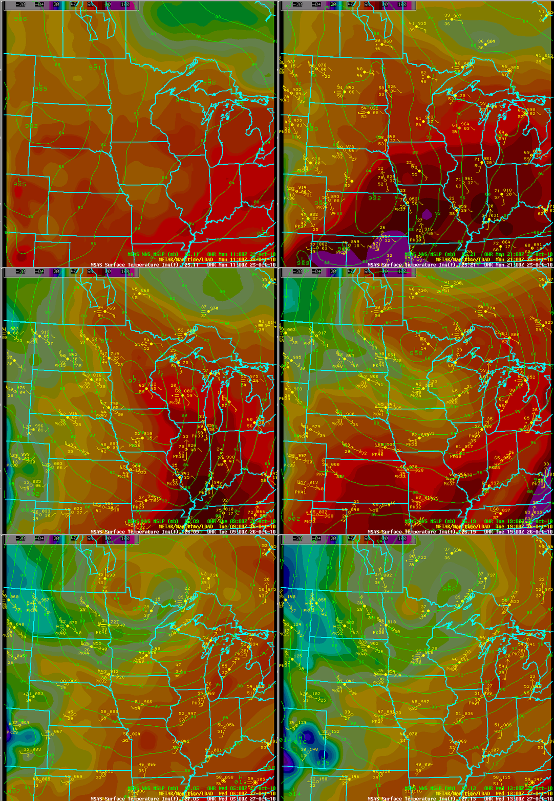
One of the strongest storms in the history of the central U.S. affected the region on October 26-27, 2010, producing wind gusts over 50 mph across much of the Midwest, severe thunderstorms and tornadoes from southeast Wisconsin and northeast Illinois to northern Alabama, and a blizzard over northern Minnesota and North Dakota. As the storm reached peak intensity late during the afternoon on October 26 over Minnesota, the lowest barometric pressure readings ever recorded in the central United States occurred. A reading of 28.21" (955.2 mb) was recorded at Bigfork, MN, a pressure that is found in Category 3 hurricanes!
As the storm moved near Wisconsin, a new state record was set for lowest air pressure. Superior, WI, recorded a pressure of 28.39" (961.3 mb) on October 26. The previous state record was set in Green Bay in April 1982.
 |
 |
| Track of the low pressure center. (Click for full view.) | Animated track of the storm's center, October 25-27. (Click for full view.) |
The intense storm produced wind gusts over 60 mph across Wisconsin on October 26 into early on October 27. Highest gusts across northeast and central Wisconsin included 79 mph in Sherwood (Calumet Co.), 68 mph in Algoma (Kewaunee Co.), 61 mph in Wausau and 60 mph in Rhinelander. In addition, a tornado was reported in Racine County on the morning of October 26.
The high winds caused widespread power outages across mainly northern Wisconsin, with as many as 60,000 customers without power at the height of the storm. Trees were knocked down in scattered locations in the region--some falling on homes and cars. The strong and persistent southwest winds pushed the water out of the Fox River and lower part of the bay of Green Bay, with water levels falling some three feet from normal. Over the course of the next two days the water sloshed back and forth with water levels rising and falling in the lower bay and Fox River between one and two feet as a seiche set up. Water levels returned to normal on the afternoon of the 28th as the winds shifted to the west then northwest.
CITY COUNTY PEAK WIND(MPH)
SHERWOOD                  WINNEBAGO           79 MPH
ALGOMA                    KEWAUNEE            68 MPH
MANITOWOC-MARITIME MUS.   MANITOWOC           64 MPH
KEWAUNEE-HARBOR MARINA    KEWAUNEE            63 MPH
MARSHFIELD                WOOD                61 MPH
WAUSAU                    MARATHON            61 MPH
RHINELANDER               ONEIDA              60 MPH
ANTIGO                    LANGLADE            60 MPH
HORTONVILLE               OUTAGAMIE           59 MPH
SHIOCTON                  OUTAGAMIE           59 MPH
CLINTONVILLE              WAUPACA             58 MPH
NEW HOLSTEIN              CALUMET             57 MPH
CHILTON                   CALUMET             57 MPH
BELLEVUE                  BROWN               57 MPH
DARBOY                    OUTAGAMIE           57 MPH
APPLETON                  OUTAGAMIE           55 MPH
KIMBERLY                  OUTAGAMIE           55 MPH
WISCONSIN RAPIDS          WOOD                54 MPH
MOSINEE                   MARATHON            54 MPH
STURGEON BAY              DOOR                54 MPH
EAGLE RIVER               VILAS               53 MPH
WASHINGTON ISLAND         DOOR                53 MPH
SISTER BAY                DOOR                53 MPH
OSHKOSH                   WINNEBAGO           52 MPH
STEVENS POINT             PORTAGE             52 MPH
GREEN BAY-NWS             BROWN               52 MPH
CHAMBERS ISLAND           DOOR                52 MPH
MANITOWOC                 MANITOWOC           52 MPH
MENOMINEE MI              MARINETTE           51 MPH
GILLS ROCK-NORTHPORT      DOOR                49 MPH
WAUPACA                   WAUPACA             47 MPH
WAUTOMA                   WAUSHARA            46 MPH
MERRILL                   LINCOLN             45 MPH
KESHENA                   MENOMINEE           45 MPH
LAONA                     FOREST              42 MPH
WAUSAUKEE                 MARINETTE           41 MPH
TOMAHAWK                  LINCOLN             39 MPH
LAND O LAKES              VILAS               38 MPH
PHELPS                    VILAS               37 MPH
Official and unofficial reports are included.
 |
Media use of NWS Web News Stories is encouraged. Please acknowledge NWS Green Bay as the source of any news information accessed from this site.
|