June 7, 2007 Tornadoes and Hail
Last updated 10/2/07
Fast moving supercell thunderstorms with damaging winds, hail larger than 5 inches in diameter, and tornadoes ripped across central and northeast Wisconsin on June 7, 2007. Five tornadoes touched down in central and northeast Wisconsin.
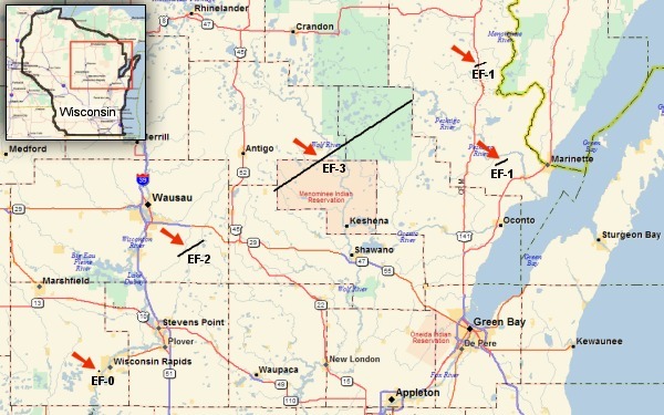
Map of northeast Wisconsin and tornado tracks. Not denoted on the map is an area of straight-line wind damage in the Thunder Mountain area of western Marinette County, caused by the same supercell that produced the long-track tornado. Click for larger image.
Click here for the summary of all severe weather events reported during the day in central and northeast Wisconsin.
Shawano-Menominee-Langlade-Oconto Counties Long-Track Tornado
A long-track tornado touched down at 4:31 pm east of Mattoon in Shawano County and continued northeast to the Oconto-Marinette County line. The tornado was on the ground for at least 40 miles, and was over 1/2 mile wide at times. Over 14000 acres of trees were snapped or flattened and many dozens of buildings were damaged or destroyed. The twister was rated an EF3 on the Enhanced Fujita scale, with estimated winds of 140 to 160 mph. Damage by this tornado alone exceeded $15 million (property and timber).
The most severe structural damage occurred 3.5 miles east of the city of White Lake in Langlade County. The Bear Paw Outdoor Adventure Resort sustained severe damage. Nearly every building was damaged or destroyed, including a three story inn.
 |
 |
| Damage at the Bear Paw Resort. Click for larger image. | More damage at the Bear Paw Resort. Click for larger image. |
As the tornado moved northeast into the Nicolet National Forest in Oconto County, it flattened tens of thousands of trees as it headed toward Highway 64. The damage path near Highway 64 was three-quarters of a mile wide! The twister caused EF2 damage four miles north of the city of Mountain on Highway 32, in the town of Riverview, with estimated winds of around 130 mph. The width of the tornado in this area was almost 1/2 mile.
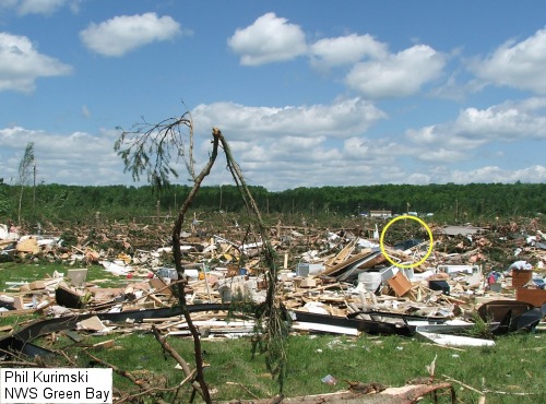
This is what remained of a double-wide mobile home in the town of Riverview. The owner heard the Tornado Warning and went into the bathtub (circled in large view), and escaped without a scratch! Click for larger image.
Tens of thousands of trees, many pines, were snapped or uprooted along the damage path. Few, if any trees exhibited debarking.
Marathon County Tornado
At 4:01 pm, a tornado touched down 10 miles east of Mosinee in a forested area of Marathon County. It traveled 7.3 miles through farmlands and woodlands before lifting or dissipating about 4 miles south of Hatley, just north of Pike Lake. The width of the tornado was approximately 250 yards. The tornado was rated EF2, with winds estimated at 115 to 125 mph. Estimated damage from this twister was nearly $350,000.
Hundreds of trees were snapped or uprooted along the path. Ten homes sustained at least minor damage.
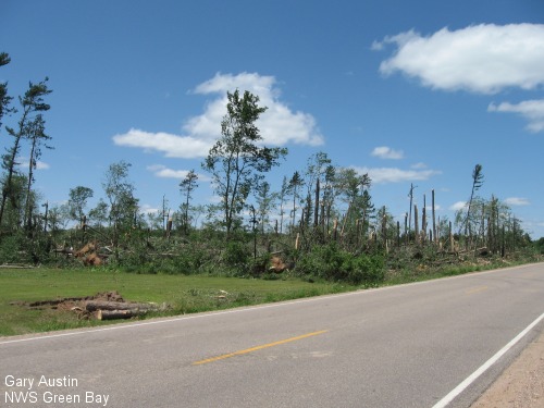
Tree damage on HWY J in Marathon Co.
Wood County Hail
Hailstones of 4 to 5+ inches in diameter fell across Port Edwards and Wisconsin Rapids in Wood County around 4:30 pm. A hailstone 5.5" in diameter was measured in Port Edwards, which is the second largest hailstone in Wisconsin weather history. (The largest hailstone in Wisconsin is 5.7" in diameter which fell in Wausau in May 1921.)
 |
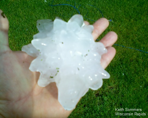 |
| A large hailstone in Port Edwards, measured at 5.5 inches in diameter. Picture courtesy WAOW-TV. Click for larger image. | A hailstone nearly 5" in diameter in Wisc. Rapids. Click for larger image. |
The large swath of hail caused considerable damage across the Port Edwards and Wisconsin Rapids area. Thousands of homes and buildings sustained damage, as did many cars. Damage estimates from the hail in Wood Co. was over $40 million.
The Meteorology Behind the Storms
Unusually strong jet stream winds ahead of an upper level low pressure system produced very strong wind shear and conditions conducive to severe thunderstorm development. The strong atmospheric winds resulted in very fast moving thunderstorms and tornadoes. Some of the storms during the late afternoon were moving at over 60 mph!
Satellite Image
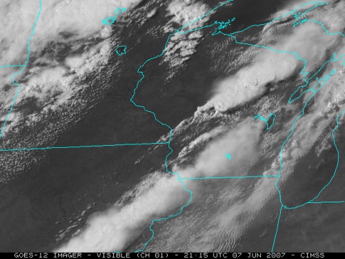
Visible satellite imagery at 4:15 PM, June 7, courtesy SSEC, UW-Madison. Storm '1' is the supercell that would produce the long-track tornado across northeast Wisconsin. '2' is the supercell that produced very large hail in Wood County. Click for larger image.
Satellite Animation
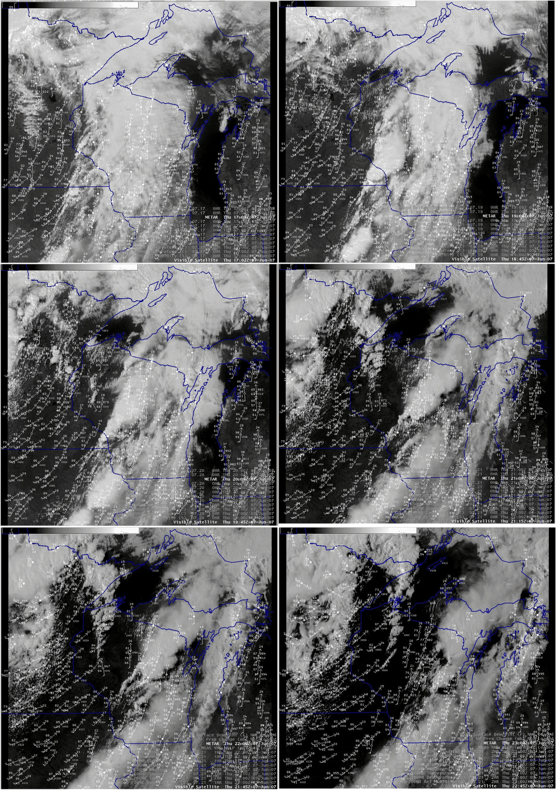
Six hour visible satellite animation, beginning at Noon on June 7. METARS overlayed. The animation is 4 MB.
Radar Animation
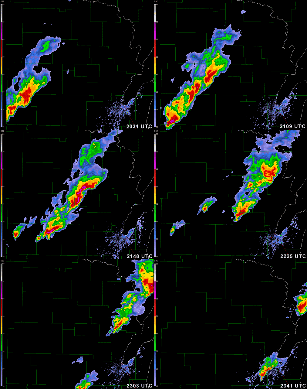
Below are three hour animation loops of radar imagery (0.5 degree base reflectivity and storm-relative velocity) from the NWS Green Bay Doppler radar, beginning at 3:31 pm on June 7. Note: The animations are about 1 MB each.
 |
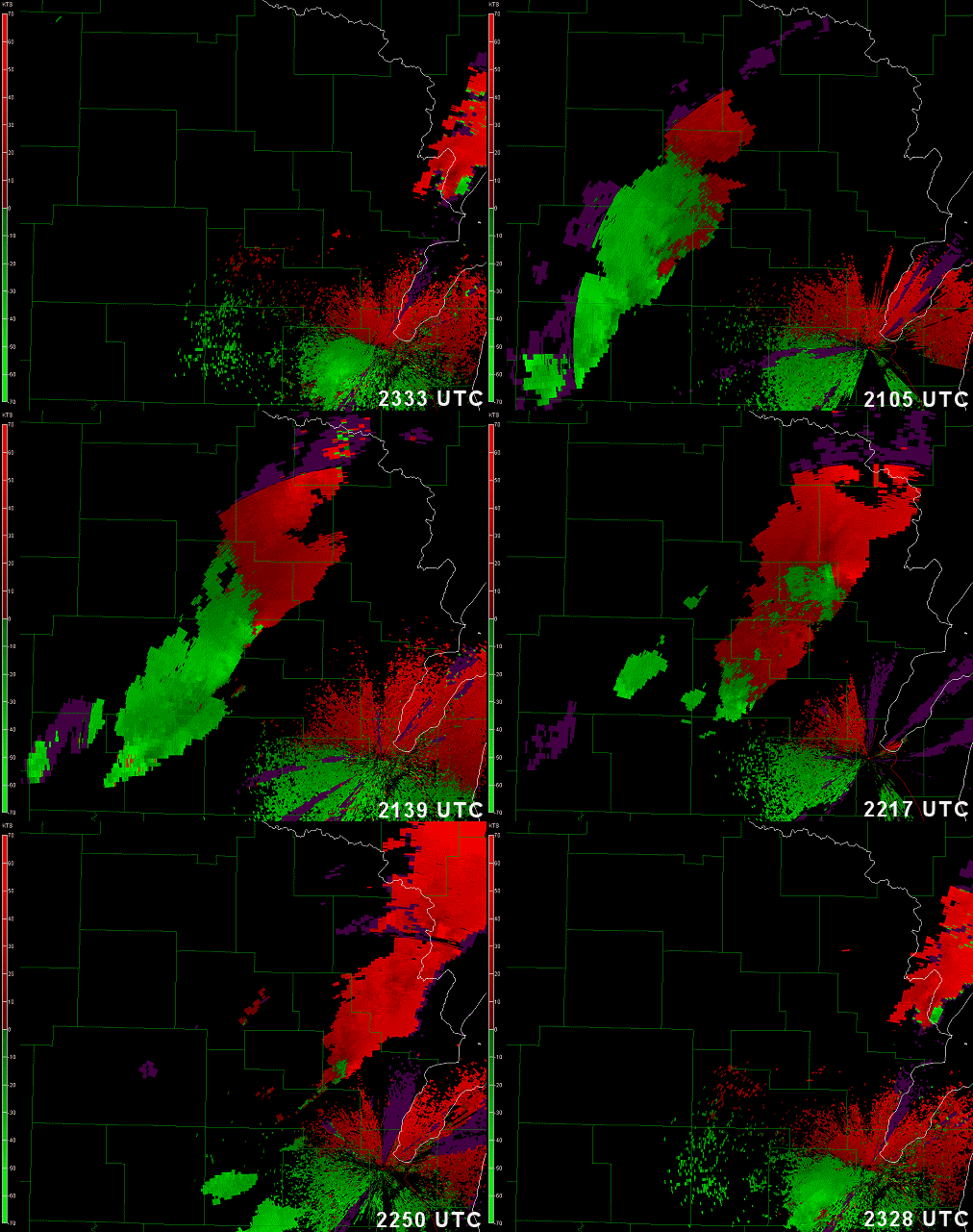 |
| Reflectivity. Click to start animation. | Storm-Relative Velocity. Click to start animation. |
Page developed by Jeff Last, WCM, NWS Green Bay