The May 12, 2000 Hail Superstorm
Click on the icons on this page to see the full picture.
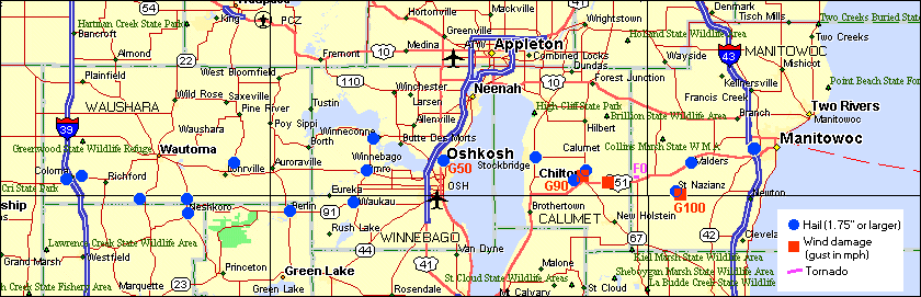
During the late morning of May 12, 2000, a single "high-precipitation" supercell thunderstorm developed in west-central Wisconsin, and moved east across the southern four counties of the NWS Green Bay forecast area. Hail up to the size of baseballs, driven by winds in excess of 60 mph, produced incredible damage in Waushara, Winnebago, Calumet, and Manitowoc counties. Chilton and St. Nazianz were particularly hard-hit by very large hail hail and hurricane force wind gusts well over 75 mph. Total damage from the storm in the state was nearly $122 million, much of that in the NWS Green Bay forecast area. This was the first time a single storm produced $100 million in damage in Wisconsin.
Radar Images
Reflectivity
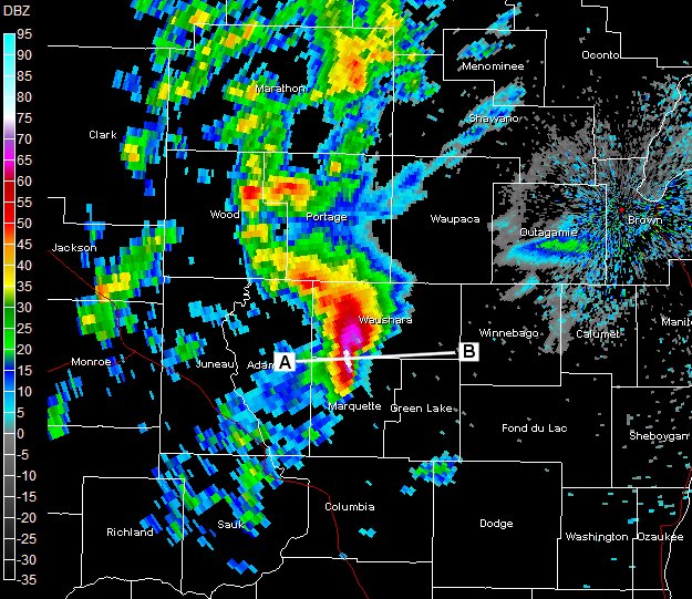 |
This is a base reflectivity radar image (0.5 deg) taken at 10:31 am CDT. At this time the storm was over Waushara and Marquette counties producing very large hail. Line A-B is the slice taken for the cross section below. |
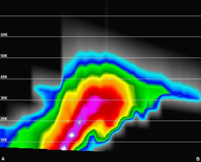 |
This image is a west-east cross section of the storm at 10:31 am. The top of the storm reached to nearly 60,000 ft into the atmosphere. Note, too, the "bounded weak echo region" (BWER). |
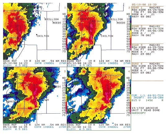 |
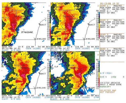
This image is a four panel reflectivity (0.5 deg base reflectivity) as the storm was moving over Calumet county. The images begin at 11:23 am (upper left-hand corner). As the storm moved over Chilton, wind gusts of 80 mph and egg-size hail were slamming the city. |
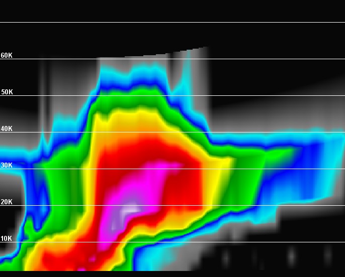 |
This image is a west-east cross section of the storm at 11:35 am as the storm was bearing down on Chilton. The top of the storm is now about 65,000 ft! |
 |
This image is a four panel reflectivity (0.5 deg base reflectivity) as the storm was moving over Manitowoc county. The images begin at 11:41 am (upper left-hand corner). Winds near 100 mph were estimated as the storm hit St. Nazianz. |
The Damage
A storm damage summary can be viewed by clicking here (PDF format).
Calumet County
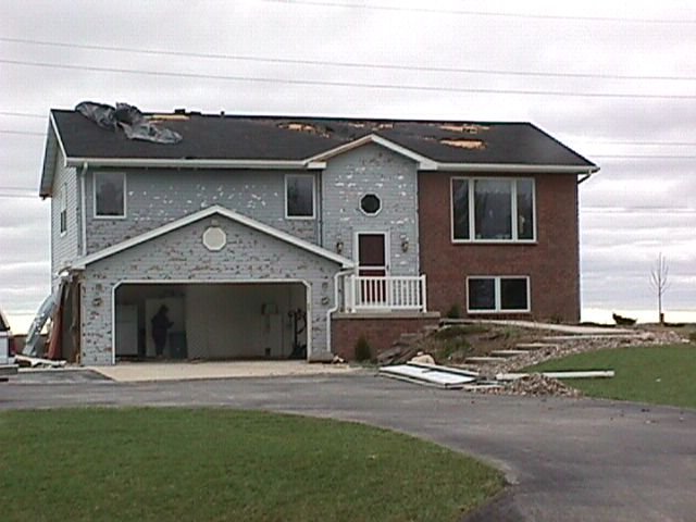 |
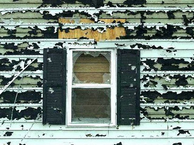
Wind driven hail damage near Chilton. Thousands of homes and businesses suffered similar damage across the southern part of the NWS Green Bay forecast area. |
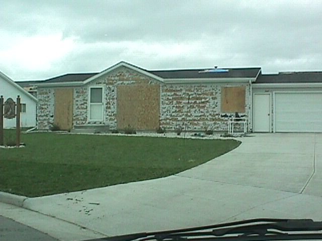 |
Another home in Chilton. |
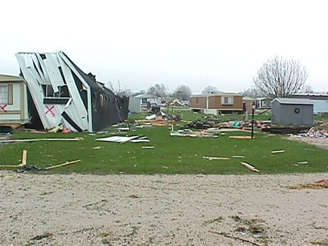
Manitowoc County
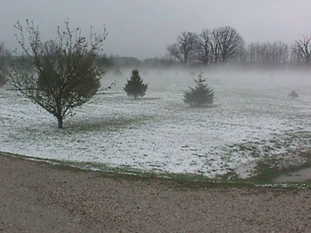 |
Outside of the hardest hit areas, dime- and nickel-size hail accumulated on the ground, causing roads to become slick. Fog developed over the cold, hail-covered ground, reducing visibilities to zero at times, which made driving to St. Nazianz very difficult. | |
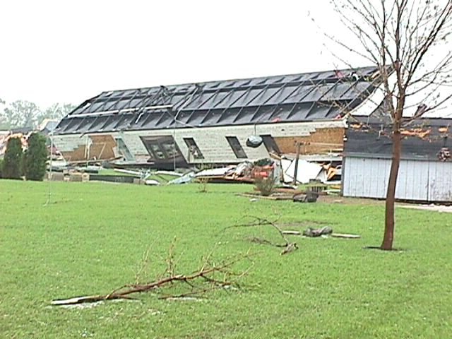 |
The small city of St. Nazianz was particularly hard hit. A mobile home park in the city suffered severe damage as straight-line winds pushed or rolled dozens of un-anchored homes off their foundations. | |
 |
Note the hail damage on this one, sustained before the wind flipped it over. Two dozen people were hurt in the park, but none seriously. | |
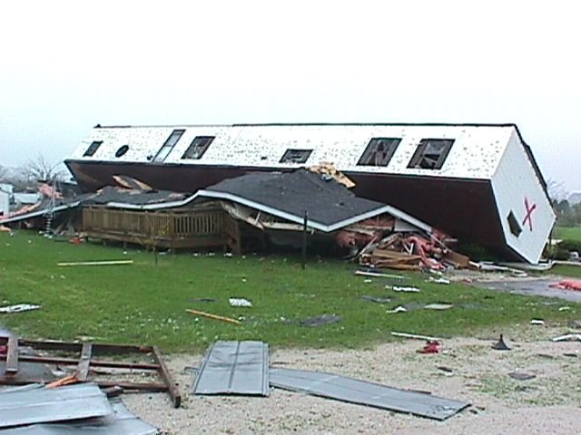
 |
Yet another un-anchored home. At least it acted as a wind-break, protecting the neighbor's home. Nearly all of the 60 or so homes in the park sustained some sort of damage. | |
|
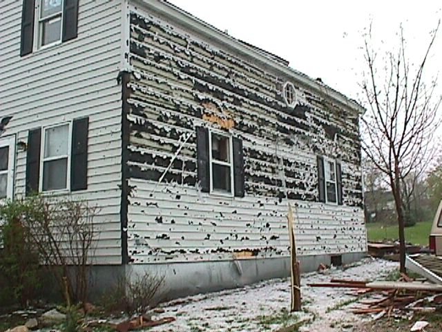
 |
Severe wind-driven hail damage to a house in St. Nazianz. |
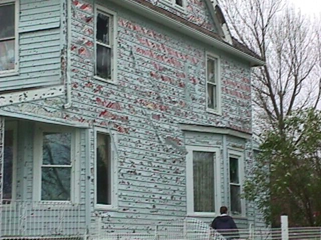 |
Another home, same story. | |
| Media use of NWS Web News Stories is encouraged. Please acknowledge NWS Green Bay as the source of any news information accessed from this site.
|

