Green Bay, WI
Weather Forecast Office
The Late-Winter Storm of March 22-23, 2011
Last updated 3/24/11
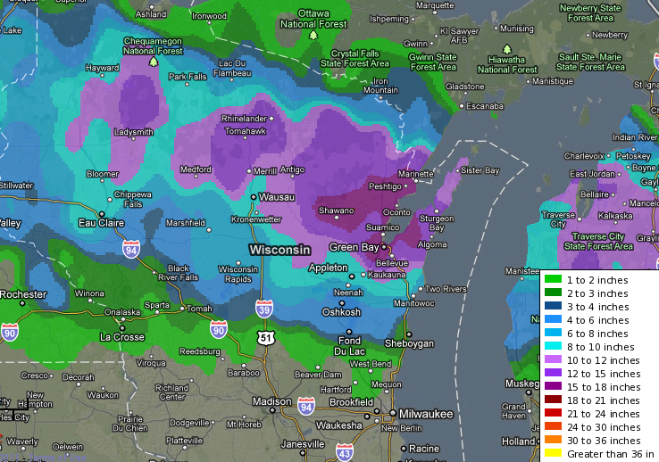
A late-season winter storm produced heavy, wet snow and occasional thundersnow across parts of central and northeast Wisconsin on March 22-23, 2011. During the two-day period, many locations reported over a foot of snow. Green Bay officially recorded 17.8 inches. That's the highest snowstorm total in over 120 years of weather records; only two storms produced more snow (29.0" in March 1888 and 23.1" in January 1889). In addition, this storm is the third one this season to produce 10 inches or more of snow in Green Bay, the first time that's ever happened during a winter season.
Here's the two-day snowfall map of Wisconsin. (Click image for full view.)
 |
A complete table of snowfall totals can be seen by clicking here.
The storm was also unusual with the number of thunderstorms in the area. Thunderstorms were reported in the Green Bay area from about 8:15 pm until just after midnight. The storms were often accompanied by heavy snow and sleet.
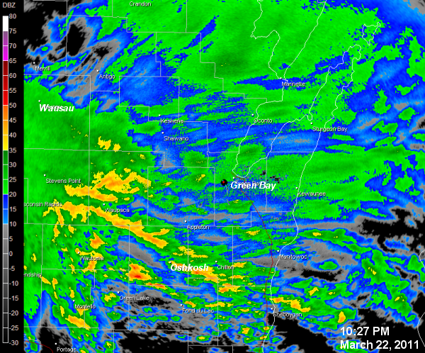
Local and regional radar images: (Click image for full view.)
 |
 |
| NWS Green Bay radar image from late evening on March 22. Thunderstorms (areas in orange and red on the image) were producing heavy snow and sleet as they moved northeast into Green Bay. |
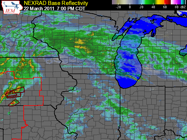
Animation of regional radar mosaic from 7 pm March 22 to midnight March 23.
|
Here's a picture of the NWS Green Bay office the morning of March 23. Several additional inches of snow fell after the picture was taken!
 |
US Dept of Commerce
National Oceanic and Atmospheric Administration
National Weather Service
Green Bay, WI
2485 South Point Road
Green Bay, WI 54313-5522
920-494-2363
Comments? Questions? Please Contact Us.

