Green Bay, WI
Weather Forecast Office
Lake Effect Snow on January 31-February 1, 2011
Last updated 2/2/11
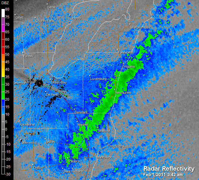
A day before a large blizzard affected southeast Wisconsin and northern Illinois, heavy lake effect snow fell over Kewaunee, Manitowoc and Door counties on January 31 and February 1, 2011. Over a foot of snow fell in several locations in the lakeshore counties as persistent northeast winds picked up moisture from Lake Michigan, depositing it as snow. A two day storm total of 16.4" was measured on the southwest side of Kewaunee by an official COOP observer.
 |
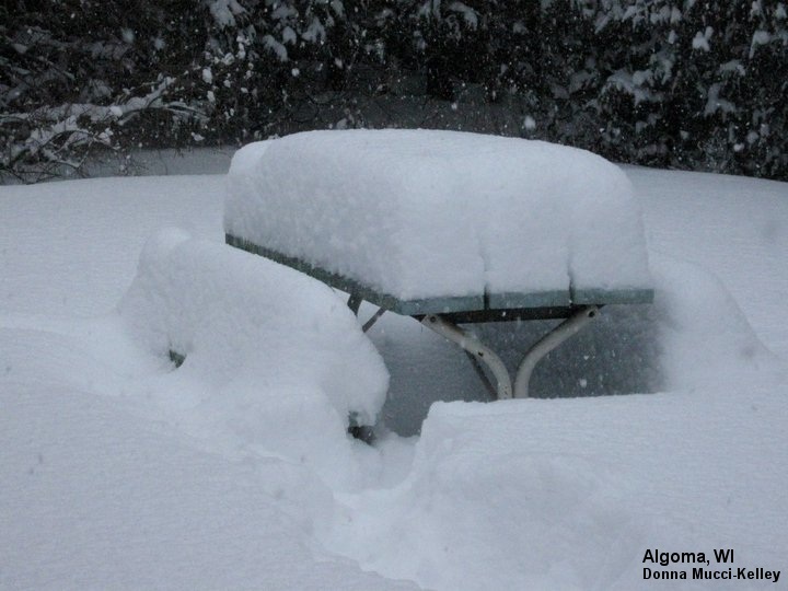 |
| Radar image showing the narrow but intense snow band over Kewaunee (click for larger view). | A photo of the heavy snowfall near Algoma (Kewaunee Co.) where a foot fell (click for larger view). |
Even inland locations, like Green Bay and Chilton, picked up a few inches of snow as the lake moisture combined with an upper level low pressure system that was moving across the state.
As the Midwest blizzard grazed northeast Wisconsin late on February 1 and early on February 2, strong winds developed, creating blowing and drifting snow. A few more inches of snow fell in Manitowoc, Calumet and Winnebago counties associated with the winter storm.
Here's a map of reported snowfall across east-central Wisconsin (click for larger view):

US Dept of Commerce
National Oceanic and Atmospheric Administration
National Weather Service
Green Bay, WI
2485 South Point Road
Green Bay, WI 54313-5522
920-494-2363
Comments? Questions? Please Contact Us.

