Active spring pattern across the center of our nation with several episodes of severe weather and heavy rainfall expected into next week. The potential for very large hail, long track tornadoes, severe wind gusts, frequent cloud to ground lightning strikes and flash flooding are in the outlook. Furthermore, dangerous early season heat wave continues for the Gulf Coast states into early next week. Read More >
La Crosse, WI
Weather Forecast Office
|
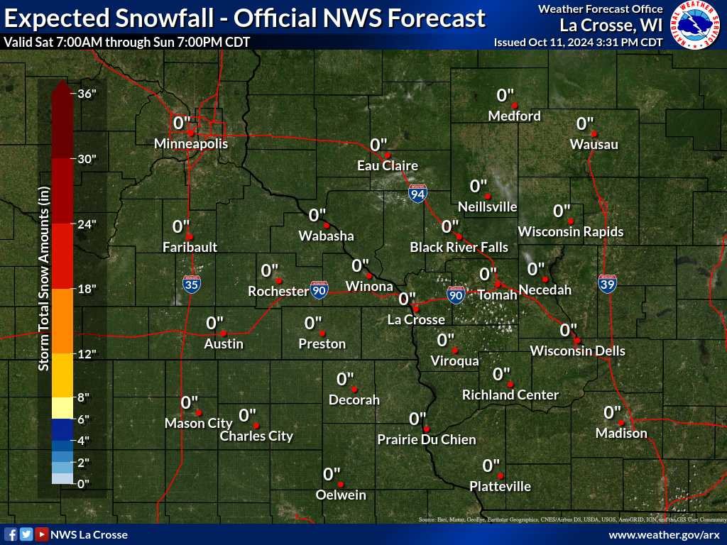
Ongoing snow slowly tapers off from west to east in the mid to late afternoon. Highest snow totals of 5 to 8 inches will be north of I-94 where there is a Winter Storm Warning in effect. Lesser amounts of 1-2" are expected to the south. Expect snow-covered roads and potentially hazardous travel conditions, especially in the warning area. Traveling? Be prepared for winter driving conditions. Use caution and take it slow.     
This Afternoon: Snow Slowly Coming to an End
Additional Information:
|
• Submit Report • Winter Monitor Precipitation Reports Snowfall Plotter Hazardous Weather Outlook Latest Winter Statement Storm Reports Current Conditions
Weather Story 
Radar |
Our Office
Staff
Community Involvement
Station / Location Info
Follow Us On Social Media
Student Opportunities
Additional Information
Storm Summaries
Cooperative Observers
Educational Resources
Science / Research
Weather Phenomenon
Mayfly Tracking
Latest
Temp/Pcpn Summary
Precipitation Reports
Forecast Discussion
Hazardous Weather Outlook
Hourly Weather
Public Information Statement
Local Storm Report
Lightning Plot Archive
River Stages
Water Temp
Observations
Precipitation Plotter
Soil Temps
US Dept of Commerce
National Oceanic and Atmospheric Administration
National Weather Service
La Crosse, WI
711 County Road FA
La Crosse, WI 54601
608-784-7294
Comments? Questions? Please Contact Us.