Event Summary:
 Warrens, WI Tornado - F1
Overview:
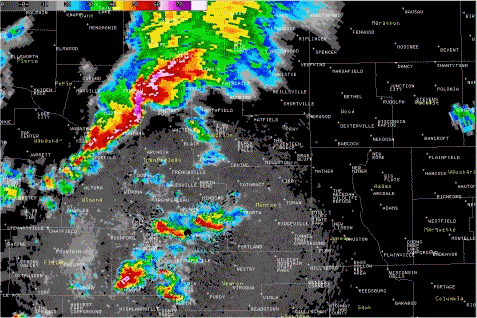
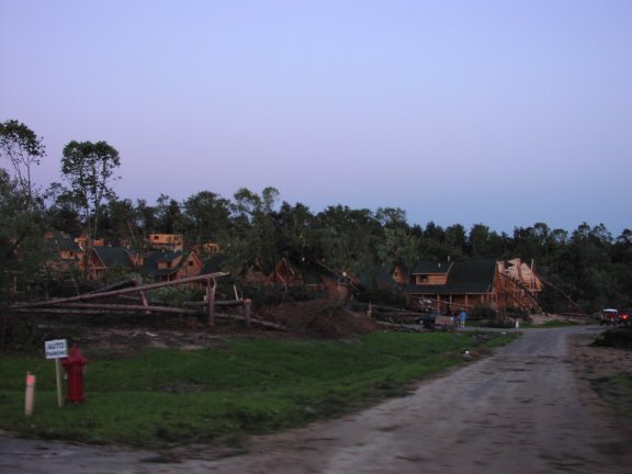
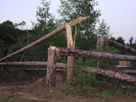
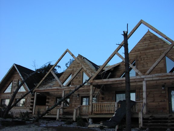
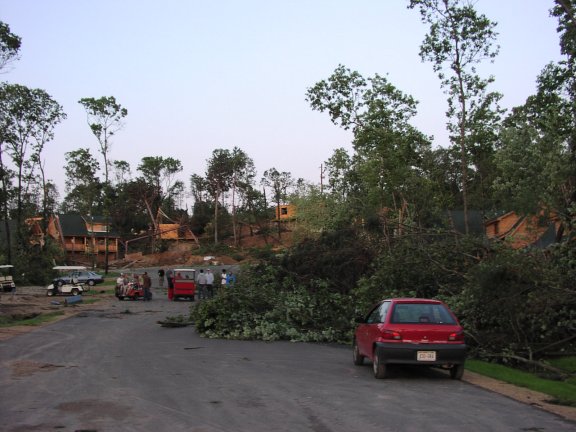
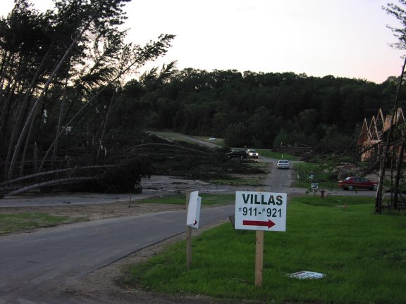
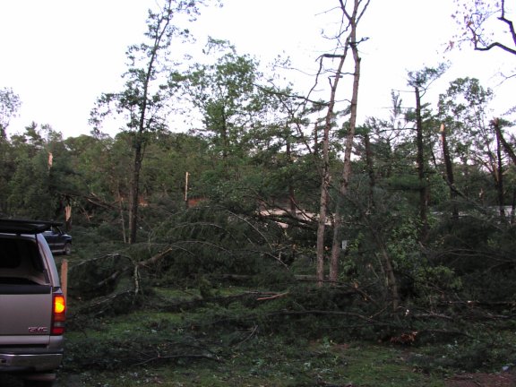
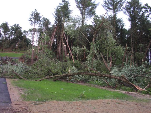
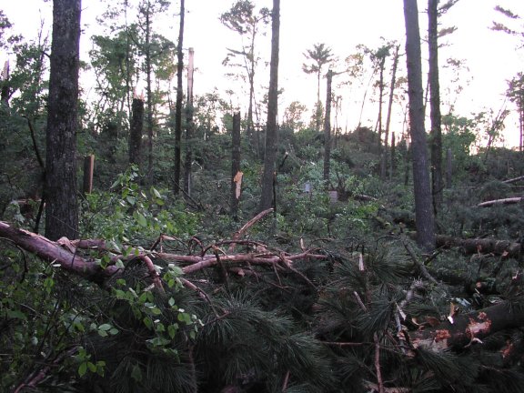
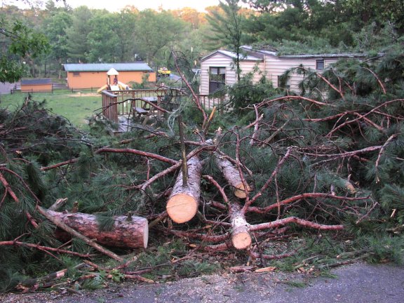
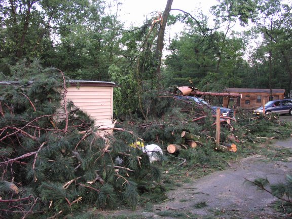
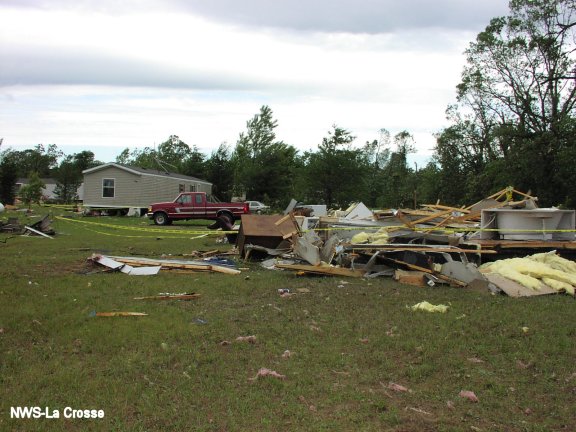
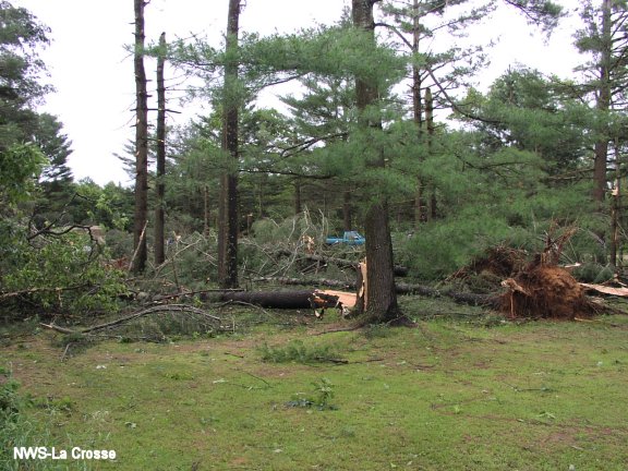
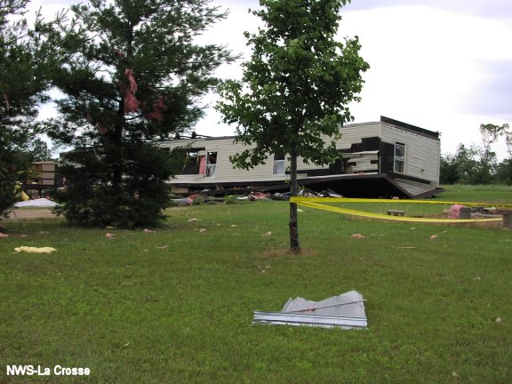
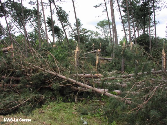
A tornado quickly developed about 3 miles west of Warrens, WI, near Arctic Road just west of Interstate 94 around 7:00 p.m. on Wednesday June 23rd. It hit a home along Interstate 94, then crossed the Interstate hitting a semi-truck, before moving into Jellystone Campground just west of Warrens. The tornado and associated strong winds around the storm knocked down hundreds of trees in this area, and damaged several tents, buildings, campers, and cars in Jellystone Campground. The tornado continued just southwest of Warrens and hit a home, blowing the roof off, south of the village along County Road O. It lifted about 2 miles southeast of Warrens around 7:15 p.m..
The tornado path was approximately 4.5 miles in total length with a maximum width of 50 yards. The tornado was rated an F1 on the Fujita Damage Scale. Wind speeds were likely 90 to 112 mph with most of the damage related to downburst winds around the actual tornado. At least 3 people were hospitalized briefly for injuries but there no fatalities.
Radar Images:
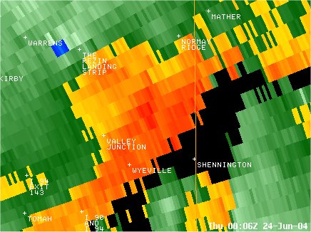
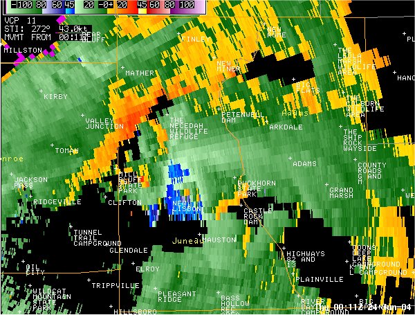
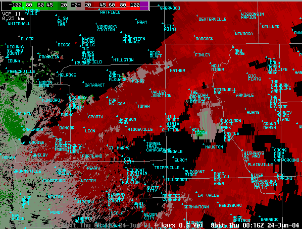
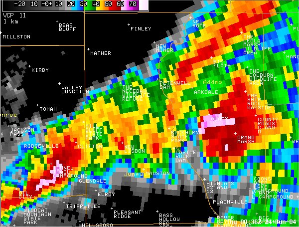
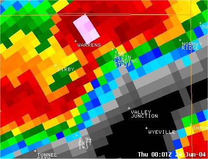 Reflectivity image of the tornado at 701 pm. |
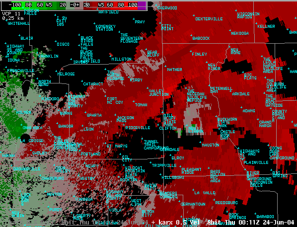
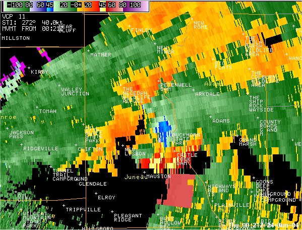
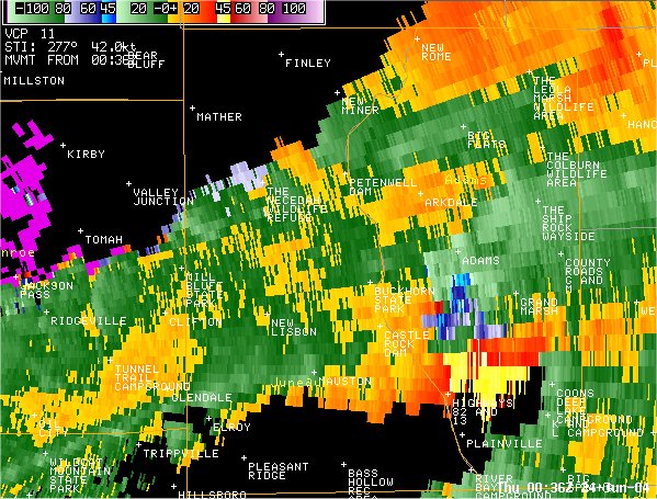
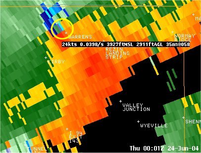 Storm relative velocity image of the tornado at 701 pm. The main circulation is highlighted in yellow. |
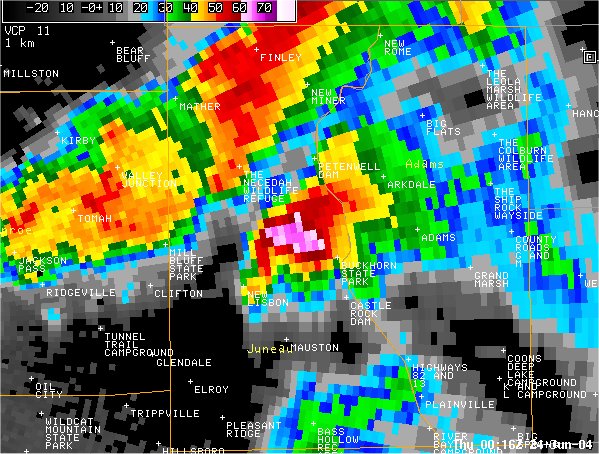
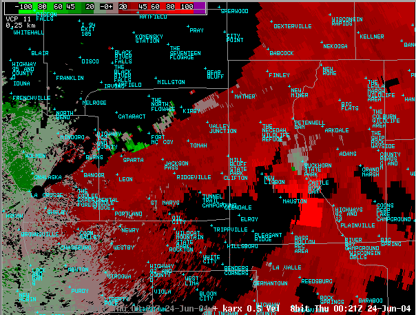
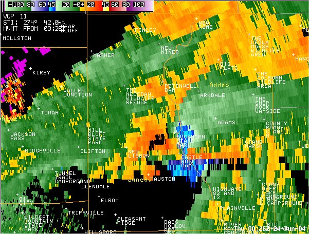
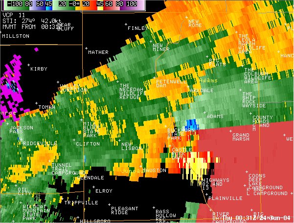
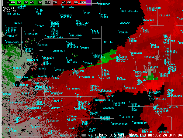
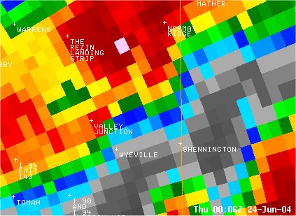 Reflectivity image at 706 pm. |
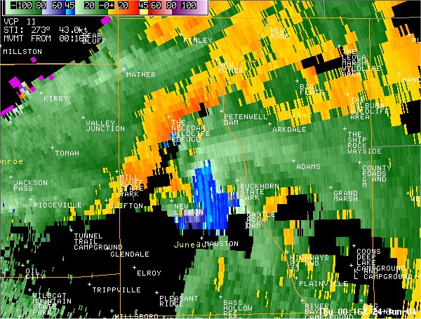
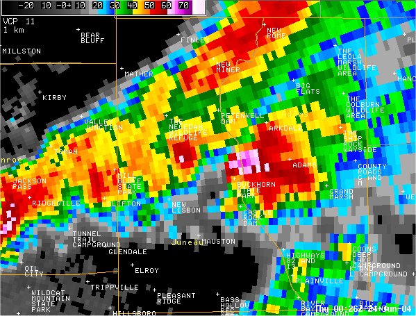
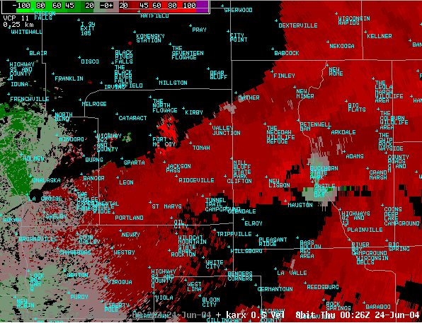
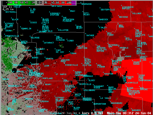
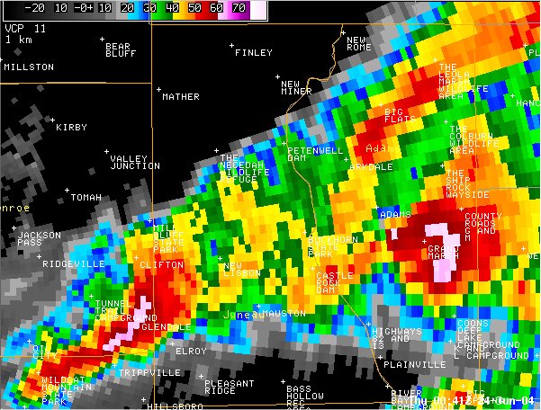
 Storm relative velocity image at 706 pm. |
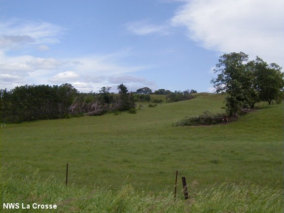
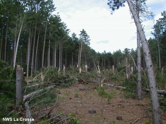
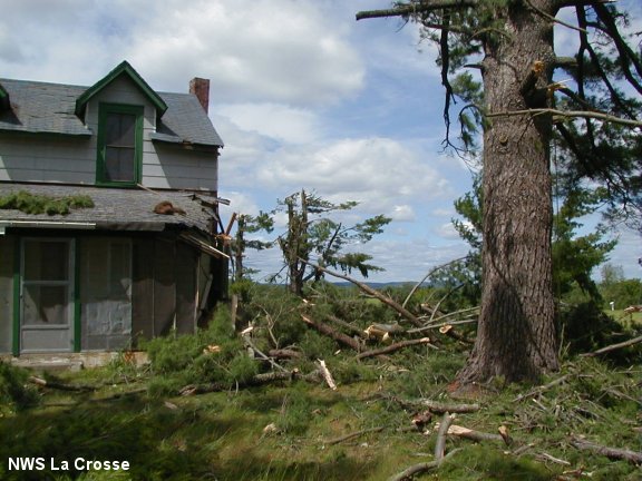
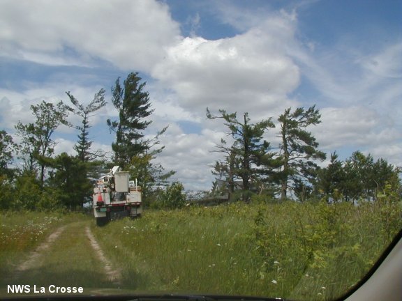
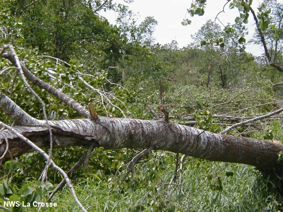
Damage Photos:
Most from the Jellystone Campground...
 |
 |
 |
 |
 |
 |
 |
 |
 |
 |
 |
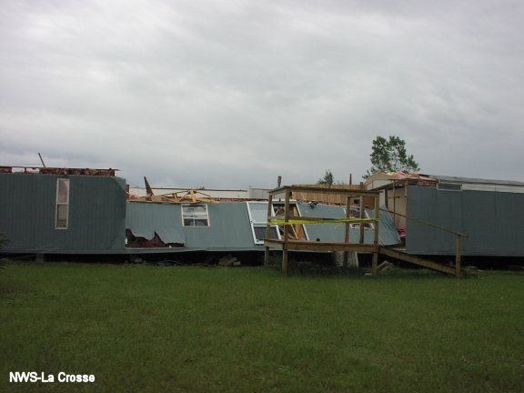
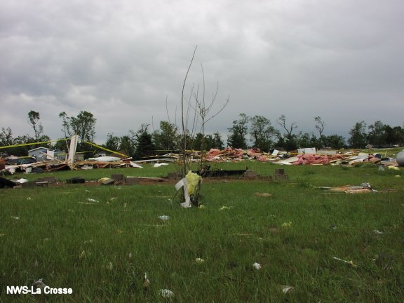
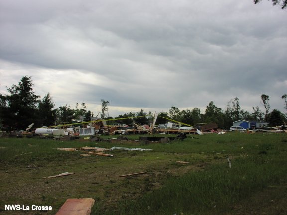
Adams/Juneau County, WI Tornado - F1
Overview:
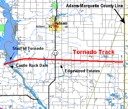
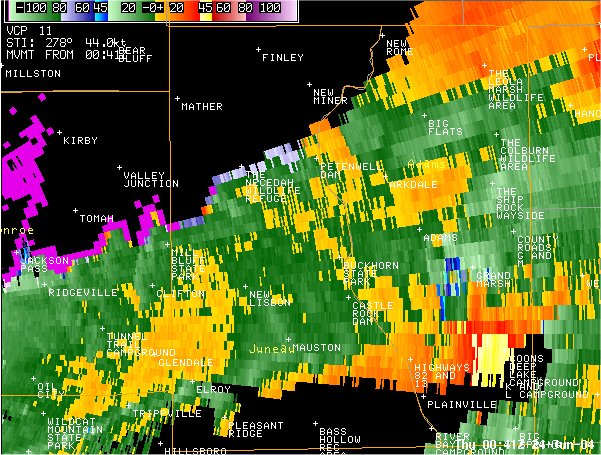
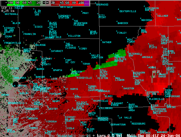
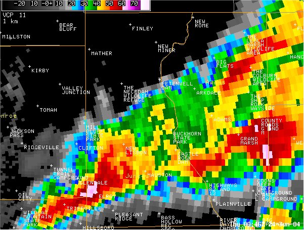
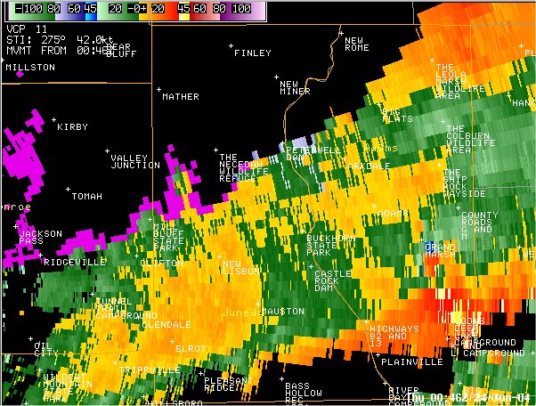
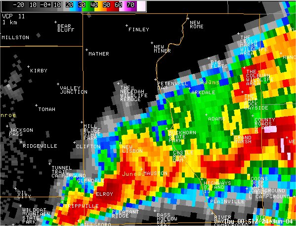
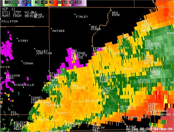
Another tornado formed in extreme eastern Juneau County, about 2 miles west of Castle Rock Dam, Wednesday evening. The tornado moved east-northeast across Castle Rock Lake and into western Adams County, Wisconsin. It tracked near or along Edgewood Ave with extensive tree damage to the Quincy Bluff area, including the lookout Ranger tower there. Hundreds of trees were blown down from strong winds rotating around the tornadic thunderstorm, in excess of 90 mph at times.
The tornado intermittently tracked east to areas just north of Edgewood Drive crossing Highway 13 approx. 5 miles south of Adams/Friendship. Downburst winds on the south side of the storm demolished at least 8 mobile homes in Edgewood Estates that were orientated north-south and took the full brunt of the cross wind. This was the same area hit by severe weather a few years back. Most of the Town of Easton had extensive damage with hundreds of trees down.
It continued to move east-southeast before lifting shortly before the Adams-Marquette County line about 3 miles southeast of Grand Marsh around 7:55 pm.
A broad area of straight line wind damage was found south of this tornado track with widespread tree damage occurring up to 1 mile south of the track.
The tornado path was approximately 17 to 18 miles in length. The tornado was rated an F1 on the Fujita Damage Scale with estimated wind speeds in the 73 to 112 mph range. There were no fatalities reported and only minor injuries.
Click here to see a detailed map of damage in Adams County, WI (PDF). Map courtesy of Adams County Emergency Management and Adams County Register of Deeds.
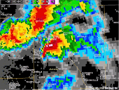
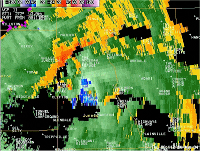
Radar Images:
Animations (7:11 to 7:51 p.m. CDT):
Individual Images:
Damage Photos:
 |
 |
 |
 |
 |
 |
 |
Taylor, WI Tornado - F1
Overview:
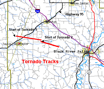
A survey in Jackson county confirmed that an F0 tornado touched down initially about 1-1/2 miles north of Taylor in far western Jackson county around 622 pm. This tornado appeared to touch down sporadically during the first two miles of its path as it moved east southeastward across highway 95. It then strengthened and stayed on the ground for another 3 miles. Many trees were knocked down, and it also demolished a garage and took the roof off two other structures. The tornado reached F1 strength (estimated 75-85 mph winds) briefly as it moved through the Davis and Taylor road areas where it demolished the garage approximately 2 miles northeast of Taylor. This tornado appeared to lift approximately 4 miles east of Taylor around 628 pm.
About 3 tenths of a mile to the south of where the first tornado lifted, a second tornado formed. This tornado primarily caused tree damage. Shortly after formation it reached F1 strength (estimated 80-100 mph winds), clearing out a path about 30 yards wide through a wooded area just north of West Pine Creek road. This tornado weakened about 5 miles east of Taylor, but caused sporadic F0 damage until it finally lifted around 632 pm About 8 miles east of Taylor in the East Pine Creek road area.
Total path length of these two tornadoes was a little over 8 miles. They were on the ground for about 10 minutes.
Only minor injuries sustained.
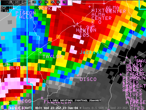
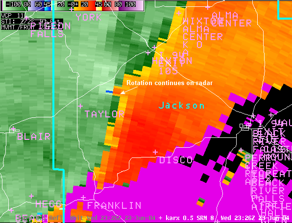
Radar Images:
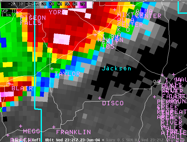 Reflectivity image at 621 pm. |
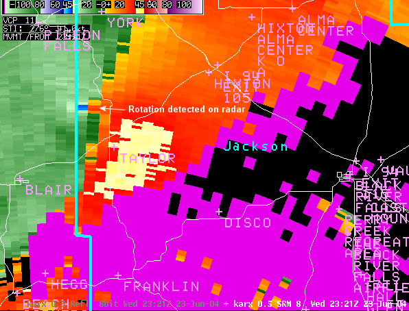 Storm relative velocity image at 621 pm. |
 Reflectivity image at 626 pm. |
 Storm relative velocity image at 626 pm. |
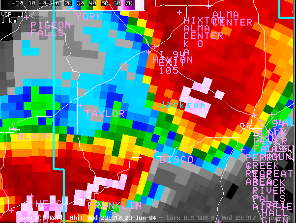 Reflectivity image at 631 pm. |
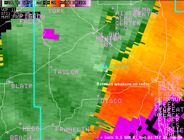 Storm relative velocity image at 631 pm. |
Damage Photos:
 |
 |
 |
 |
 |
Summarized Severe Weather Reports
..TIME...   ...EVENT...     ...CITY LOCATION...      ...LAT.LON...
..DATE...   ....MAG....     ..COUNTY LOCATION...ST.. ...SOURCE....
            ..REMARKS..

0519 PM     HAIL             TROY                    43.86N 92.07W
06/23/2004  0.75 INCH        WINONA             MN   CO-OP OBSERVER

0533 PM     TSTM WND GST     WEST CONCORD            44.15N 92.90W
06/23/2004  50 MPH           DODGE              MN   LAW ENFORCEMENT

0538 PM     TSTM WND GST     3 S ZUMBRO FALLS        44.29N 92.43W
06/23/2004  80 MPH           WABASHA            MN   LAW ENFORCEMENT

0538 PM     TSTM WND DMG     PRESTON                 43.67N 92.08W
06/23/2004                   FILLMORE           MN   LAW ENFORCEMENT

            LARGE TREE DOWN BLOCKING ROADWAY

0538 PM     TSTM WND GST     ZUMBRO FALLS            44.29N 92.43W
06/23/2004  60 MPH           WABASHA            MN   LAW ENFORCEMENT

0545 PM     TSTM WND DMG     WABASHA                 44.37N 92.05W
06/23/2004                   WABASHA            MN   LAW ENFORCEMENT

            TREES AND POWER LINES DOWN IN THE CITY

0547 PM     TSTM WND DMG     2 SE WABASHA            44.35N 92.02W
06/23/2004                   WABASHA            MN   LAW ENFORCEMENT

            TREES AND POWER LINES DOWN IN THE SAND PRAIRIE AREA

0548 PM     HAIL             3 NW AMHERST            43.61N 91.92W
06/23/2004  0.88 INCH        FILLMORE           MN   AMATEUR RADIO

            DIME TO NICKEL SIZE HAIL COVERING GROUND. HAIL STRIPPED
            AND DESTROYED BEAN FIELD

0552 PM     HAIL             MONDOVI                 44.57N 91.67W
06/23/2004  0.88 INCH        BUFFALO            WI   LAW ENFORCEMENT

0557 PM     TSTM WND DMG     MONTANA                 44.35N 91.67W
06/23/2004                   BUFFALO            WI   LAW ENFORCEMENT

            POLE BARN SHED BLOWN OVER

0613 PM     TSTM WND GST     ARCADIA                 44.25N 91.49W
06/23/2004  60 MPH           TREMPEALEAU        WI   AMATEUR RADIO

0615 PM     HAIL             ARCADIA                 44.25N 91.49W
06/23/2004  0.75 INCH        TREMPEALEAU        WI   AMATEUR RADIO

0620 PM     HAIL             PLEASANTVILLE           44.45N 91.30W
06/23/2004  1.00 INCH        TREMPEALEAU        WI   PUBLIC

0620 PM     TSTM WND DMG     WHITEHALL               44.37N 91.31W
06/23/2004                   TREMPEALEAU        WI   PUBLIC

            LARGE TREE DOWN BLOCKING MAIN STREET

0621 PM     HAIL             PRICE                   44.58N 91.05W
06/23/2004  0.88 INCH        JACKSON            WI   TRAINED SPOTTER

0621 PM     TSTM WND GST     PRICE                   44.58N 91.05W
06/23/2004  65 MPH           JACKSON            WI   TRAINED SPOTTER

0623 PM     HAIL             5 W HIXTON              44.38N 91.11W
06/23/2004  0.75 INCH        JACKSON            WI   CO-OP OBSERVER

0625 PM     HAIL             6 S RENO                43.51N 91.28W
06/23/2004  0.88 INCH        HOUSTON            MN   AMATEUR RADIO

0626 PM     TSTM WND DMG     3 E TAYLOR              44.32N 91.06W
06/23/2004                   JACKSON            WI   LAW ENFORCEMENT

            2 BARNS DOWN ALONG LINCOLN ROAD

0628 PM     HAIL             NEW ALBIN               43.50N 91.29W
06/23/2004  0.88 INCH        ALLAMAKEE          IA   LAW ENFORCEMENT

0630 PM     TSTM WND DMG     10 E PRICE              44.58N 91.05W
06/23/2004                   JACKSON            WI   LAW ENFORCEMENT

            LARGE TREES DOWN NEAR FAIRCHILD.

0630 PM     HAIL             10 E PRICE              44.58N 90.85W
06/23/2004  0.75 INCH        CLARK              WI   LAW ENFORCEMENT

0635 PM     HAIL             VICTORY                 43.48N 91.22W
06/23/2004  0.75 INCH        VERNON             WI   CO-OP OBSERVER

0645 PM     HAIL             TOMAH                   43.99N 90.50W
06/23/2004  0.75 INCH        MONROE             WI   AMATEUR RADIO

0645 PM     TSTM WND GST     FOUR CORNERS            44.08N 90.91W
06/23/2004  60 MPH           MONROE             WI   TRAINED SPOTTER

            TWO SMALL TREES DOWN

0645 PM     TORNADO          2 N BLACK RIVER FALLS   44.33N 90.85W
06/23/2004                   JACKSON            WI   EMERGENCY MNGR

            TWO SEMIS REPORTED DAMAGED ON FREEWAY

0647 PM     TSTM WND GST     NEILLSVILLE             44.56N 90.59W
06/23/2004  60 MPH           CLARK              WI   PUBLIC

0647 PM     TSTM WND GST     SHAMROCK                44.18N 90.80W
06/23/2004  60 MPH           JACKSON            WI   LAW ENFORCEMENT

0647 PM     HAIL             NEILLSVILLE             44.56N 90.59W
06/23/2004  0.75 INCH        CLARK              WI   PUBLIC

0647 PM     HAIL             SHAMROCK                44.18N 90.80W
06/23/2004  0.75 INCH        JACKSON            WI   LAW ENFORCEMENT

0649 PM     HAIL             NEILLSVILLE             44.56N 90.59W
06/23/2004  0.75 INCH        CLARK              WI   AMATEUR RADIO

0649 PM     TSTM WND DMG     1 S NEILLSVILLE         44.55N 90.59W
06/23/2004                   CLARK              WI   LAW ENFORCEMENT

            TREES BLOWN OVER HWY 73

0650 PM     TSTM WND DMG     CATARACT                44.09N 90.83W
06/23/2004                   MONROE             WI   AMATEUR RADIO

            6 TO 10 INCH TREES DOWN

0653 PM     HAIL             GRANTON                 44.59N 90.46W
06/23/2004  0.75 INCH        CLARK              WI   LAW ENFORCEMENT

0653 PM     TORNADO          10 E BLACK RIVER FALLS  44.30N 90.64W
06/23/2004                   JACKSON            WI   AMATEUR RADIO

0653 PM     TSTM WND GST     GRANTON                 44.59N 90.46W
06/23/2004  59 MPH           CLARK              WI   AMATEUR RADIO

0658 PM     TSTM WND DMG     2 E SOLDIERS GROVE      43.39N 90.73W
06/23/2004                   CRAWFORD           WI   AMATEUR RADIO

            2 LARGE TREES DOWN ALONG COUNTY ROAD X NEAR BOYLE ROAD

0658 PM     HAIL             SOLDIERS GROVE          43.39N 90.77W
06/23/2004  0.75 INCH        CRAWFORD           WI   AMATEUR RADIO

            DIME SIZE HAIL COVERING THE GROUND IN SOLDIERS GROVE

0700 PM     HAIL             7 N TOMAH               44.09N 90.50W
06/23/2004  0.75 INCH        MONROE             WI   AMATEUR RADIO

0704 PM     TORNADO          WARRENS                 44.13N 90.50W
06/23/2004  F1               MONROE             WI   NWS STORM SURVEY

            *** 3 INJ *** PRELIMINARY STORM SURVEY CONFIRMED 3
            INJURIES AND PRODUCED A PRELIMINARY LOW F1 DAMAGE RATING
            FOR THIS TORNADO. TWO OF THE INJURIES OCCURRED IN
            JELLYSTONE CAMPGROUND...THE THIRD OCCURRED IN A HOUSE
            JUST WEST OF INTERSTATE 94.

0704 PM     TORNADO          WARRENS                 44.13N 90.50W
06/23/2004                   MONROE             WI   AMATEUR RADIO

            AT MILE MARKER 135/136 ON I-94

0710 PM     HAIL             3 W BOSSTOWN            43.38N 90.68W
06/23/2004  0.88 INCH        CRAWFORD           WI   PUBLIC

            PUBLIC REPORTED NICKEL SIZE HAIL

0720 PM     FUNNEL CLOUD     3 N MAUSTON             43.84N 90.08W
06/23/2004                   JUNEAU             WI   LAW ENFORCEMENT

0723 PM     HAIL             2 N BUCKHORN STATE PARK 43.95N 89.98W
06/23/2004  2.00 INCH        JUNEAU             WI   PUBLIC

            TREE TOP BROKEN OFF.

0726 PM     TSTM WND DMG     NORWALK                 43.83N 90.63W
06/23/2004                   MONROE             WI   AMATEUR RADIO

            TREES DOWN

0731 PM     HAIL             8 NE NEW LISBON         43.96N 90.05W
06/23/2004  1.00 INCH        JUNEAU             WI   LAW ENFORCEMENT

            CORRECTED LOCATION FROM PREVIOUS REPORT. HAIL OCCURRED IN
            GERMANTOWN TOWNSHIP.

0733 PM     HAIL             1 S ADAMS               43.94N 89.82W
06/23/2004  1.75 INCH        ADAMS              WI   LAW ENFORCEMENT

0738 PM     TSTM WND GST     1 NE WHITE CREEK        43.85N 89.85W
06/23/2004  60 MPH           ADAMS              WI   LAW ENFORCEMENT

0743 PM     TORNADO          3 SW GRAND MARSH        43.90N 89.71W
06/23/2004                   ADAMS              WI   LAW ENFORCEMENT

            TORNADO DAMAGED SEVERAL MOBILE HOMES IN AREA

0743 PM     TSTM WND DMG     6 S ADAMS               43.87N 89.82W
06/23/2004                   ADAMS              WI   AMATEUR RADIO

            MULTIPLE TREES DOWN

0750 PM     TSTM WND DMG     2 S BROOKS              43.79N 89.63W
06/23/2004                   ADAMS              WI   AMATEUR RADIO

            1 10 INCH DIAMETER TREE DOWN AND SEVERAL 10 INCH DIAMETER
            BRANCHES DOWN. 1 BRANCH FELL ON TENT AT CAMPGROUND. NO
            INJURIES.


 Weather Story
 Weather Map
 Local Radar