|
Boaters - Marine |
Contact NWS La Crosse via phone or email at nws.lacrosse@noaa.gov |
| Click anywhere on the map for the forecast. Turn "on and off" the various weather parameters using the display options. Hover over a highlighted area to see the hazard. | Map Display Options |
|
Hazardous Weather Outlook Latest Conditions Regional Hazards |
|
| La Crosse & Regional Radar | ||
La Crosse |
National Radar |
|
| Other Local Radars | ||||||||
Minneapolis |
Des Moines |
Davenport |
Milwaukee/Sullivan |
Green Bay |
||||
National Severe Weather Outlooks - (Risk Categories Explanation)
| Today / Tonight | Days 2-8 | |||||||||
|
Day 2 [Details] |
Day 3 [Details] |
Days 4-8 [Details] |
|||||||
Local Severe Weather Outlooks
| Today/Tonight | Tomorrow | Day 3 |
 |
 |
 |
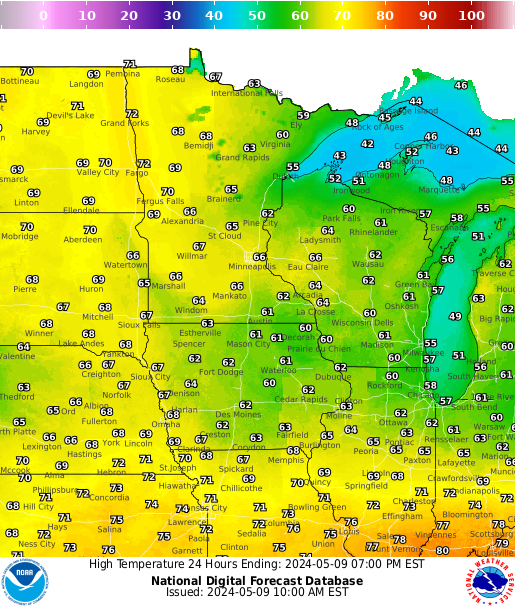
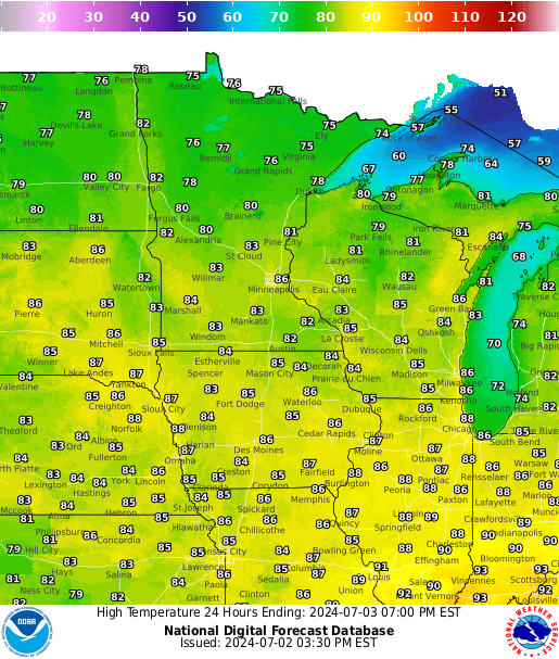
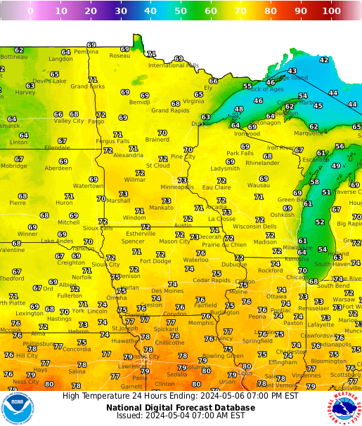
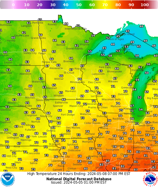
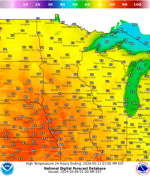
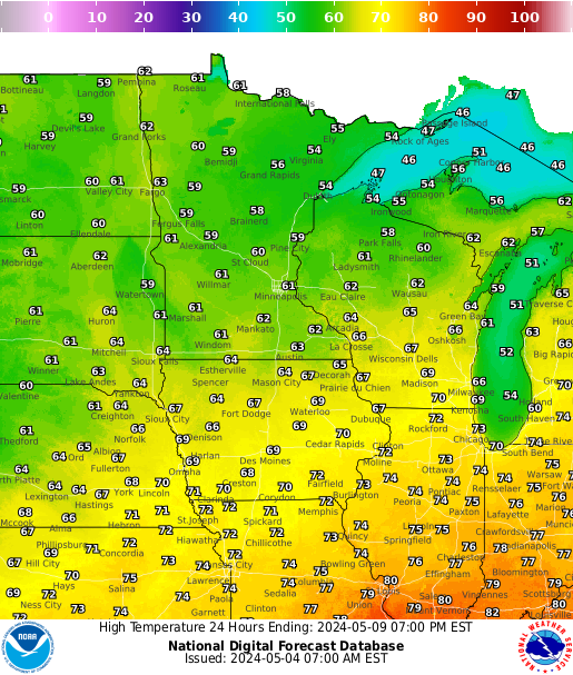
| Forecast Highs | ||||||
 |
 |
 |
 |
 |
 |
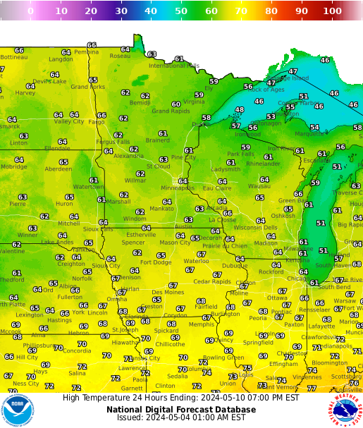 |
| Highs Day 1 | Highs Day 2 | Highs Day 3 | Highs Day 4 | Highs Day 5 | Highs Day 6 | Highs Day 7 |
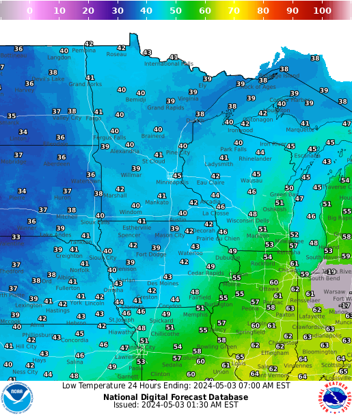
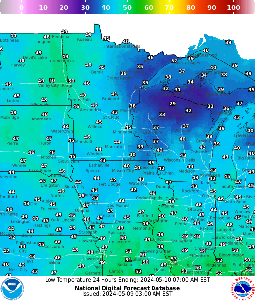
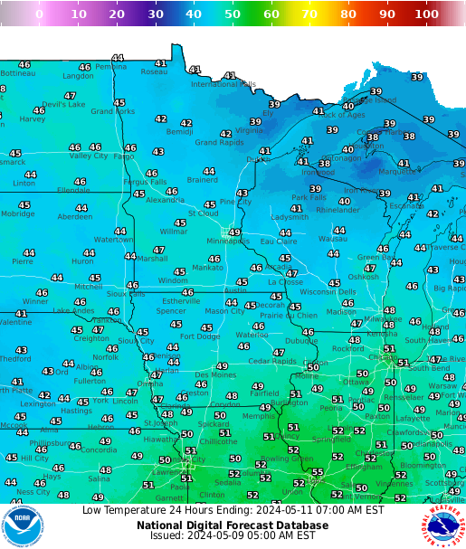
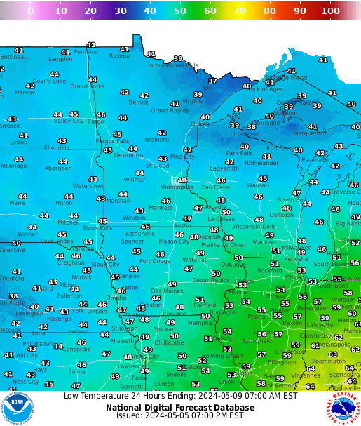
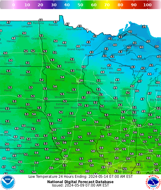
| Forecast Lows | ||||||
 |
 |
 |
 |
 |
 |
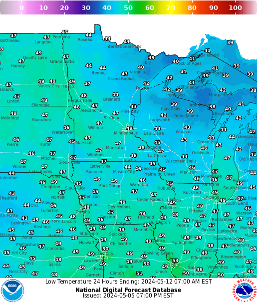 |
| Lows Day 1 | Lows Day 2 | Lows Day 3 | Lows Day 4 | Lows Day 5 | Lows Day 6 | Lows Day 7 |
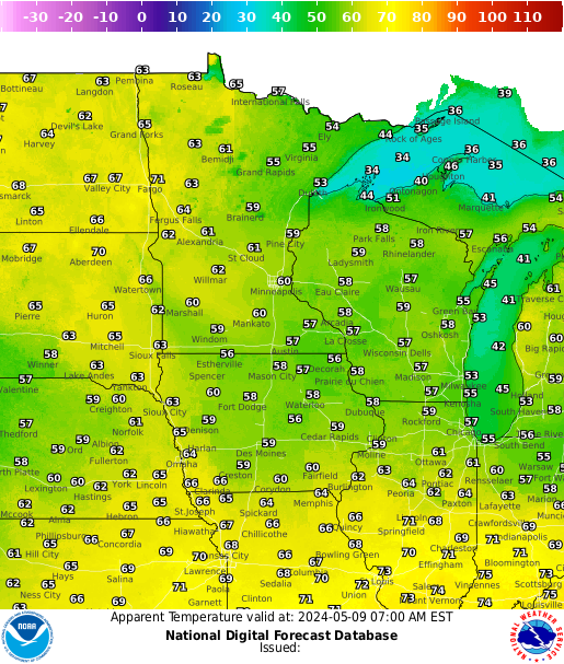
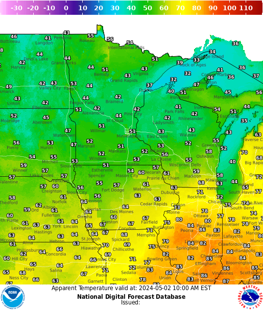
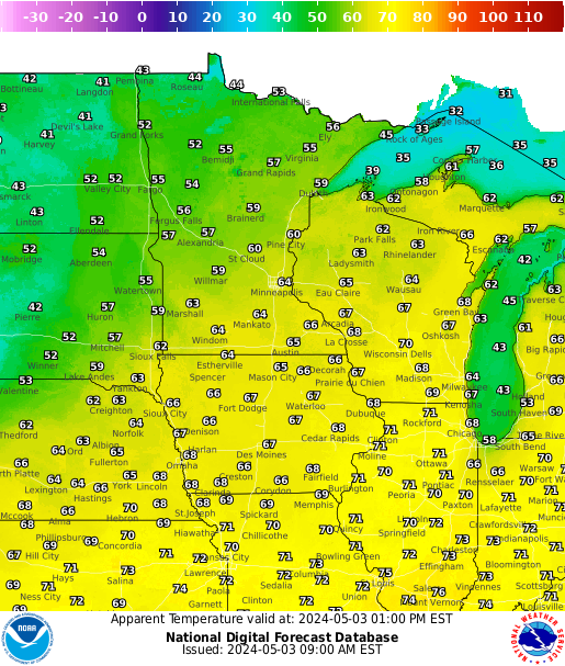
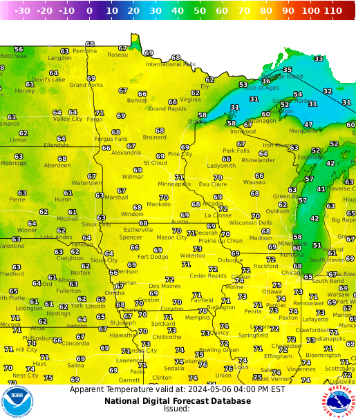
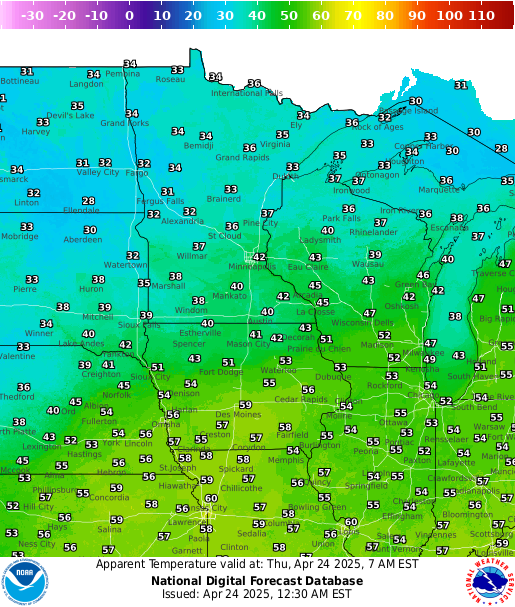
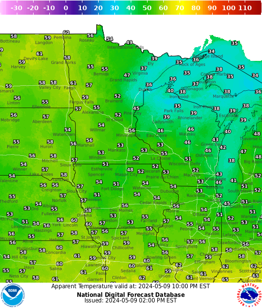
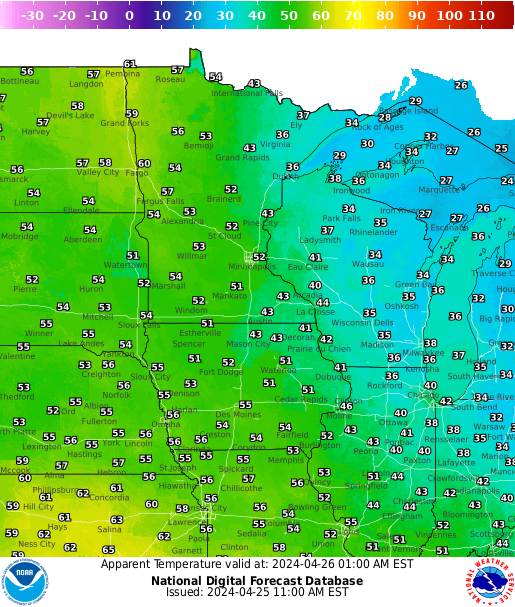
| Forecast Heat Index | ||||||
 |
 |
 |
 |
 |
 |
 |
| Most Current | 18 hours | |||||
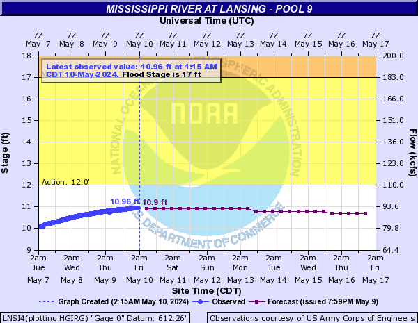
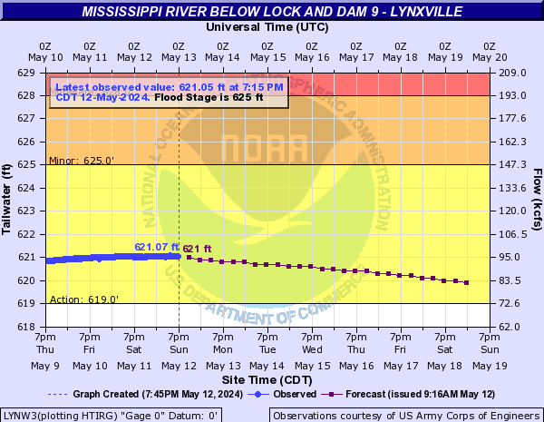
Local River Links
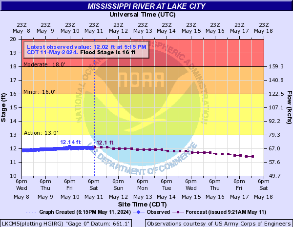
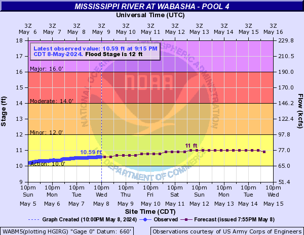
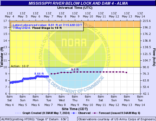
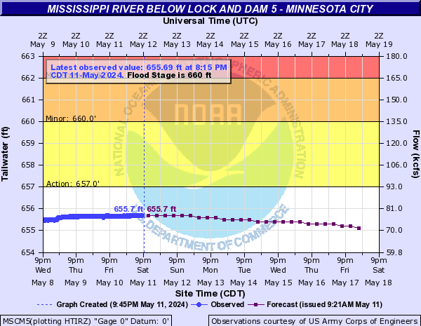
| Lake City | Wabasha | Alma | Minnesota City Dam 5 |
 |
 |
 |
 |
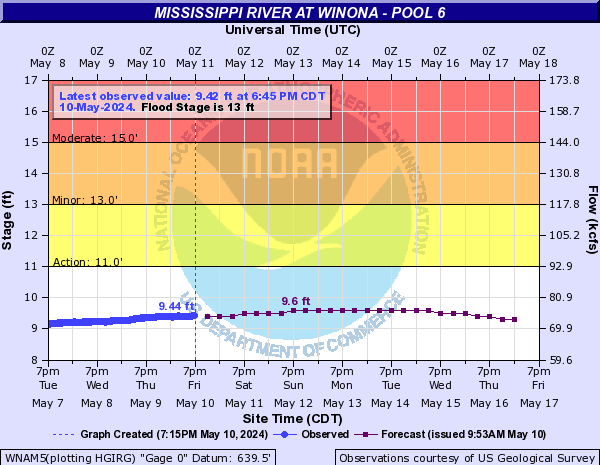
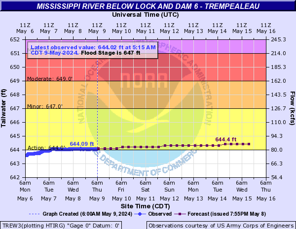
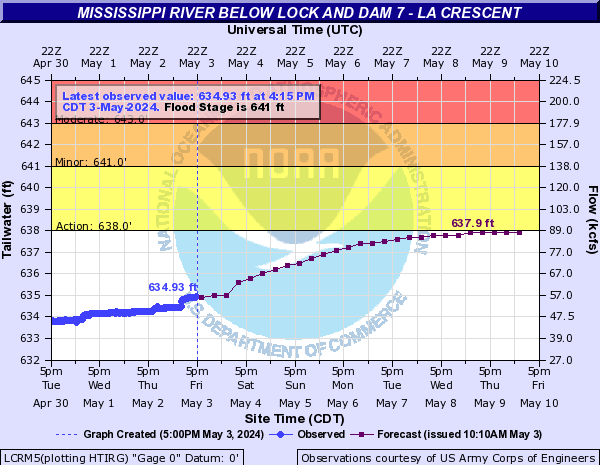
| Winona Dam 5A | Winona | Trempealeau Dam 6 | La Crescent Dam 7 |
 |
 |
 |
 |
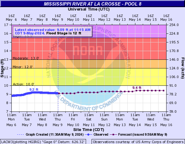
| La Crosse | Genoa Dam 8 | Lansing | Lynxville Dam 9 |
 |
 |
 |
 |
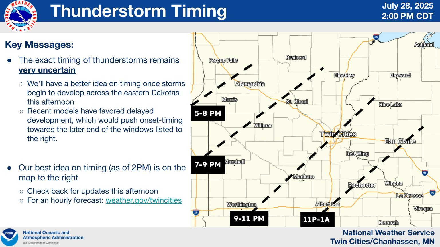
Weather Story Graphics
| La Crosse | Other Local Weather Stories | |||||||
Details |
|
|||||||
Additional Forecasts
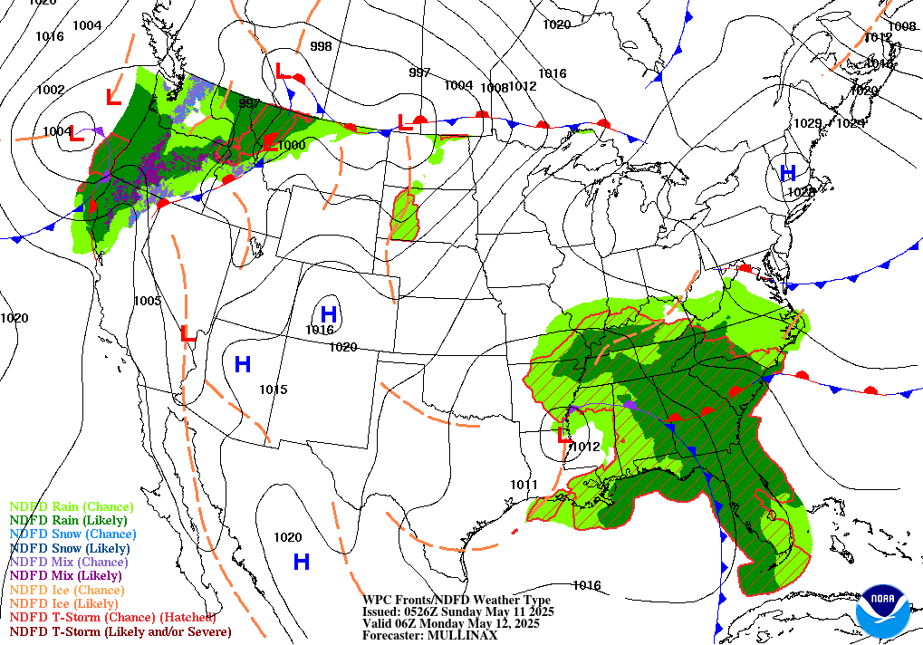
| Weather Maps (Animation) | Forecast Radar (HRRR Model) | |
Next 48 hrs |
Next 48 hrs (NOTE: This is model data and may not reflect current forecast) |
| 6-hr Surface Map | 12-hr Surface Map | 18-hr Surface Map | 24-hr Surface Map |
 |
 |
 |
 |
| 30-hr Surface Map | 36-hr Surface Map | 48-hr Surface Map | 60-hr Surface Map |
 |
 |
 |
 |
| 6-10 Day Temperature Forecast | 6-10 Day Precipitation Forecast |
 |
 |
| 8-14 Day Temperature Outlook | 8-14 Day Precipitation Outlook |
 |
 |
Safety Information
|
|
||
|
|
|
|
|
|
|
|
|
|
|
|
|
|
|
|
|
|
|
|
|
|
|
|
|
|
|
|
Informational Products (Links):
 |
Contact your local NWS office for additional details | |


 Weather Story
 Weather Map
 Local Radar