National Weather Service United States Department of Commerce

Regional Outbreaks of Severe Weather Through Early Next Week; Early Season Heat Wave across the South

Active spring pattern across the center of our nation with several episodes of severe weather and heavy rainfall expected into next week. The potential for very large hail, long track tornadoes, severe wind gusts, frequent cloud to ground lightning strikes and flash flooding are in the outlook. Furthermore, dangerous early season heat wave continues for the Gulf Coast states into early next week. Read More >

Additional heavy rainfall is expected tonight as the pattern remains active. These heavy rains could lead to flash flooding and rises on mainstem rivers given the already saturated conditions. A Flood Watch is now in effect until 1 PM Saturday. Additional heavy rains are expected for the weekend, which could lead to additional flooding potential.
Strong to severe thunderstorms are expected to be ongoing Saturday morning across portions of the area, with additional thunderstorms developing into the afternoon and evening across far southeast Oklahoma. Damaging winds and heavy rainfall/ flash flooding will continue to be the favored hazards, along with potential for large hail and tornadoes.
Another complex of strong to severe thunderstorms is expected to impact the region Sunday evening and overnight. These storms will likely be capable of producing damaging wind gusts, large hail, and a limited tornado threat.
Tulsa Radar (Inola, Ok - KINX)
Latest Text Product Selector (Selected product opens in a new window)
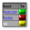
Decision Support Winter Hazards Observations Climate Hydrology
 
 
Social Media Satellite Fire Weather Weather Radio Spotter Training Text Products
 
 
Models