|
|
|
|
|
|
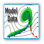
| Short Term (1-24 hours) | |
| Model | Link |
| RAP | rapidrefresh.noaa.gov/RAP |
| HRRR | rapidrefresh.noaa.gov/HRRR |
| Mid Term (1-3 days) | |
| Model | Link |
| NAM | mag.ncep.noaa.gov |
| Long Term (1-10 days) | |
| Model | Link |
| GFS | mag.ncep.noaa.gov |
| ECMWF | www.ecmwf.int |
| UKMET | meteocentre.com |
| Canadian | weather.gc.ca |
| Ensembles) | |
| Model | Link |
| GEFS Spaghetti | mag.ncep.noaa.gov |
| GEFS Mean and Spread | mag.ncep.noaa.gov |
| NAEFS | mag.ncep.noaa.gov |
| SREF | mag.ncep.noaa.gov |
 |
 |
 |
 |
 |
 |
| Decision Support | Winter | Hazards | Observations | Climate | Hydrology |
 |
 |
 |
 |
 |
 |
| Social Media | Satellite | Fire Weather | Weather Radio | Spotter Training | Text Products |
 |
|||||
| Models | |||||