Tropical Depression Two is expected to gradually strengthen and could bring tropical storm conditions to the Florida Panhandle beginning late Monday. Areas of flash flooding will be possible through Thursday along the eastern and central Gulf Coast. Severe thunderstorms will develop and move along a cold front crossing the Upper Midwest Monday, and through the Ohio Valley/Mid-Atlantic on Tuesday. Read More >
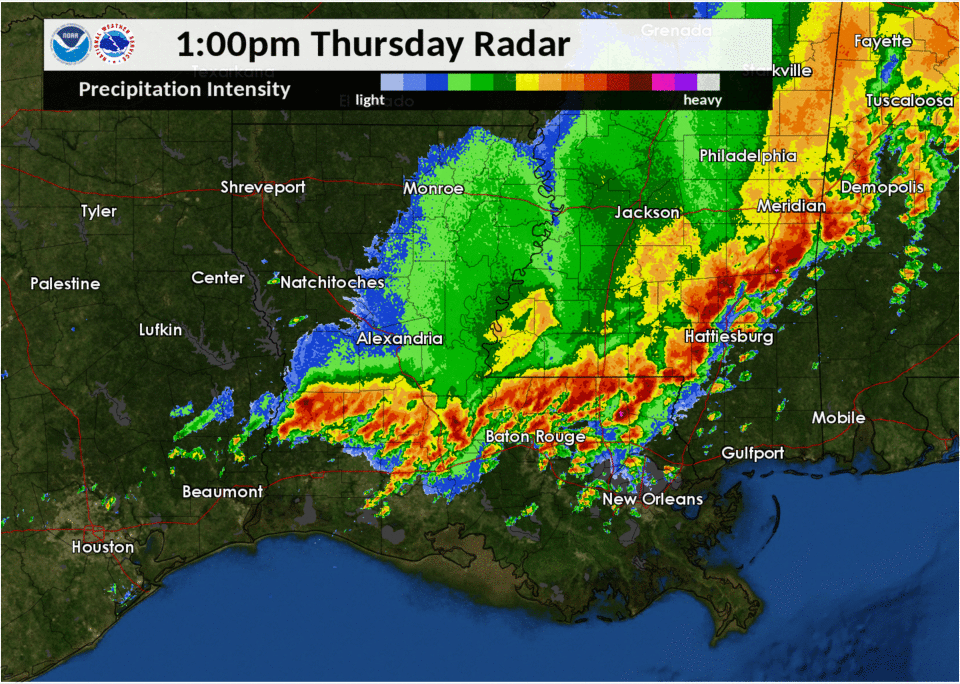
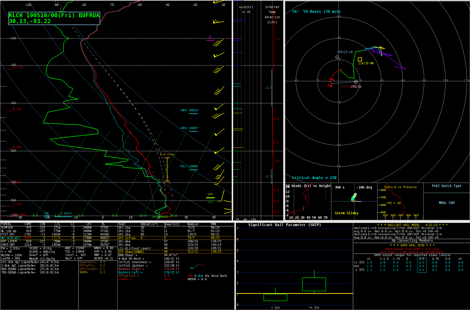
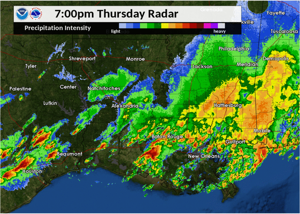
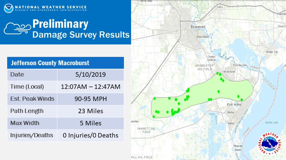
Outflow from showers and thunderstorms earlier in the day and a slowly moving cold front produced several rounds of severe thunderstorms through the evening hours into the overnight hours of May 9th and 10th. Several supercell thunderstorms produced significant hail in excess of two inches across Southeast Texas and Southwest Louisiana. A squall line then moved through the region during the overnight hours and produced significant straight line winds across Southeast Texas.
|
Meteorological Overview
Hail Swaths
Jefferson County Macroburst
|
|||||||||||||
| Back to Top | |||||||||||||