
Remnant moisture from Tropical Storm Rachel will persist over portions of the Great Basin and Southwest on Monday, bringing a potential heavy to excessive rainfall risk. Well above average and potentially record breaking temperatures will develop across the Plains and Midwest early this week, spreading into the Lower Mississippi Valley and Southeast midweek. Read More >
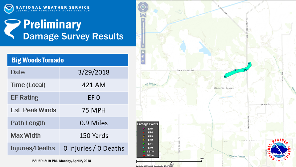
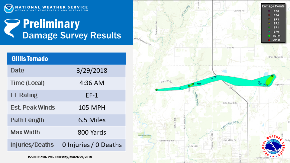
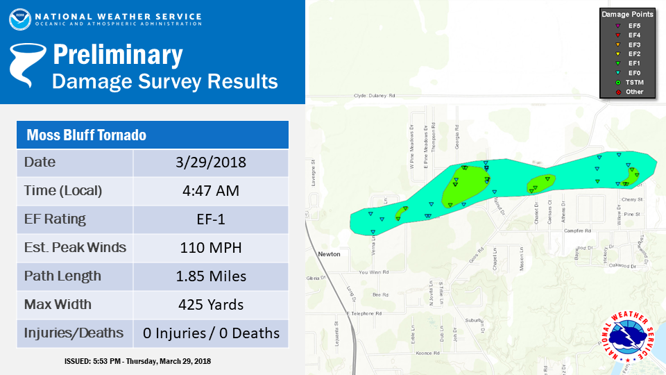
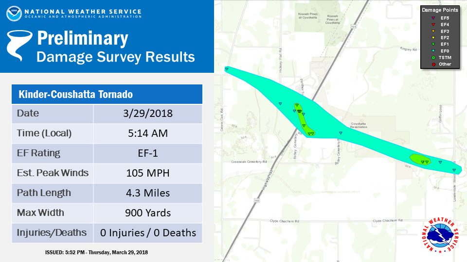
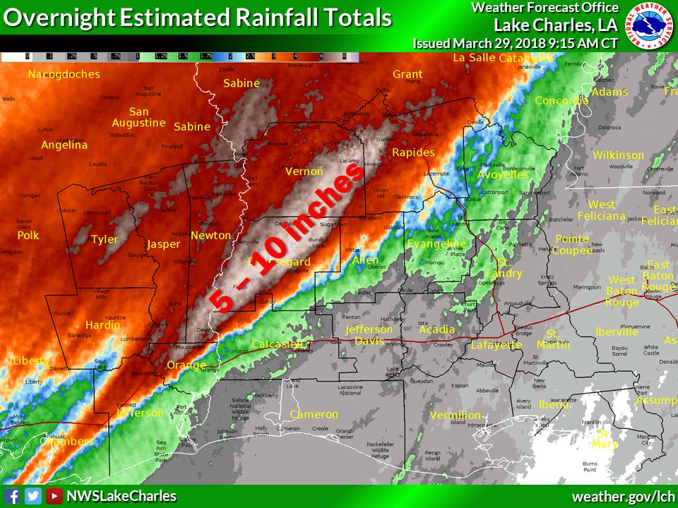
A slow moving cold front triggered multiple rounds of thunderstorms across Southeast Texas and Southwest Louisiana on March 28th and 29th, 2018. These thunderstorms trained over the same location resulting in rainfall totals of 5 to 10 inches that produced flooding, particularly in Beauregard Parish. During the early morning hours of the 29th, the line of thunderstorms began to accelerate eastward as they became more organized and produced four tornadoes in Calcasieu and Allen Parishes.
|
Tornadoes
Rainfall
|
||||||||||||||
| Back to Top | ||||||||||||||


 Follow us on X
 Follow us on Facebook
 Follow us on YouTube
 LCH RSS Feed