
Areas of rain and thunderstorms are forecast Monday across the central and eastern states. Some mixed rain and snow is possible in the high Sierra Mountains. Heavy to excessive rain may bring flooding in the central Appalachians. Read More >
Lake Charles, LA
Weather Forecast Office
DeQuincy Tornado - December 20, 2011
During the early morning hours of December 20, 2011, a cold front moved across Southeast Texas and Southwest Louisiana producing isolated showers and thunderstorms ahead of it. By 5:00 AM, the activity had consolidated into a line of showers with embedded thunderstorms across Southeast Texas. The line continued to push east into Southwest Louisiana and by 8:00 AM extended across the CWA from Vernon parish Southwest into Jefferson County, Texas. At 8:24 AM, NWS radar at Lake Charles indicated rotation with a thunderstorm across northern Calcasieu and southern Bearegard parishes.
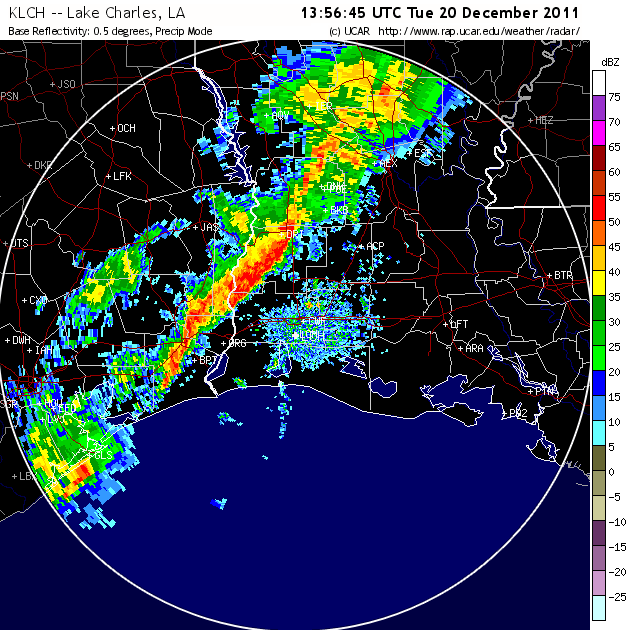
Reflectivity at 7:56 AM on the morning of the 20th.
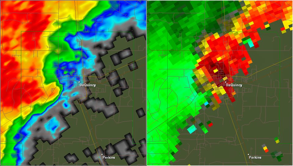
Reflectivity and Velocity images just prior to tornado touchdown
A Tornado Warning was issued at 8:25 AM for Southern Bearegard and North Central Calcasieu parishes, including the city of DeQuincy. Shortly thereafter, WFO LCH received a report of weather related damage to DeQuincy Memorial Hospital via Facebook. Calls to the hospital confirmed the damage report and a storm surveyer was dispatched. The results of that survey are outlined below.

Damage Path of DeQuincy Tornado
NWS Storm Survey
Date: 12/20/2011
Time: 8:25 AM
Event: Tornado
Rating: EF 1 (86–110 MPH)
Location: ENE DeQuincy (Calcasieu)
Injuries: 0
Fatalities: 0
Damage path extended from one quarter mile Southwest of Bearegard Memorial Hospital to one half mile Northeast of the hospital. Damage included the roof blown off of West wing of Patient Care Center facility of DeQuincy Memorial Hospital, trees and powerlines downed as well as damage to three vehicles in the parking lot of the hospital.
Review by Calcasieu parish emergency managers estimated $750,000 worth of damage to DeQuincy Memorial Hospital and an additional $100,000 worth of damage to vehicles in the hospital parking lot.
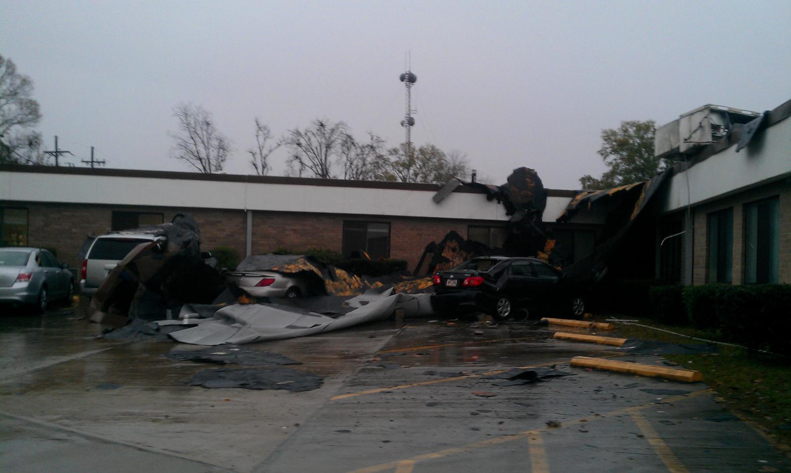
Tornado damage at Bearegard Memorial Hospital
Photo Courtesy of Kent Kuyper, NWS LCH
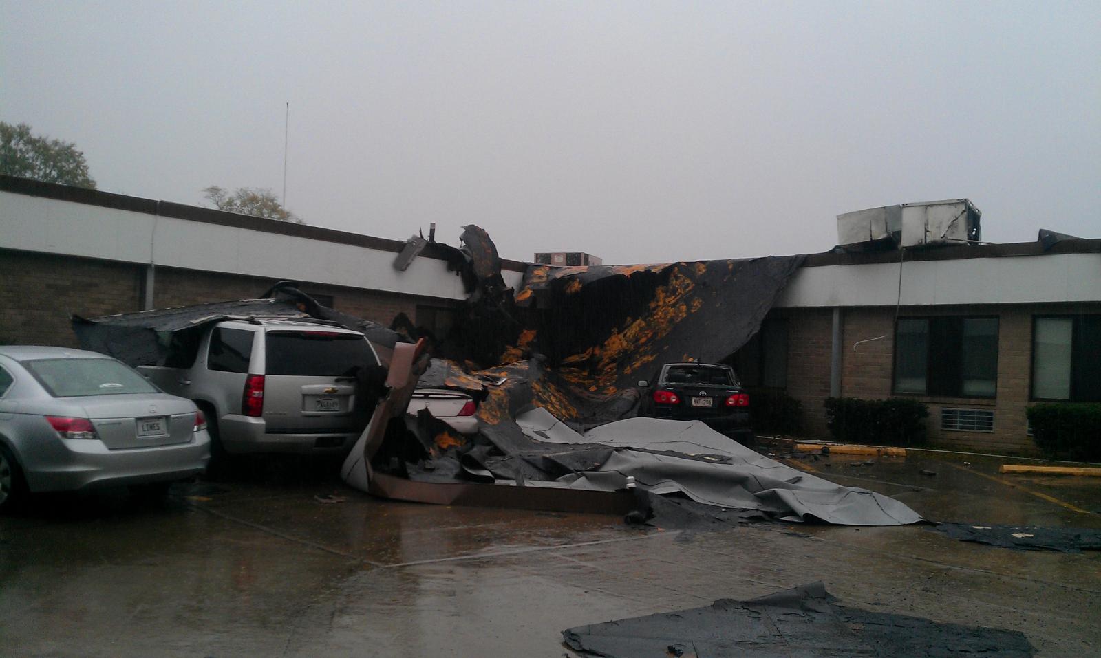
Tornado damage at Bearegard Memorial Hospital
Photo Courtesy of Kent Kuyper, NWS LCH
The DeQuincy tornado was the 1,881st U.S. tornado reported in 2011, but the first confirmed during the month of December, 2011
No other reports were received during the event.
Webpage Created By Donald Jones
Forecasts
Wet Bulb Globe Temps
Aviation Weather
Activity Planner
Mardi Gras Decision Support
Marine Forecasts
Local Products
Model Data
Forecaster's Discussion
Fire Weather
Graphical Forecasts
Other Links
National Hurricane Ctr
Storm Prediction Ctr
Weather Prediction Ctr
Other Links
Office History
LCH StoryMap
Hazards
Severe Weather
Tropical Weather
National Outlooks
Local Storm Reports
Tropical Cyclone Reports
Current
Satellite Data
Observations
Tide Data
Hydrology
Calcasieu Par. Network
Jefferson Co. DD6 Network
River/Lake Forecasts
Radar
Shreveport (SHV)
New Orleans (LIX)
Fort Polk (POE)
Houston/Galveston (HGX)
Lake Charles (LCH)
Probabilistic Pages
Probabilistic Snowfall
Probabilistic Rainfall
Probabilistic DSS

US Dept of Commerce
National Oceanic and Atmospheric Administration
National Weather Service
Lake Charles, LA
500 Airport Boulevard
Lake Charles, LA 70607
(337) 477-5285 M-F 8a to 4p only
Comments? Questions? Please Contact Us.


 Follow us on X
 Follow us on Facebook
 Follow us on YouTube
 LCH RSS Feed