National Weather Service United States Department of Commerce

Banner
Banner image courtesy Mark Anderton

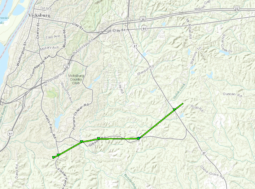
Warren County EF-1 Tornado

Click on map above to see entire damage point notation and damage pictures at select points.

Event Summary
This tornado started just west of Fisher Ferry Road where several trees were snapped. The tornado then paralleled Gibson Road for a short period where some tin was peeled from a roof and several other trees were snapped or uprooted. A couple trees also fell on power lines along Gibson Road. This tornado ended just east of Highway 27 where a few additional trees were snapped.

Rating:
(Click for EF Scale)
EF-1
Estimated Maximum Wind: 105 mph
Fatalities/Injuries: none
Damage Path Length: 4.75 miles
Maximum Path Width: 200 yards
Approximate Start Point/Time:

4.5 S Vicksburg
4:55 pm

Approximate End Point/Time:

5.25 SE Vicksburg
5:05 pm