Event Summary
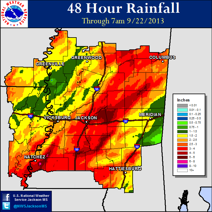
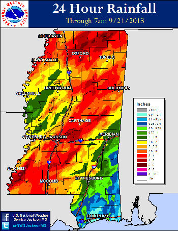
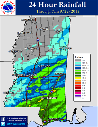
Heavy, and much needed, rain fell beginning on September 20th and continued into the 21st ahead of an approaching cold front. High moisture content was present ahead of this front as atmospheric profiles showed moisture content nearing two standard deviations above normal for late September. This set the stage for several inches of rain to fall over a region that was seeing below normal monthly rainfall, burn bans and high fire danger. A steady rain fell during the overnight hours of the 20th into the 21st, bringing widespread 1 to 3 inches of rain to the ArkLaMiss. The heaviest rain fell along the Natchez Trace Parkway corridor, where 3 to 5 inches of rain fell. Some flash flooding was reported resulting from some of the heaviest rainbands.
In addition to the needed rainfall, 6 tornadoes occurred across portions of the ArkLaMiss. Just enough wind shear was present across the region as a surface low tracked just along the Natchez Trace. These tornadoes were very small, very quick and brief occurrences embedded in the rain shield. The first four tornadoes occurred in smaller discrete cells, while the last two occurred in a strong rainband. Much of the damage was minor and no fatalities or injuries occurred.
Tornado Track Map
Click on map above to see entire event tracks and damage point notation. Individual track maps also available on individual tornado pages.
Survey Information - Click on the location in the table for additional maps and details
| Location | Start/ End Time |
Event Type | Fatalities/ Injuries |
Path Length | Path Width |
| Sunflower County 6 ENE Renova |
7:24 pm - 7:25 pm |
EF-0 Tornado 75 mph |
none | 1/2 mile | 100 yards |
| Simpson County 4 S White Oak to 2 SSE White Oak |
9:57pm - 10:05 pm |
EF-0 Tornado 75 mph |
none | 2.3 miles | 50 yards |
| Adams County 1 SW Kingston to 1 W Kingston |
11:30 pm - 11:33 pm |
EF-2 Tornado 115 mph |
none | 1 mile | 200 yards |
| Adams County 2 E Cranfield |
11:54 pm - 11:56 pm |
EF-1 Tornado 100 mph |
none | 0.3 miles | 200 yards |
| Rankin County 6 W Polkville to 5.5 W Polkville |
2:53 am - 2:54 am |
EF-1 Tornado 100 mph |
none | 0.5 miles | 100 yards |
| Smith County 3 WNW Pineville |
3:33 am - 3:35 am |
EF-1 Tornado 95 mph |
none | 0.75 miles | 50 yards |
Local Storm Reports
Click on the map below for additional details.
Rainfall Totals
Storm Total Rainfall

Mississippi Rainfall Totals
| 9/20 AM - 9/21 AM | 9/21 AM - 9/22 AM |
 |
 |