Jackson, Mississippi
Weather Forecast Office
February 24, 2011 Severe Weather Event
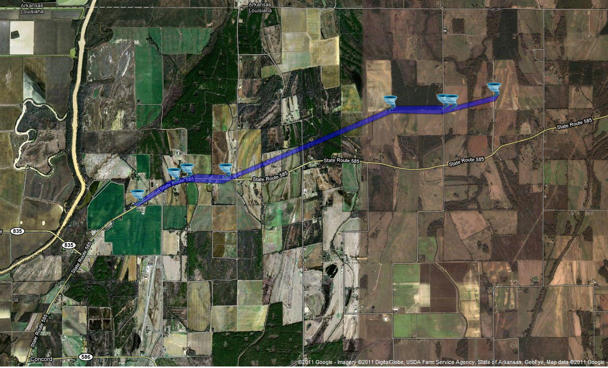
West Carroll Parish Tornado
Click on Map Below to Zoom In/Out and To See Damage Notation
|
Event Summary The tornado first touched down near the intersection of highways 585 and 835 in the northwest part of West Carroll Parish. A grain truck was overturned first. Significant damage occurred to the roof of a church and minor damage occurred to the nearby parsonage. Then, the tornado knocked down a very large tree, which fell on a shed and the corner of a house. Two people narrowly escaped harm from this falling tree. As the tornado continued to move east-northeast, it destroyed a small shed, damaged a larger shed, and blew out some windows of a house. A large antenna was also significantly bent over. A travel trailer was turned about 45 degrees into a garage. The next structure the tornado encountered was a double-wide trailer, which had a large part of the roof blown off. Finally, another trailer was turned over in Kilbourne. Numerous trees were snapped and uprooted along the path. |
|
US Dept of Commerce
National Oceanic and Atmospheric Administration
National Weather Service
Jackson, Mississippi
234 Weather Service Dr.
Flowood, MS 39232
601-936-2189
Comments? Questions? Please Contact Us.


