Jackson, Mississippi
Weather Forecast Office
Severe Storms Produce Tornado Near Pocahontas
 |
County: Madison County
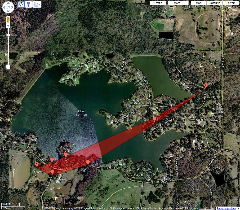
TORNADO STARTED ALONG COKER ROAD...WHERE IT DOWNED SEVERAL TREES AND LARGE LIMBS...BLEW DOWN A FENCE...DOWNED A POWERLINE...AND CAUSED MINOR DAMAGE TO A BARN. AT LEAST ONE HOME WAS DAMAGED BY A LARGE SECTION OF A TREE FALLING ON THE CORNER OF IT. THE TORNADO THEN TRACKED EAST NORTHEAST ACROSS MOSS RIDGE ROAD WHERE A COUPLE OF TREES AND SEVERAL LARGE LIMBS WERE DOWNED...DAMAGING SOME FENCES. FROM THERE THE TORNADO MOVED ACROSS LAKE LORMAN...AND THEN DOWNED SOME TREES...LIMBS AND A POWERLINE ALONG LAKESHORE DRIVE. THE TORNADO DISSIPATED SHORTLY AFTER THIS POINT. THE PATH OF DAMAGE WAS RELATIVELY FOCUSED...WITH VERY LITTLE DAMAGE OBSERVED OUTSIDE OF THIS PATH.
US Dept of Commerce
National Oceanic and Atmospheric Administration
National Weather Service
Jackson, Mississippi
234 Weather Service Dr.
Flowood, MS 39232
601-936-2189
Comments? Questions? Please Contact Us.

