Jackson, Mississippi
Weather Forecast Office
Easter Sunday Heavy Rain and Severe Weather
 |
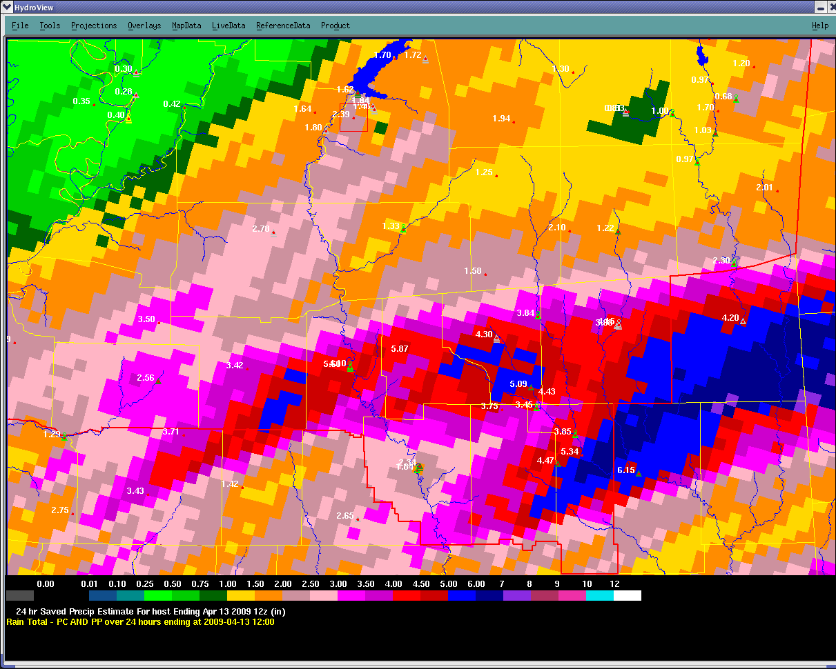
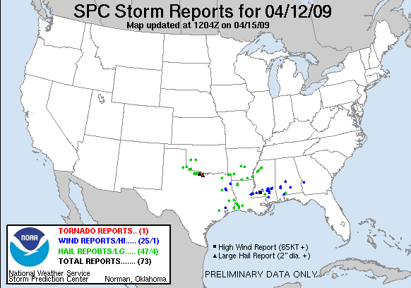
During the late afternoon and evening hours of Easter Sunday, a large and strong upper level low clashed into an airmass where high levels of moisture were being pulled northward. This resulted in scattered severe storms which produced penny to half dollar sized hail and damaging winds. Most of the hail occurred across NW portions of the forecast area where the damaging winds occurred across the southern 1/3 rd. All of the convective wind damage occurred within the Highway 84 corridor from Natchez to Laurel. A bowing line of storms moved through this area and downed numerous trees. Some of the winds could have been as high as 80 mph across northern Lawrence, Jefferson Davis, and Covington Counties.
Aside from the convective winds during the line of thunderstorms, a wake low event occurred across the NE quadrant of the forecast area (locations E of I-55 and N of I-20). This wake low occurred as higher pressures were held on to by the stratiform rain shield. As the back edge of the rain pushes east, surface pressures are allowed to drop rapidly in response to the main surface low which was located over S Arkansas. The rapid drop in pressure, forced the winds to increase and shift more out of the east. As this occurred Sunday evening, sustained easterly winds increased to 30 to 45 mph with gusts between 50 and 60 mph. These strong winds downed may trees and caused other minor damage across the NE portion of the area.
Severe weather reports across the region from 4/12/09
 |
US Dept of Commerce
National Oceanic and Atmospheric Administration
National Weather Service
Jackson, Mississippi
234 Weather Service Dr.
Flowood, MS 39232
601-936-2189
Comments? Questions? Please Contact Us.

