Jackson, Mississippi
Weather Forecast Office
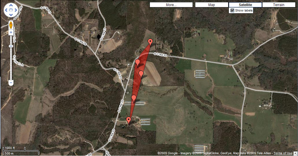 |
Location / Time of event: Smith County, 1/3/09 1:12-1:14 pm
Beginning Point: 4 WNW Stringer
Ending Point: 4 NW Stringer
Rating: EF1 maximum estimated wind speed at 90 mph
Path Length: 1 mile
Maximum Width: 175 yd
Fatalities: 0
Injuries: 0
Summary of Damages: Several hardwood and softwood trees uprooted and one softwood tree snapped. Three chicken houses had some of the roof blown off and one had a section that collapsed. The roofing material of the chicken houses was blown downwind for the length of the tornado. Three houses received minor damage to the roofs including shingles blown off and gutters damaged. A window was blown in at one house. Several fences were blown over and a large carport/shed was destroyed.
US Dept of Commerce
National Oceanic and Atmospheric Administration
National Weather Service
Jackson, Mississippi
234 Weather Service Dr.
Flowood, MS 39232
601-936-2189
Comments? Questions? Please Contact Us.

