Damage Surveys from Rankin County
 |
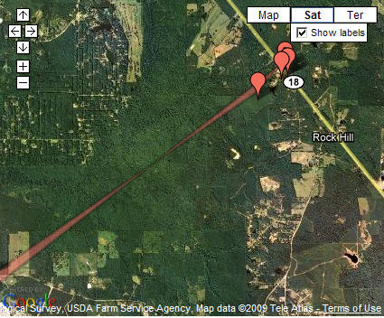
Location / Time of event: Rankin County, 904pm CST 12/9/08
Beginning Point: 1.2 miles northwest of Star
Ending Point: 1.3 miles north northeast of Star
Rating: EF2 with max winds estimated at 112mph
Path Length: 1.1 miles
Maximum Width: 300 yards wide
Fatalities: 0
Injuries: 0
Summary of Damages: The tornado path began 1.2 miles northwest of Star and moved northeast for about 1.1 miles across southwest Rankin county. The tornado caused extensive damage to the Star baseball field. It knocked down the light fixtures off the poles. Metal fences were blown down and the dugout structure was destroyed. Damage to a couple of cars in the area also occurred due to fallen trees. The tornado damaged a residence with an 8 foot hole to the roof and completely destroying a well constructed metal outbuilding that housed a small personal airplane. This is where the tornado was deemed to be the strongest with winds estimated to be around 112 mph and a rating of EF2. Most of the other damage along the path was uprooted and snapped trees. The top to a small well house was also toppled.
Location / Time of event: Rankin County, 908pm CST 12/9/08
Beginning Point: 6.3 miles northeast of Star
Ending Point: 5 miles SSE of Brandon
Rating: EF1 with max winds estimated at 94mph
Path Length: 5.1miles
Maximum Width: 0.75 miles
Fatalities: 0
Injuries: 0
Summary of Damages: The tornado touched down again 6.3 miles northeast of Star. It caused extensive tree damage along Garrett Road, Shell Oil Road, Highway 18 and Cannon Drive, extending to the Southeast of the Robinhood community with snapped and uprooted trees as well as downed powerlines.
Location / Time of event: Rankin County, 921pm CST 12/9/08
Beginning Point: 7.2 miles southwest of Pelahatchie
Ending Point: 4.0 miles southwest of Pelahatchie
Rating: EF1 with max winds estimated at 86mph
Path Length: 3.2 miles
Maximum Width: 200 yards
Fatalities: 0
Injuries: 0
Summary of Damages: The tornado finally touched down about 7 miles southwest of Pelahatchie, causing tree damage with snapped trees and tree limbs being the primary damage. A couple of trees were uprooted and the metal roof from an abandoned building was torn off and strewn across the neighboring field. This small location was where the tornado likely reached its peak speed of EF1 strength at 86 mph. Otherwise, most tree damage along the path was minor and likely of EF0 strength and speeds of around 75 mph.