Jackson, Mississippi
Weather Forecast Office
Damage Survey from Montgomery County
 |
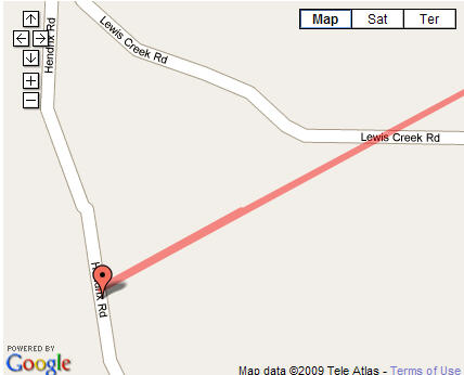
Location / Time of event: Montgomery County, 637 pm 12/9/08
Beginning Point: 4.5W Kilmichael
Ending Point: 3.7WNW Kilmichael
Rating: EF1, Estimated winds of 90 mph
Path Length: 1 mile
Maximum Width: 75 yd
Fatalities: 0
Injuries: 0
Summary of Damages: Just after touching down, the tornado heavily damaged a mobile home on Hendrix Road. Half the roof and structure was destroyed, all the windows were blown out, and the windows on a nearby car were blown out. Another nearby mobile home had the skirting blown out. The tornado tracked northeast, taking the tops out of some trees along Lewis Creek Road. The tornado dissipated shortly after this point.
US Dept of Commerce
National Oceanic and Atmospheric Administration
National Weather Service
Jackson, Mississippi
234 Weather Service Dr.
Flowood, MS 39232
601-936-2189
Comments? Questions? Please Contact Us.

