Jackson, Mississippi
Weather Forecast Office
"Ivan" Storm Summary Page
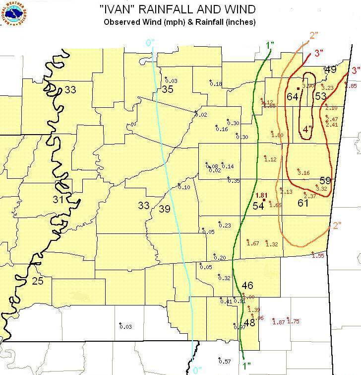
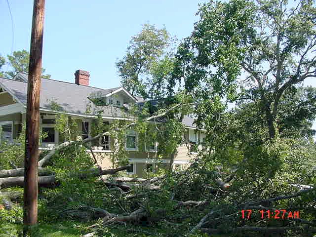
Hurricane Ivan made landfall on the Alabama coast late Wednesday night and tracked northward into west central Alabama by early Thursday afternoon (SEE BACKGROUND AND PATH from WFO Birmingham). As it did so, strong north winds on the backside of "Ivan" resulted in considerable tree damage (see damage below from the Lauderdale County area) over portions of east Mississippi. In addition, a persistent band of heavier rainfall set up from the Golden Triangle region southward toward Meridian. Radar estimated that greater than 4 inches of rain fell in association with this rain band. Otherwise, rainfall totals of 1 to 3 inches were common over eastern Mississippi. As is typically the case with the back side of land-falling tropical cyclones, there was a sharp western edge to the heavier rain. Areas along the I-55 corridor received almost no measurable rainfall, and the winds were not as strong, although occasional gusts to near tropical storm force (>38 mph) occurred. For a more in depth look on "Ivan's" impact click here (NWS Mobile).
Click on the images below for larger pictures:
Click on the images below for larger pictures:

US Dept of Commerce
National Oceanic and Atmospheric Administration
National Weather Service
Jackson, Mississippi
234 Weather Service Dr.
Flowood, MS 39232
601-936-2189
Comments? Questions? Please Contact Us.


