"Hurricane Lili" Storm Summary Page
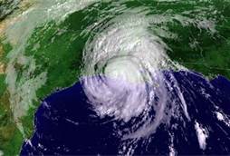
Hurricane Lili crossed western Cuba as a category 2 hurricane and made landfall on the Louisiana coast as a category 1 hurricane. Lili also affected the Windward Islands as a tropical storm, the northeastern Cayman Islands as a category 1 hurricane, and caused serious flooding in Jamaica. Nine deaths are attributed to Lili. Lili reached category 4 intensity over the Gulf of America.
1) SYNOPTIC HISTORY
Lili originated from a tropical wave that moved over the tropical Atlantic Ocean from the west coast of Africa on 16 September. Convective clouds became sufficiently well organized on 21 September to qualify the system as a tropical depression, while centered about 900 n mi east of the Windward Islands. The tropical cyclone moved just north of due westward at over 20 kt, crossing the Windward Islands as a developing tropical storm on 23 September. Lili’s winds briefly reached 60 kt the next day, but the storm degenerated to an open wave on 25–26 September in the east-central Caribbean Sea as its organization was disrupted by vertical wind shear. Lili redeveloped a lowlevel closed circulation on 27 September. A day later, its forward speed decreased to about 5 kt, and the system began a slow northward jog around the north coast of Jamaica, while dumping large amounts of rain on that island over a 4-day period. Resuming a west-northwestward track, Lili became a hurricane on 30 September while passing over Little Cayman and Cayman Brac Islands. Lili continued to strengthen, and its maximum winds were near 90 kt when the center moved over the southwestern tip of the Isle of Youth on the morning of 1 October, and over western mainland Cuba a few hours later.
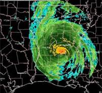
After departing Cuba, Lili strengthened over the Gulf of Mexico. On 2 October, while the hurricane approached the central Gulf, it intensified rapidly to an estimated maximum wind speed of 125 kt, category 4 intensity, by 0000 UTC 3 October. Then, while still over water, Lili weakened even more rapidly than it had strengthened. Accelerating to about 15 kt, Lili turned northward and made landfall on the Louisiana coast on 3 October with an estimated intensity of 80 kt. Although Lili weakened considerably before making landfall on the central Louisiana coast, it caused significant wind and flood damage in that area. Strong winds toppled trees onto houses and into roadways, stripped shingles from roofs, and blew out windows. The wind and driving rain flattened sugar cane fields throughout southern Louisiana. A combination of storm surge and rain caused levees to fail in Montegut and Franklin, Louisiana. Lili also temporarily curtailed oil production in the Gulf of America. The U.S. insured property damage total obtained from the American Insurance Services Group is $430 million: $415 million for Louisiana and $15 million for Mississippi. The total U.S. damage is estimated at $860 million. One fatality occurred as an indirect result of Lili in
Thus, during the 13 h prior to landfall, the hurricane’s winds decreased by about 45 kt. After moving inland, Lili was absorbed by an extratropical low on 4 October while moving northeastward near the Tennessee–Arkansas border.
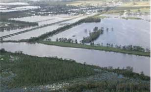
Below is an image of Southern Louisiana Flooding.
Crowley, Louisiana, where an elderly woman died from carbon monoxide poisoning from a generator. Another indirect fatality occurred in Vermilion Parish where a 79-year-old Erath man died when he fell from a ladder cleaning up storm debris. Lili killed at least 16 people throughout its lifetime, with 14 of those deaths being direct one, and it left at least $882,000,000 in damage. Lili broke a two year hiatus of US landfalling hurricanes. For the NWS Jackson Forecast Area Lili had caused some counties in the south to have a few to numerous trees blown down. This data came from our storm reports log at SPC.
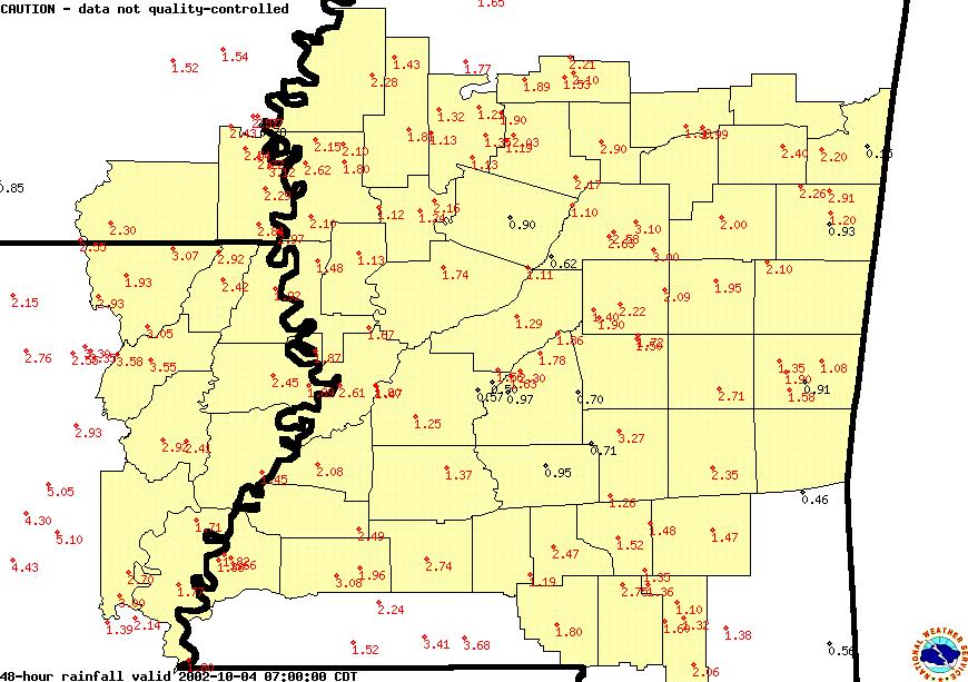
Across the ArkLaMiss the highest rainfall amounts were across the Mississippi
River where 2 to 3.5 inches had fallen from Lili.
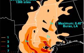
Below is a broad image of some rainfall amounts out side of the ArkLaMiss Region
in inches.
