Overview
|
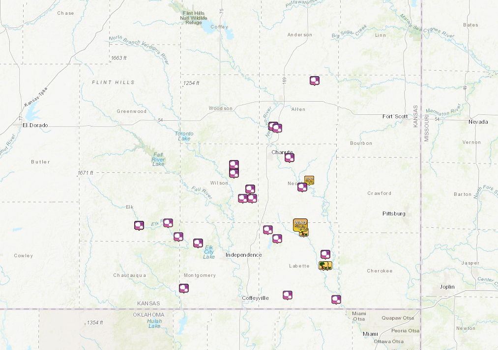
Very humid air and above normal temperatures combined to produce extreme instability across the region on the afternoon and evening hours of July 11, 2020. Scattered thunderstorms developed across east central Kansas during the afternoon hours and spread slowly south and east across southeast Kansas through the late afternoon and early evening hours. Some of the storms produced very large hail around the size of softballs as well as numerous reports of damaging winds. The Oswego area experienced more widespread wind damage with estimated speeds around 90 mph with isolated higher gusts. |
Photos & Video
|
|
|
|
|
|
|
|
|
|
Photo taken near Oswego, KS -photo courtesy Labette Co EM |
Photo taken near Oswego, KS -photo courtesy Labette Co EM |
Oswego, KS -photo courtesy Labette Co EM |
|
Oswego, KS -photo courtesy Labette Co EM |
Oswego, KS -photo courtesy Labette Co EM |
Oswego, KS -photo courtesy Labette Co EM |
|
Photo taken near Oswego, KS -photo courtesy Labette Co EM |
Photo taken near Oswego, KS -photo courtesy Labette Co EM |
Storm Reports
| Large Hail & Damaging Wind Reports | |
 |
Environment and Radar
| Above normal temperatures in the mid and upper 90s combined with dewpoint temperatures in the mid and upper 70s to produce extreme instability during the afternoon and evening hours of July 11, 2020 over portions of southern Kansas. Furthermore, a cold front approaching from the north served as a focus for thunderstorm development. | The difference in wind speed and direction between the surface and 6 km above ground of 50+ kts proved more than sufficient for severe storm organization and longevity, especially given the extreme amounts of instability. |
 |
|
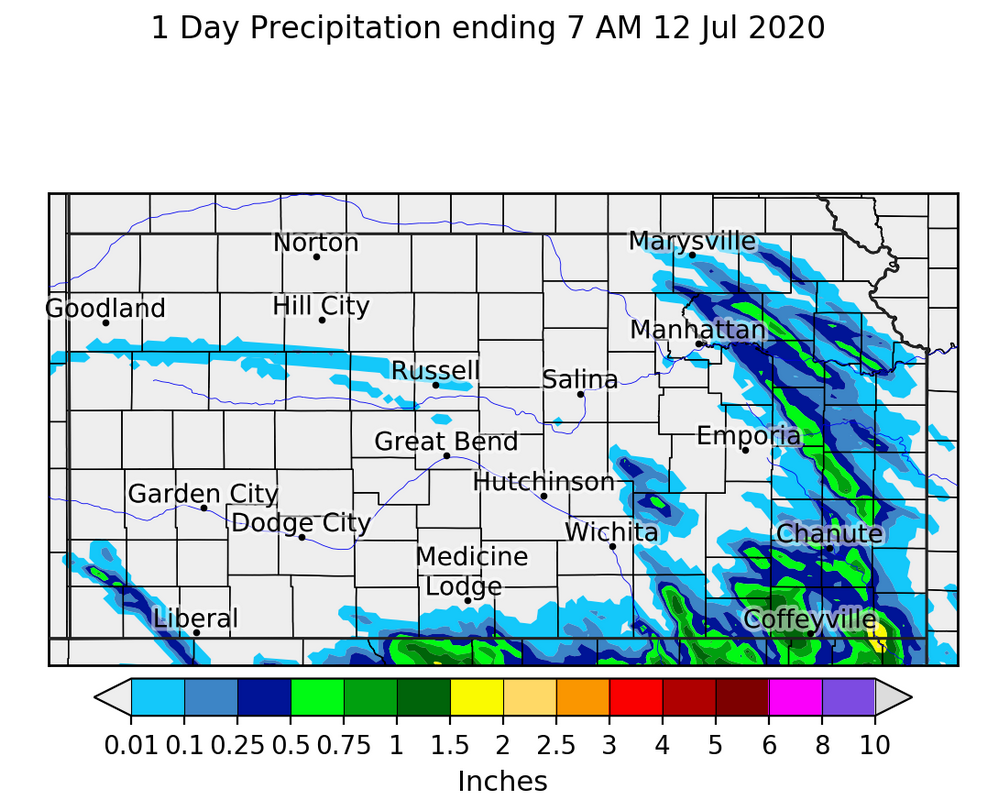
| Area radar loop from 4-8:30 PM on July 11. A relatively small cluster of storms impacted southeast Kansas. | Estimated 24-hour rainfall through 7 AM July 12. |
 |
Media use of NWS Web News Stories is encouraged! Please acknowledge the NWS as the source of any news information accessed from this site. |
 |