Overview
|
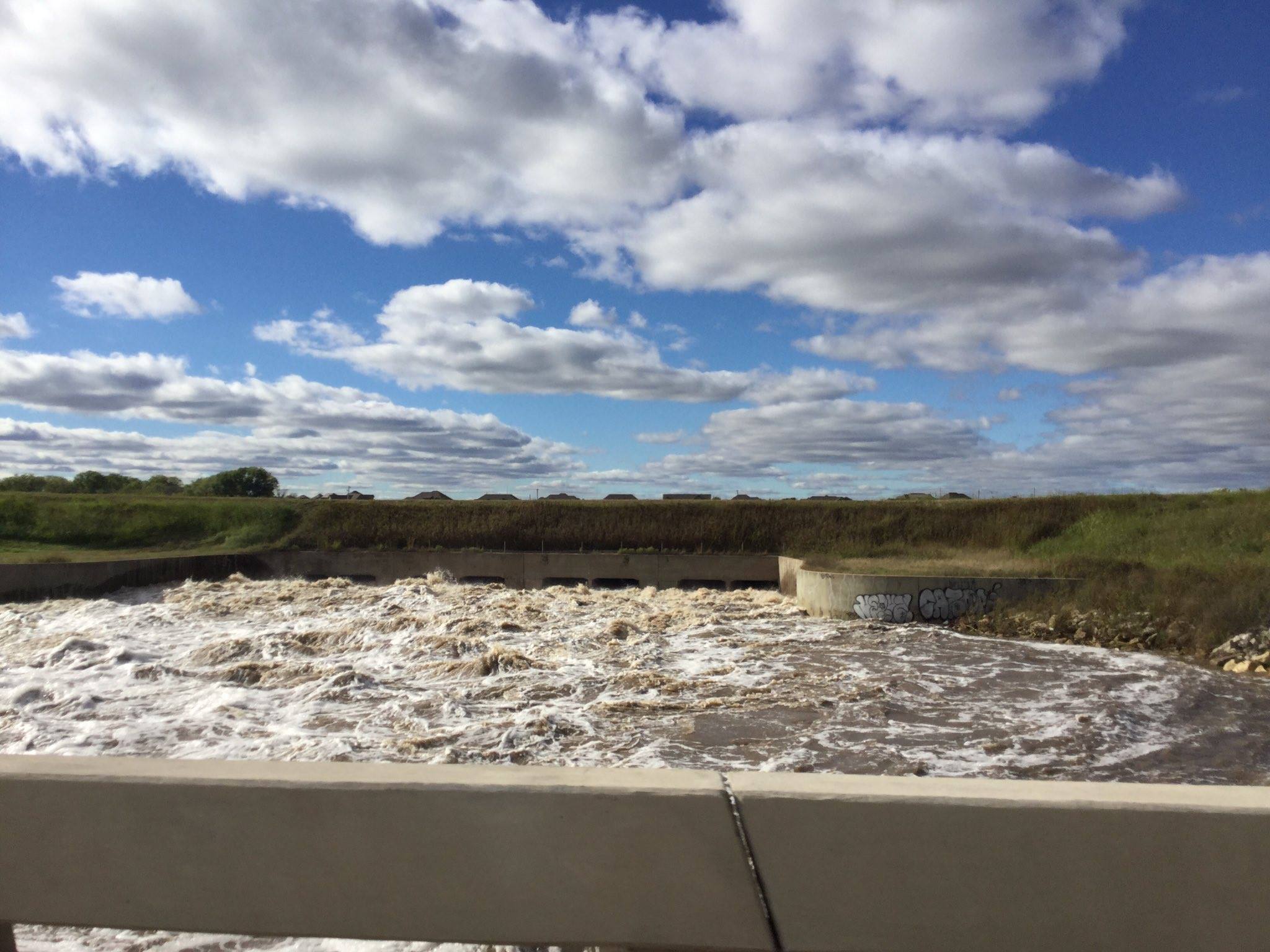
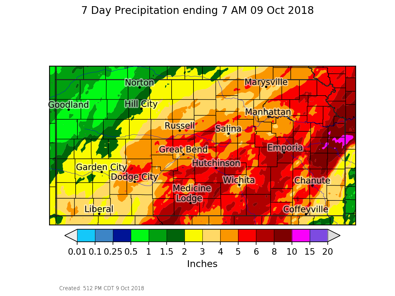
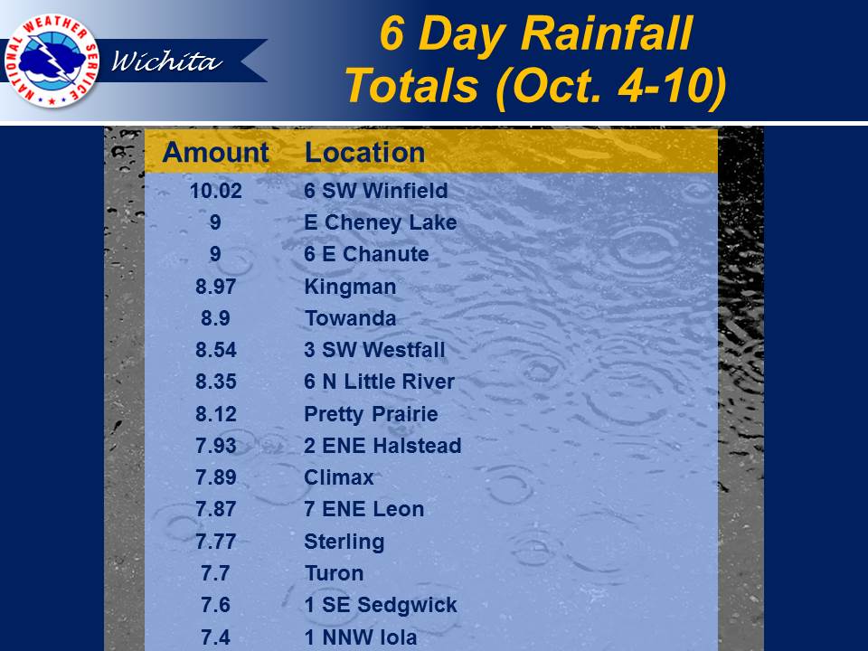
A deep upper level low pressure system setup over the southwest U.S. by Saturday October 6th and allowed unseasonably rich Gulf moisture to stream into the Plains. Multiple rounds of heavy rain affected much of Kansas with the majority of it falling on October 8th and 9th. Most locations received between 4 and 6 inches of rainfall with some locally higher amounts. This lead to widespread flooding across the region. At one point, NWS Wichita had river flood warning for 35 points along with 20 additional areal flood warnings. |
 |
Heavy Rain
 |
 |
Photos
|
Picture of swollen Arkansas River in and around downtown Wichita. |
Picture of swollen Arkansas River in and around downtown Wichita. |
Picture of swollen Arkansas River in and around downtown Wichita. |
Flooding from the Little Arkansas River near Alta Mills |
|
Flooding along the Ninnescah river near Clearwater |
Flooding from the Ninnescah river along Highway 81 near Belle Plaine |
Flooding from the Ninnescah river along Highway 81 near Belle Plaine |
Flooding from the Ninnescah river west of Belle Plaine. |
|
|
|
|
|
|
|
|
Hydrographs
 |
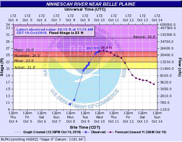 |
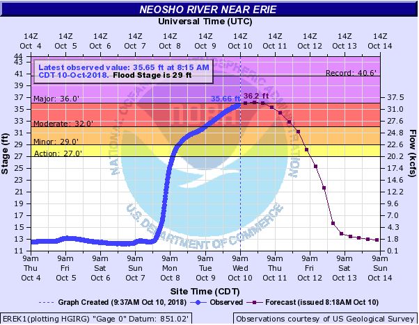 |
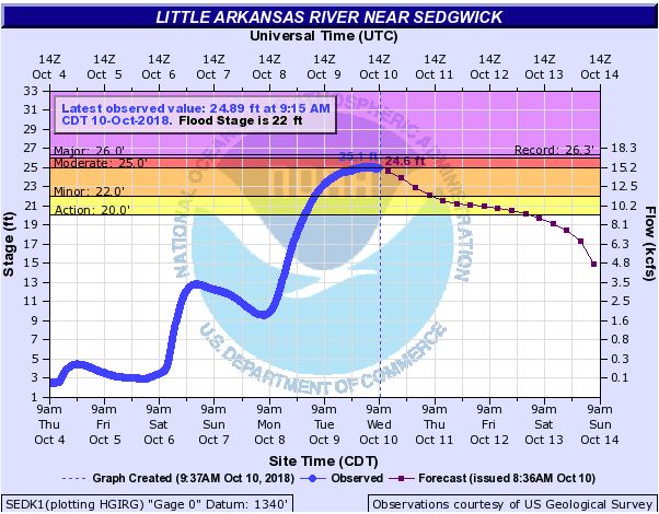 |
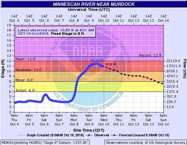
| Moderate flooding on the Ninnescah at Murdock | Major flooding on the Ninnescah River at Belle Plaine | Major flooding on the Neosho River at Erie | Moderate flooding on the Little Arkansas River at Sedgwick |
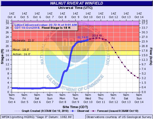 |
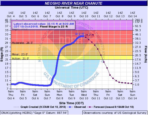 |
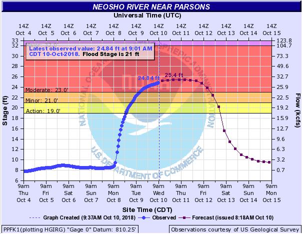 |
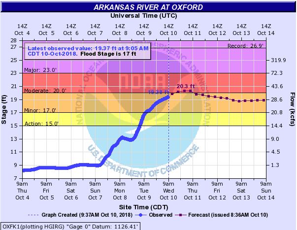 |
| Moderate Flooding on the Walnut River at Winfield | Moderate flooding on the Neosho River at Chanute | Moderate flooding on the Neosho River at Parsons | Moderate flooding on the Arkansas River at Oxford |
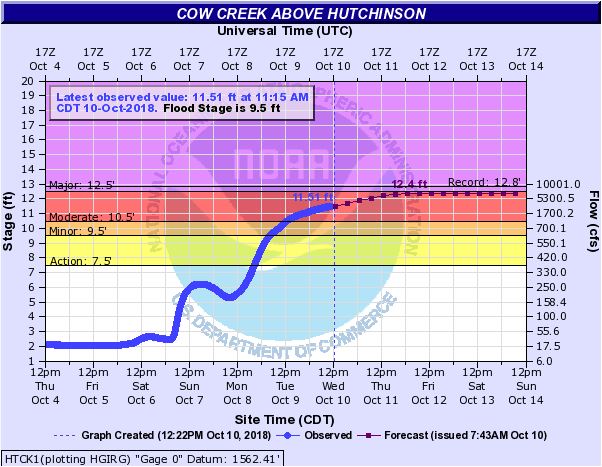 |
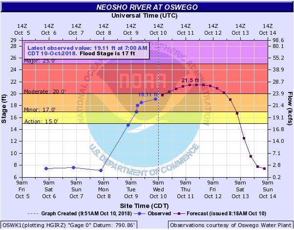 |
| Moderate Flooding on the Cow Creek near Hutchinson | Moderate flooding on the Neosho River at Oswego |
Environment - coming soon
Insert synoptic summary.
 |
 |
|
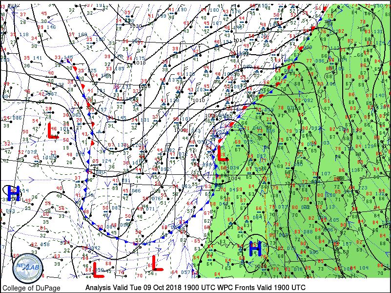
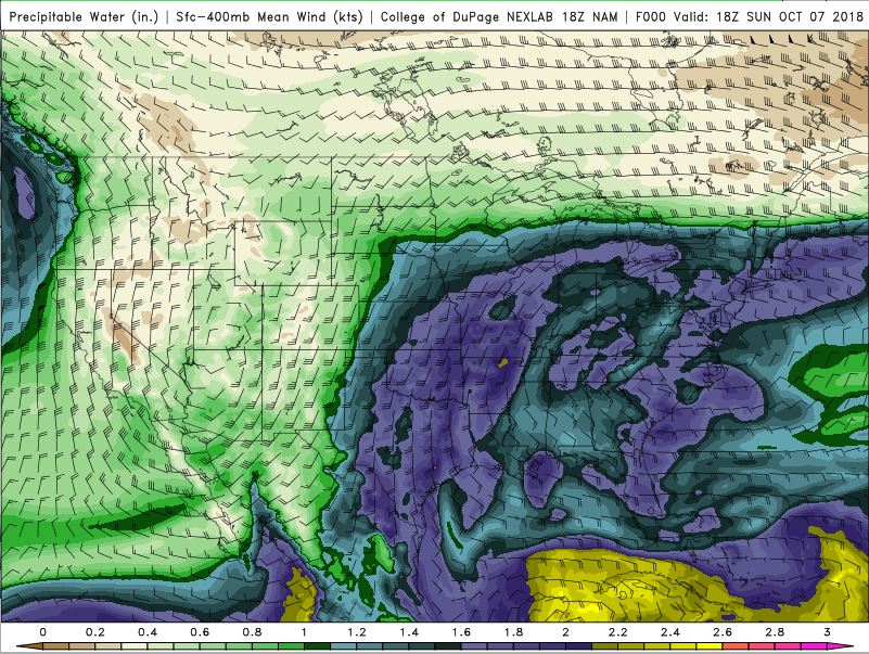
| Low pressure system moving NE across Kansas on Tuesday. | NAM representation of precipitable water imagery of 1.6-2 inches over most of eastern Kansas. This means plenty of moisture was in place across the area. | Figure 3: Caption |
| Figure 4: Caption | Figure 5: Caption | Figure 6: Caption |
 |
Media use of NWS Web News Stories is encouraged! Please acknowledge the NWS as the source of any news information accessed from this site. |
 |