Wichita, Kansas
Weather Forecast Office
Overview
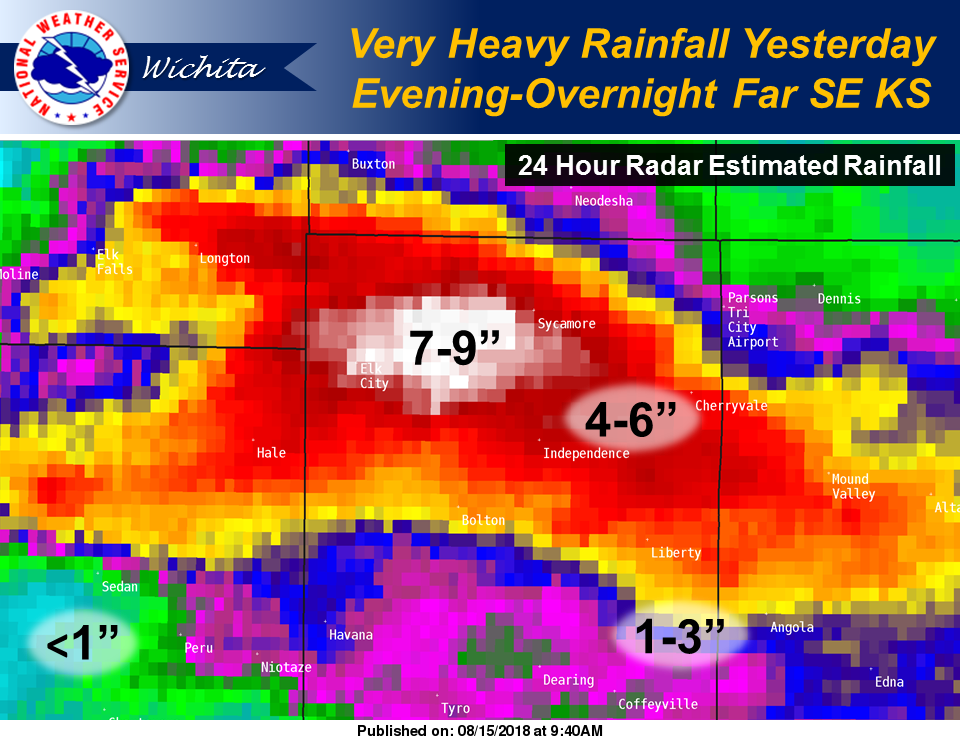
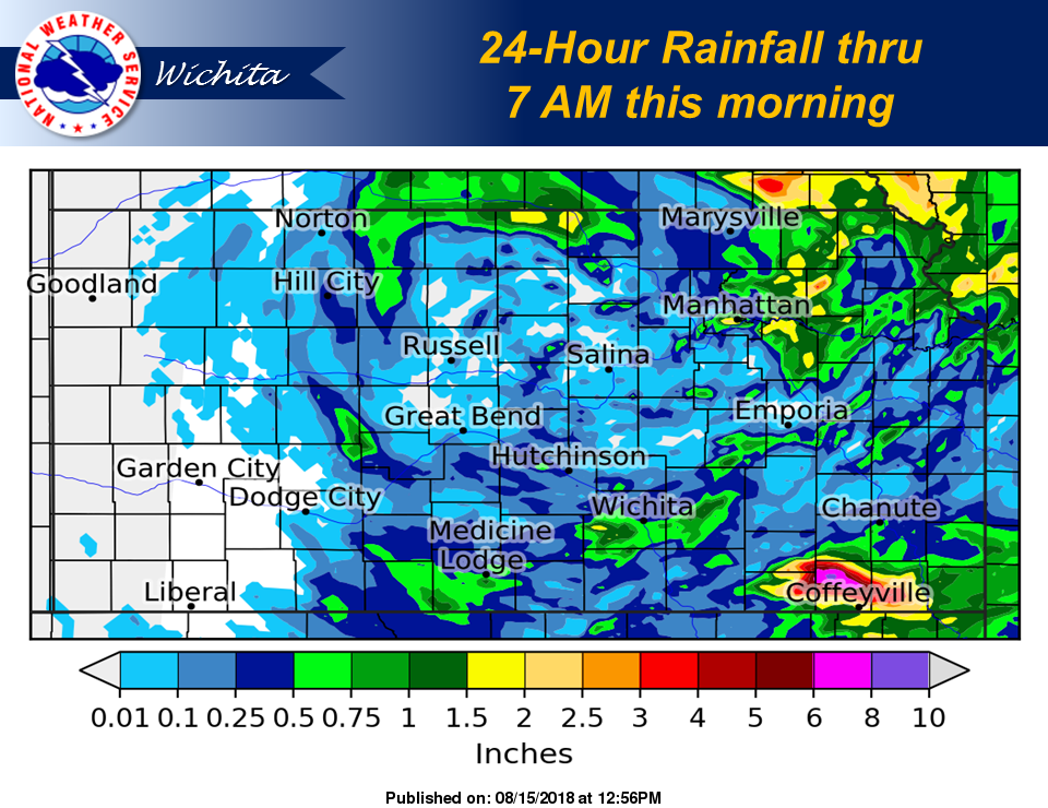
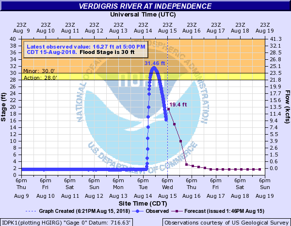
Training showers and thunderstorms yesterday evening and into the overnight produced intense rainfall totals across far southeast Kansas, especially Montgomery county, where radar estimated 7 to 9 inches fell northwest of Independence between Elk City and Sycamore. Widespread flooding resulted, with water rescues reported in and around Independence. Tragically, there were two known fatalities near Elk City Lake.Flooding
Information
 |
 |
 |
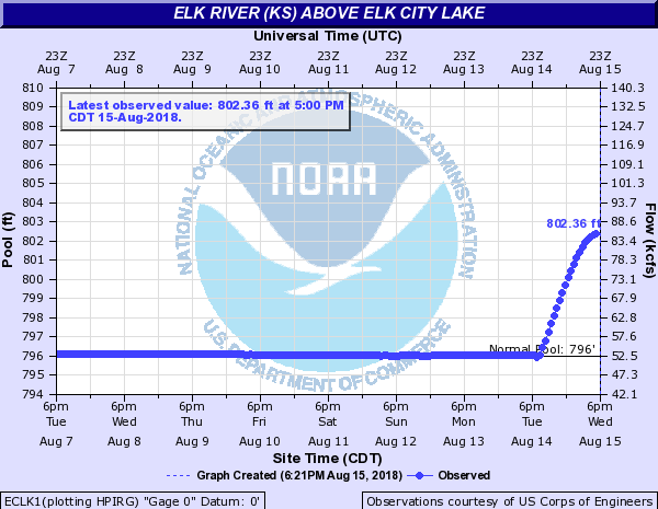 |
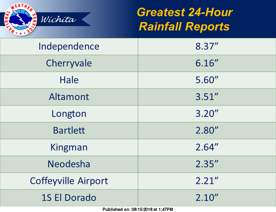
| Rainfall amounts across Montgomery and Labette counties | 24 hour rainfall amounts from this event | A few of the higher rainfall reports | Graph showing the rise in the level at Elk City Lake. |
 |
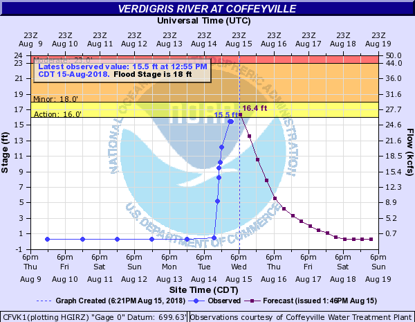 |
| Hydrograph showing the rapid rise in the Verdigris river at Independence | Hydrograph showing the rapid rise in the Verdigris river at Coffeyville |
 |
Media use of NWS Web News Stories is encouraged! Please acknowledge the NWS as the source of any news information accessed from this site. |
 |
Hazards
Briefing pages
Local weather story
Submit a storm report
Storm Prediction Center
Enhanced Hazardous Weather Outlook
Current Conditions
Local Radar
National Radar
Satellite
Hourly weather(text)
Precip Analysis
Snowfall analysis
This day in weather history
7 Day Lightning Archive
Forecasts
Forecast Discussion
Weather Story
Fire Weather
Activity Planner
Aviation Weather
Soaring Forecast
Hurricane Center
Graphical Forecasts
Regional Weather Summary
Probabilistic Snow
Probabilistic QPF
Wet Bulb Globe temp
Climate
Local Climate Page
Daily/Monthly data(F6)
Daily Records
Climate Normals
Local drought page
Latest Climate Report(ICT)
Latest Climate Report(SLN)
Latest Climate Report(CNU)
CoCoRaHS
7 Day Lightning Archive
US Dept of Commerce
National Oceanic and Atmospheric Administration
National Weather Service
Wichita, Kansas
2142 S. Tyler Road
Wichita, KS 67209-3016
316-942-3102
Comments? Questions? Please Contact Us.

