Wichita, Kansas
Weather Forecast Office
Severe Weather Outbreak
April 14, 2011
|
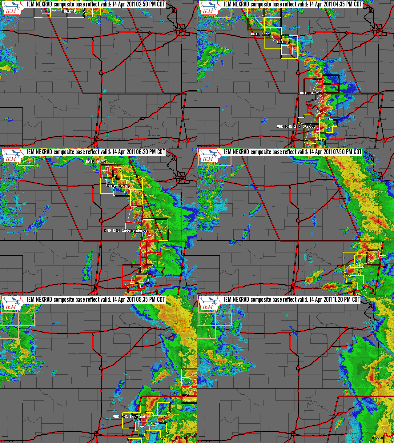
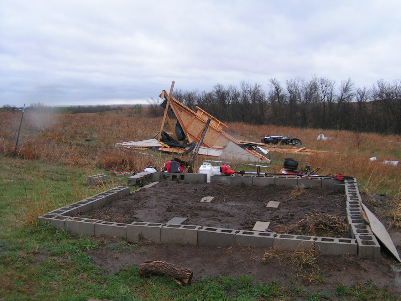
What happened: A line of severe thunderstorms produced a few brief tornadoes, several funnel clouds, quarter to tennis ball sized hail, and 70 mph winds on the evening of Thursday, April 14th, 2011.
Background: A powerful spring storm system over the Rocky mountains moved east and strengthened across the High Plains on April 14, 2011. Thunderstorms rapidly developed by mid-afternoon along a dryline extending from southern Kansas to Texas. With abundant instability and wind shear, the storms became severe and moved rapidly northeast across central and southeast Kansas. Thunderstorms initially developed near the intersection of the dry air behind the dryline and the moisture which surged north from the Gulf of America.
|
| Overview loop of radar data, warnings, and storm reports |
|
|
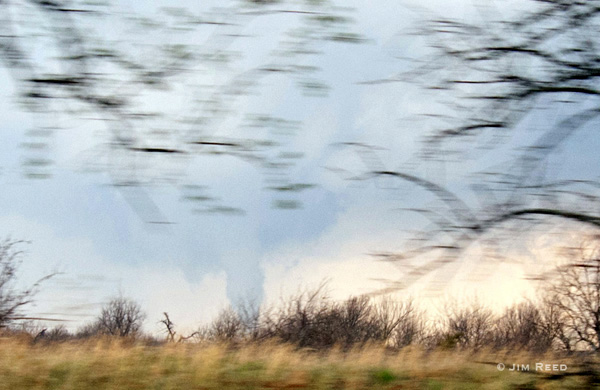
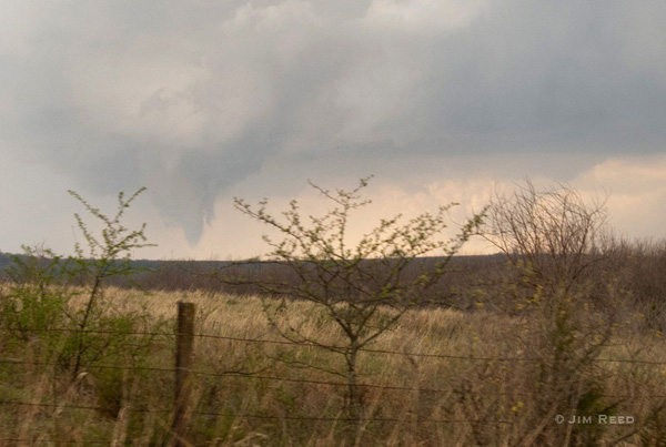
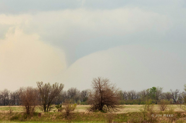
Multiple funnel clouds in Cowley, Chautauqua, and Greenwood Counties.
|
 |
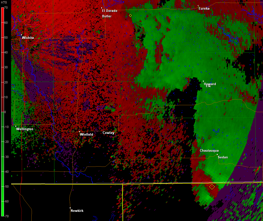 |
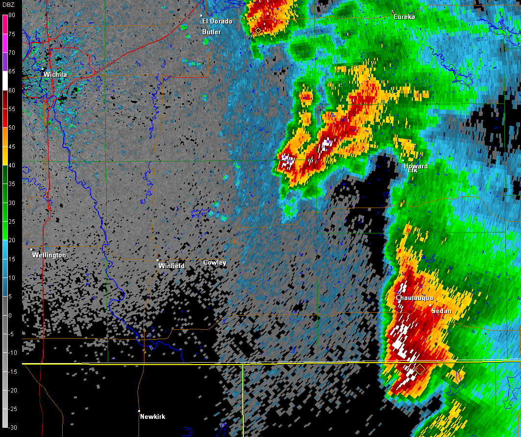
| KICT WSR-88D Base Reflectivity at 516 PM CDT | KICT WSR-88D Base Reflectivity at 517 PM CDT |
Images
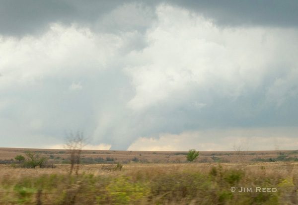
Tornado located on the Cowley/Elk County line. Courtesy of Jim Reed
|
|
Photo near Cowley/Elk county line at 504PM CDT. Photo courtsey Jim Reed |
Photo near Cowley/Elk county line at 504PM CDT. Photo courtsey Jim Reed |
Photo of funnel cloud in southwest Elk county at 514pm CDT. Photo courtsey Jim Reed |
|
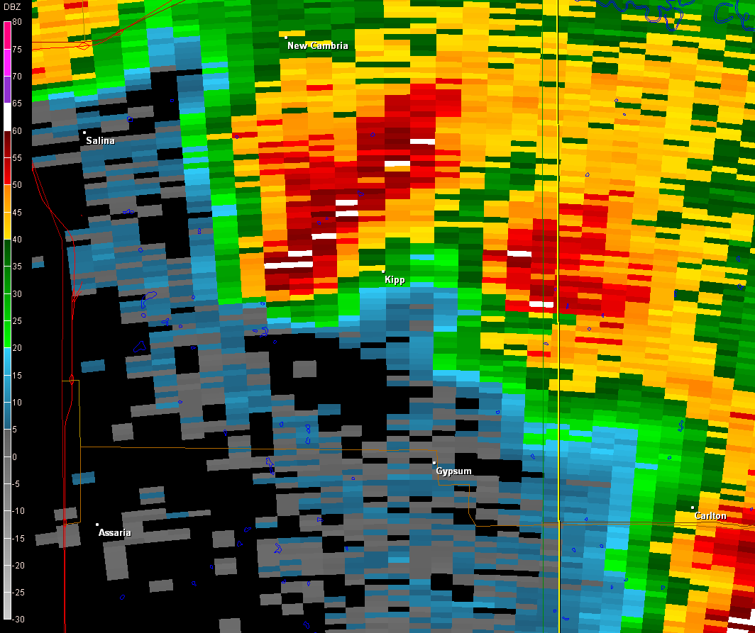
2 Tornadoes occurred in Saline County.
|
 |
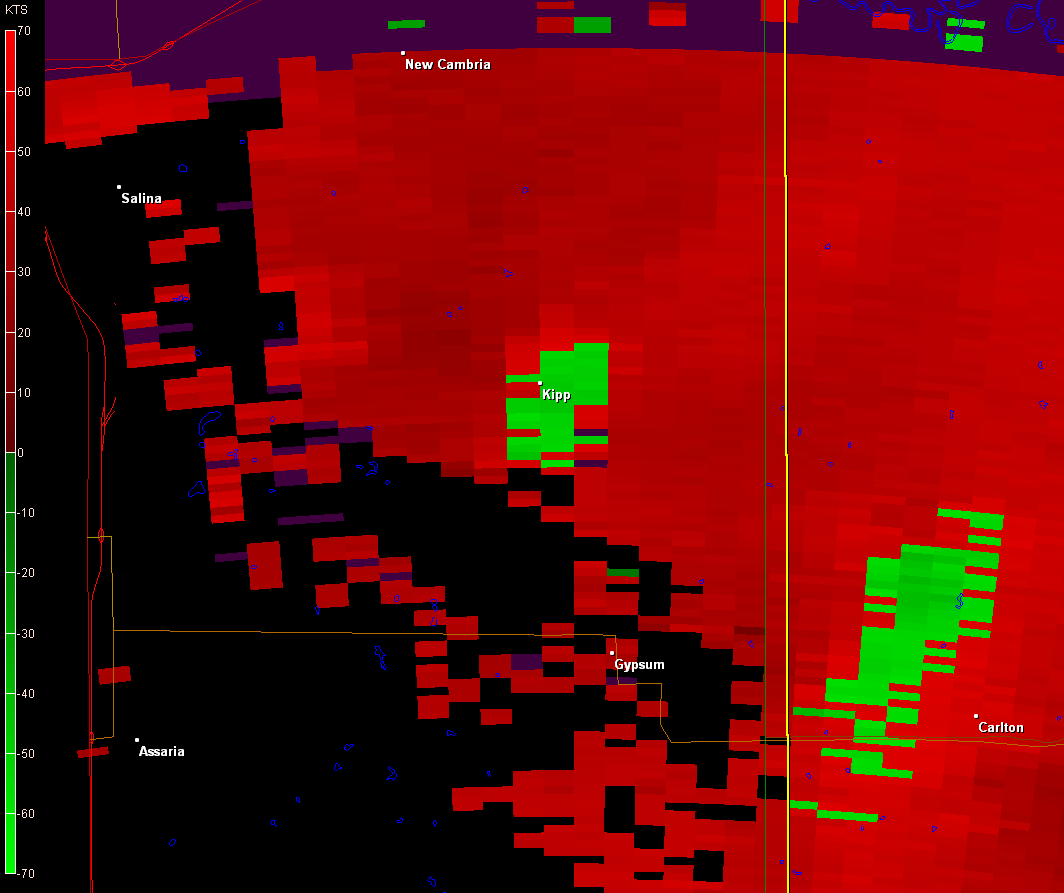 |
| KICT WSR-88D Base Reflectivity at 507 PM CDT | KICT WSR-88D Base Velocity at 507 PM CDT |
Hazards
Briefing pages
Local weather story
Submit a storm report
Storm Prediction Center
Enhanced Hazardous Weather Outlook
Current Conditions
Local Radar
National Radar
Satellite
Hourly weather(text)
Precip Analysis
Snowfall analysis
This day in weather history
7 Day Lightning Archive
Forecasts
Forecast Discussion
Weather Story
Fire Weather
Activity Planner
Aviation Weather
Soaring Forecast
Hurricane Center
Graphical Forecasts
Regional Weather Summary
Probabilistic Snow
Probabilistic QPF
Wet Bulb Globe temp
Climate
Local Climate Page
Daily/Monthly data(F6)
Daily Records
Climate Normals
Local drought page
Latest Climate Report(ICT)
Latest Climate Report(SLN)
Latest Climate Report(CNU)
CoCoRaHS
7 Day Lightning Archive
US Dept of Commerce
National Oceanic and Atmospheric Administration
National Weather Service
Wichita, Kansas
2142 S. Tyler Road
Wichita, KS 67209-3016
316-942-3102
Comments? Questions? Please Contact Us.


