A major winter storm will continue to bring blizzard conditions, heavy snowfall, icing, and strong winds through Monday across the Upper Midwest and Upper Great Lakes. A line of storms will be capable of producing widespread damaging winds, tornadoes, and some large hail from the Mid-South to the Ohio Valley and the Southeast through tonight, moving into the Mid-Atlantic Monday. Read More >
Honolulu, HI
Weather Forecast Office
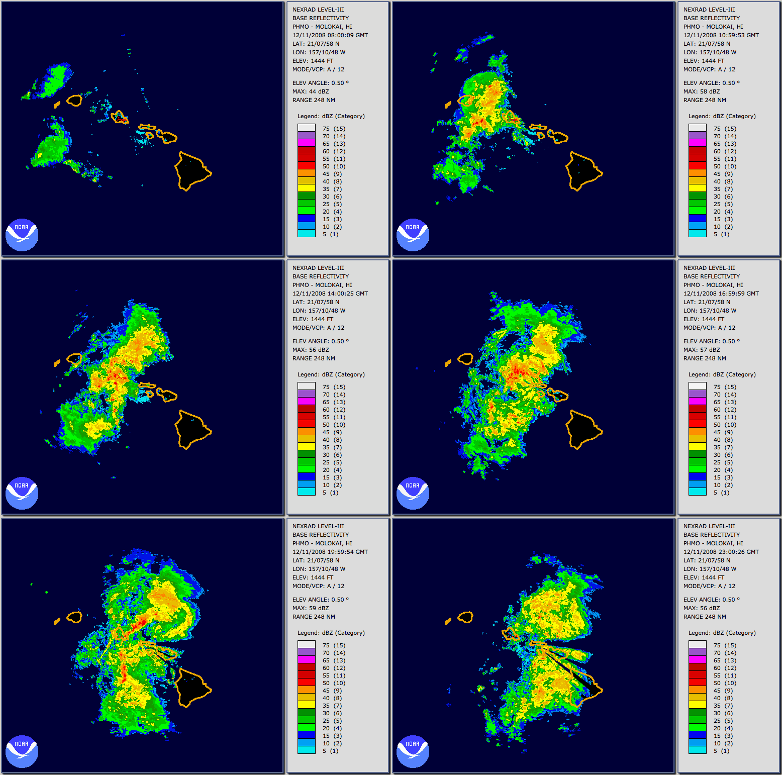
A kona low, which developed northwest of the state on December 10, produced several rounds of heavy rainfall. The initial rain band hit Kauai and Oahu during the early morning hours of December 11 and caused significant flooding. Oahu was the hardest hit, with severe damage reported in the north, west, and central sections of the island. Several Oahu rain gauges recorded an incredible 10 to 13 inches in a 12-hour period. A second round of serious flooding started during the night of December 13. This second round primarily affected Kauai and Oahu. Serious flooding occurred on Kauai in Waimea town, and closed the highway into Hanalei. A tornado also occurred just before 1 PM near Hanapepe and Pakala on the south side of the island. Storm activity shifted from Kauai to Oahu during the afternoon of the 13th, bringing heavy rainfall to most of the island, but causing the most serious problems near Makaha and Waialua. Maui county and the Big Island received rainfall from this storm system, but managed to avoid serious flooding problems. In fact, the rainfall on those islands brought much needed drought relief.
A geographic representation of observed rainfall, flooding, and damages reported during the event
Disclaimer
Download the data for this map as a KML file.


Radar Loop
Data from the Molokai radar from 10:00 PM HST 12/10/2008 to 1:00 PM HST 12/11/2008. Note that the heaviest precipitation, indicated by the red areas, passed over Oahu between 4:30 AM and 7:30 AM on the 11th. Rainfall rates of three to four inches per hour were observed during these three hours.
US Dept of Commerce
National Oceanic and Atmospheric Administration
National Weather Service
Honolulu, HI
2525 Correa Rd Suite 250
Honolulu, HI 96822
(808) 973-5286
Comments? Questions? Please Contact Us.

