Honolulu, HI
Weather Forecast Office
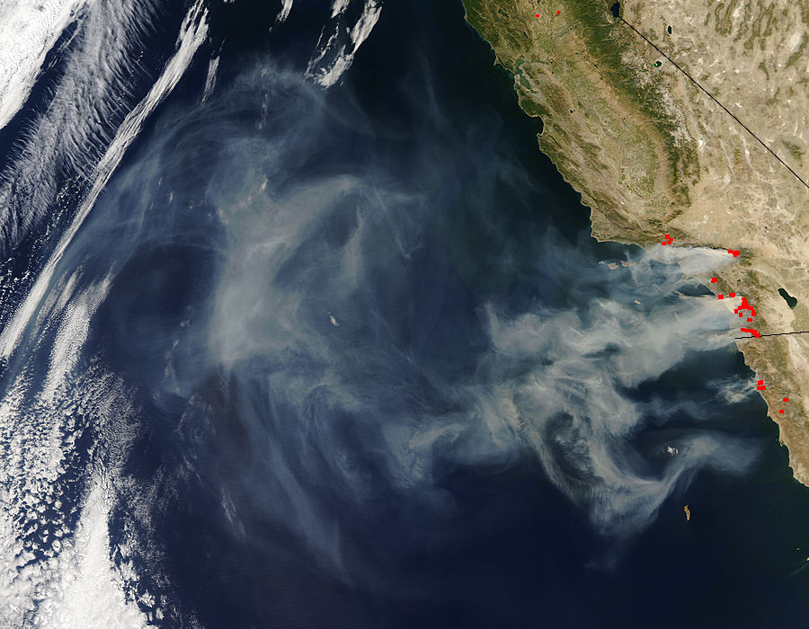
Last week (October 21-27, 2007), wildfires in California resulted in a large plume of smoke extending westward over the northeast Pacific, that was viewable from both high- and low-resolution satellite imagery.

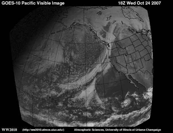
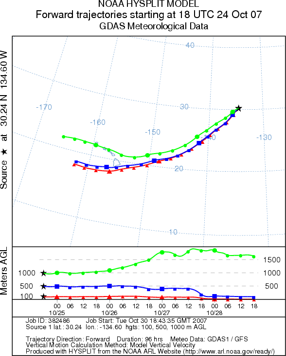
Initially, expectations were that this smoke plume would "mix-out" in the trade wind flow before reaching the islands of Hawaii. This was a difficult forecast to make, as the concentrations of smoke and ash particulates embedded in the trade wind flow were not measured, and therefore their rate of dispersal could not be quantified. However, a trajectory analysis reveals that the recent hazy skies over the main Hawaiian islands can be attributed to the smoke from the California wildfires. In the attached image, using the National Oceanic and Atmospheric Administration's (NOAA's) Hysplit Model, forward trajectories of air parcels based at 100, 500 and 1000 meter heights were made based on the above image. In the image, the arrow points to the leading edge of drier and smokier air associated with the wildfires. This point was chosen, and forward trajectories from this point place the smoke over the Hawaiian Islands during the day on Saturday, October 27th, when hazy skies were first observed on Oahu by National Weather Service personnel.
US Dept of Commerce
National Oceanic and Atmospheric Administration
National Weather Service
Honolulu, HI
2525 Correa Rd Suite 250
Honolulu, HI 96822
(808) 973-5286
Comments? Questions? Please Contact Us.

