National Weather Service United States Department of Commerce

Heavy Rainfall Along the Central Gulf Coast; Critical Fire Weather Conditions in Southern California

Heavy to excessive rainfall, and the potential for scattered flash flooding is forecast through midweek along portions of the Gulf Coast and into the Southeast. A Slight Risk (level 2 of 4) of Excessive Rainfall is in effect Monday and Tuesday. Damaging Santa Ana winds and very low humidity will result in Critical Fire Weather conditions Monday and Tuesday across Southern California. Read More >

Satellite Viewer
Weather Viewer
Surface Analysis Viewer
Upper Air Soundings
World Area Forecast System (WAFS)
Map TAF Viewer
Ceiling Visibility Viewer
Icing Viewer
Surface Forecast Day 1-3
All-In-One Graphical Forecast
Model Vertical Wind Profiles
Convective
LAMP Forecast Meteograms
LAMP Probability Plots
Terminal Weather Dashboard
Winter Weather Dashboard
Decision Support Imagery
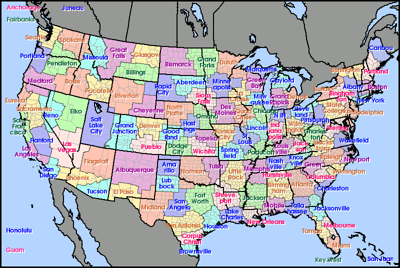
Click on region to access forecast discussion.
NWS Anchorage, AK NWS Fairbanks, AK NWS Juneau, AK NWS Honolulu, HI NWS Guam NWS Amarillo, TX NWS Lubbock, TX NWS Pleasent Hill, MO NWS Des Moines, IA NWS Norman, OK NWS Tulsa, OK San Angelo, TX NWS Brownsville, TX NWS Milwaukee, WI NWS Chicago, IL NWS Lincoln, IL NWS St. Louis, MO NWS Grand Rapids, MI NWS Detroit, MI NWS Northern Indiana, IN NWS Indianapolis, IN NWS Louisville, KY NWS Memphis, TN NWS Nashville, TN NWS Cleveland, OH NWS Pittsburgh, PA NWS State College, PA NWS Wilmington, OH NWS Sterling, VA NWS Charleston, WV NWS Blacksburg, VA NWS Jackson, KY NWS Knoxville, TN NWS Raleigh, NC NWS Greer, SC NWS Wilmington, NC NWS Atlanta, GA NWS Key West, FL NWS San Juan, PR NWS Houston, TX NWS Atlanta, GA NWS Cheyenne, WY NWS Missoula, MT NWS Spokane, WA NWS Seattle, WA NWS Pendleton, OR NWS Portland, OR NWS Medford, OR NWS Boise, ID NWS Pocatello, ID NWS Great Falls, MT NWS Glasgow, MT NWS Billings, MT NWS Riverton, WY NWS Salt Lake City, UT NWS Elko, NV NWS Los Angeles, CA NWS San Francisco, CA NWS Hanford, CA NWS Reno, NV NWS Eureka, CA NWS Las Vegas, NV NWS Flagstaff, AZ NWS Phoenix, AZ NWS San Diego, CA NWS Tucson, AZ NWS Grand Junction, CO NWS Paducah, KY NWS Little Rock, AR NWS Springfield, MO NWS Wichita, KS NWS Topeka, KS NWS Jackson, MS NWS Birmingham, AL NWS Mobile, A NWS New Orleans, LA NWS Shreveport, LA NWS North Platte, NE NWS Omaha, NE NWS Hastings, NE NWS Goodland, KS NWS Denver, CO NWS Pueblo, CO NWS Albuquerque, NM NWS El Paso, TX NWS Midland, TX NWS Dodge City, KS NWS Corpus Christi, TX NWS San Antonio, TX NWS Fort Worth, TX NWS Aberdeen, SD NWS Sioux Falls, SD NWS Minneapolis, MN NWS Bismarck, ND NWS Grand Forks, ND NWS Duluth, MN NWS Marquette, MI NWS Green Bay, WI NWS La Crosse, WI NWS Quad Cities, IA NWS Buffalo, NY NWS Binghamton, NY NWS Albany, NY NWS New York, NY NWS Philadelphia, PA NWS Wakefield, VA NWS Newport, NC NWS Huntsville, AL NWS Columbia, SC NWS Tallahassee, FL NWS Charleston, SC NWS Jacksonville, FL NWS Tampa Bay, FL NWS Melbourne, FL NWS Miami, FL NWS Boston, MA NWS Portland, ME NWS Caribou, ME NWS Burlington, VT NWS Lake Charles, LA NWS Gaylord, MI NWS Sacramento, CA
Federal Aviation Administration
WPC Winter Weather
Wind Roses
Decode METAR/TAF
Sunrise/Sunset Data
Airport Information
World Area Forecast System
Detected Smoke Plumes
Volcanic Ash Alerts
Brief Weather Lessons
MetEd Weather Training

For the map below, click on the tabs on the corners to change options. Hover over or click station to get METAR and TAF (if available). Click refresh data if you pan to a different location. VFR   MVFR   IFR   LIFR