Overview
Enter summary/what happened:Tornado:
|
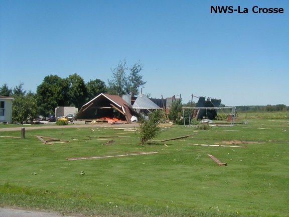
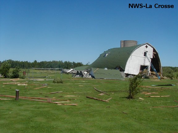
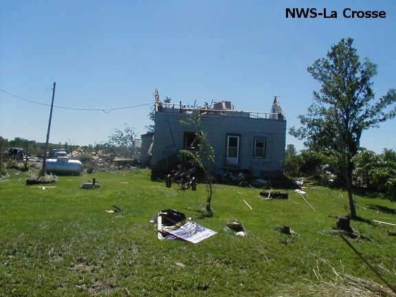
Tornado - Gilman, WI
Track Map  |
||||||||||||||||
|
||||||||||||||||
The Enhanced Fujita (EF) Scale classifies tornadoes into the following categories:
| EF0 Weak 65-85 mph |
EF1 Moderate 86-110 mph |
EF2 Significant 111-135 mph |
EF3 Severe 136-165 mph |
EF4 Extreme 166-200 mph |
EF5 Catastrophic 200+ mph |
 |
|||||
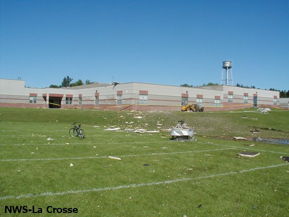
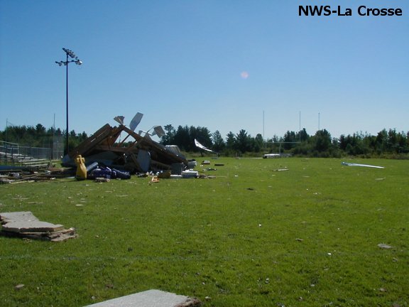
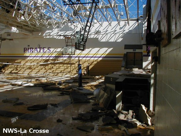
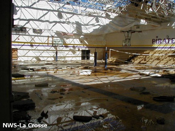
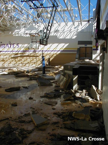
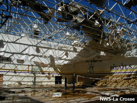
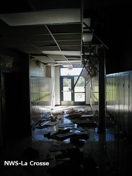
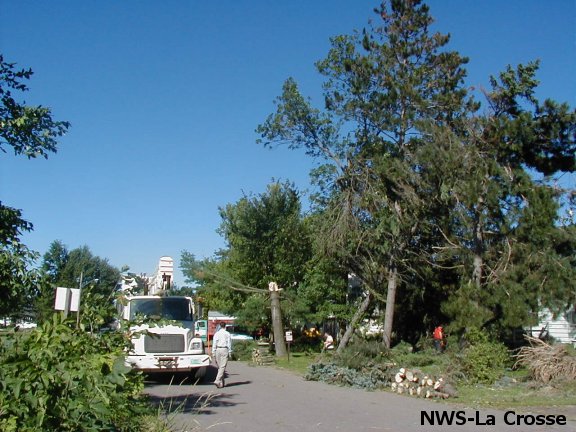
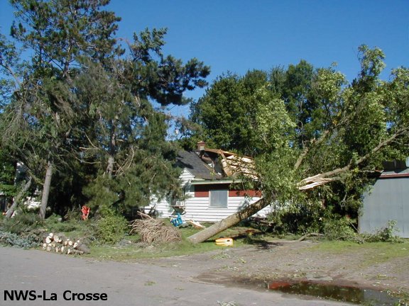
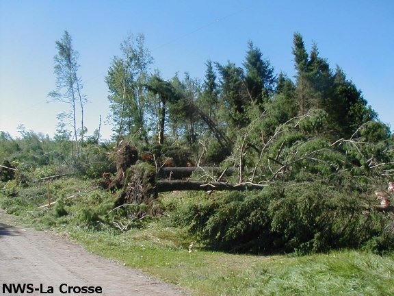
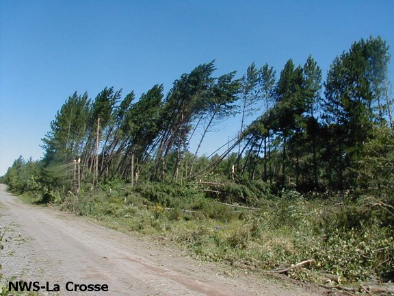
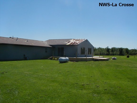
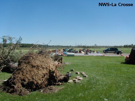
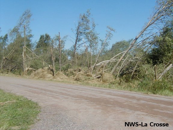
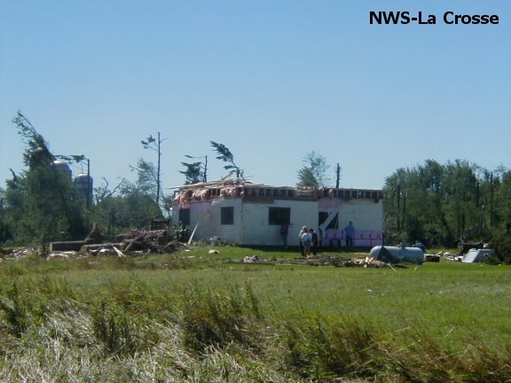
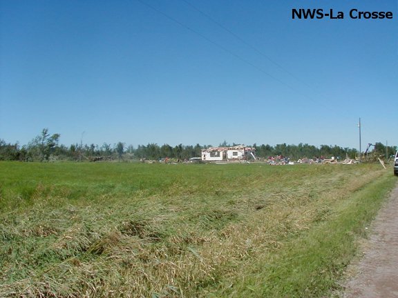
Photos:
 |
 |
 |
 |
 |
 |
 |
 |
 |
 |
 |
 |
 |
 |
 |
 |
 |
 |
 |
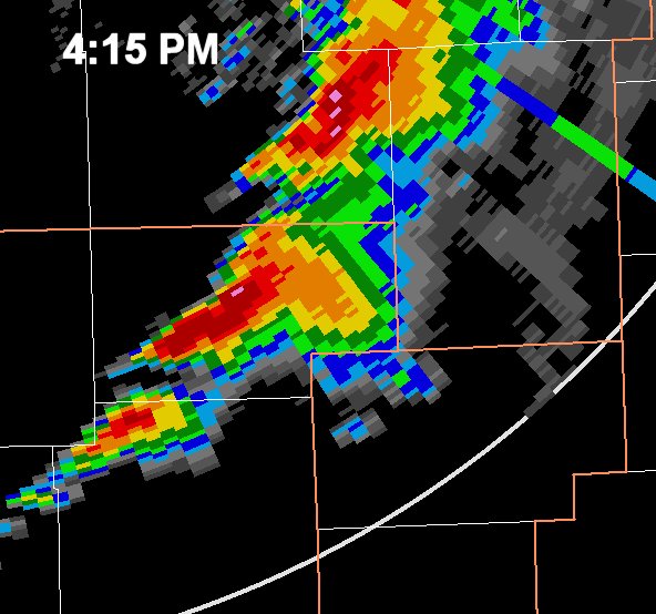
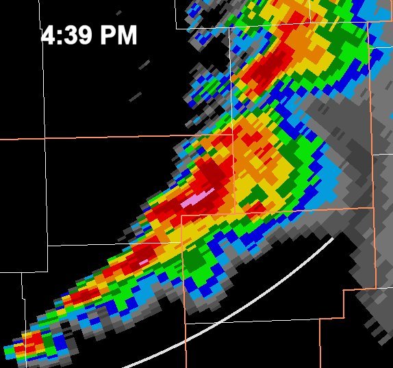
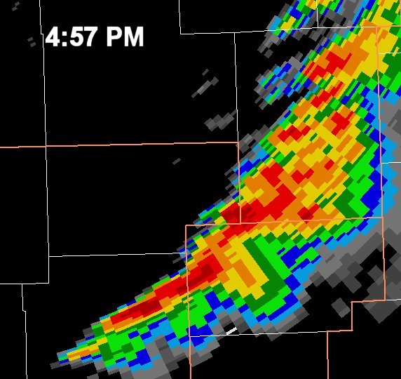
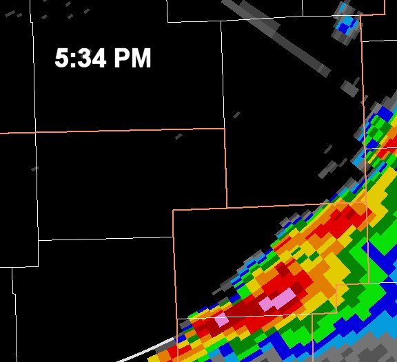
Radar:
(Note: The La Crosse Doppler Radar (KARX) was not operating for this event due to a lightning strike earlier that day.)
 |
 |
 |
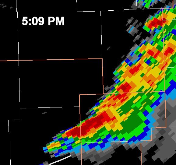 |
| Reflectivity from KDLH - 4:15 p.m. | Reflectivity from KDLH - 4:39 p.m. | Reflectivity from KDLH - 4:57 p.m. | Reflectivity from KDLH - 5:09 p.m. |
 |
|||
| Reflectivity from KDLH - 5:34 p.m. |
 |
Media use of NWS Web News Stories is encouraged! Please acknowledge the NWS as the source of any news information accessed from this site. |
|


 Weather Story
 Weather Map
 Local Radar