|
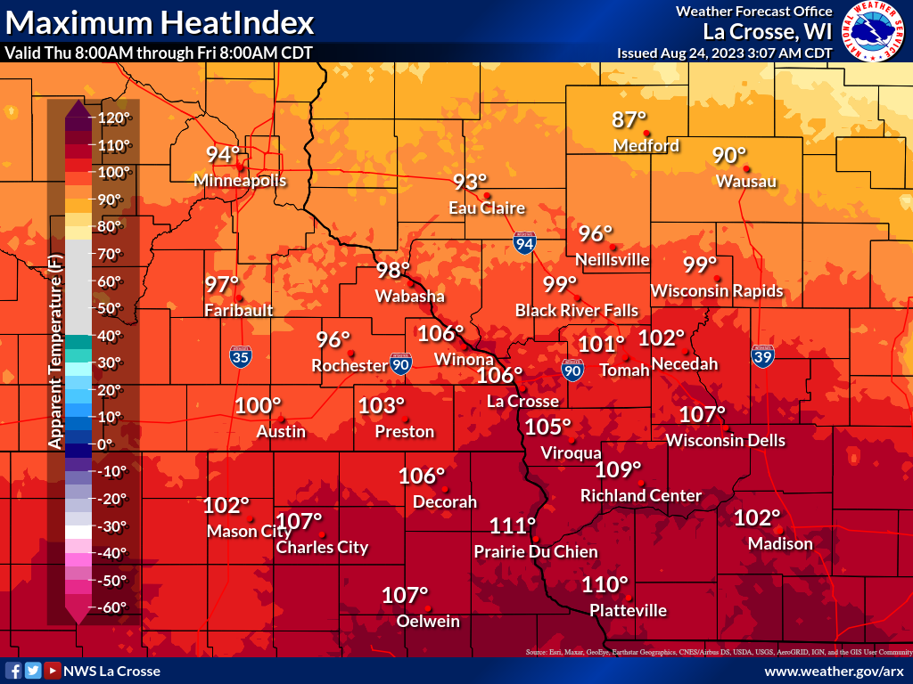
Dangerous heat persists for one more day today with afternoon heat indices from 95 to 110 expected. The hottest conditions will be along and south of Interstate 90. The weekend brings much cooler and less humid conditions will highs from the mid 70s to around 80. For those with outdoor activities, especially work related or sports, watch for any signs of heat related illnesses. Take frequent breaks, drink water regularly, and find locations to cool down in air conditioning if possible.     
Today: Dangerous Heat Continues
Additional Information:
|
• Submit Report • Hazardous Weather Outlook Heat Warnings/Adv Latest Reports Current Conditions

Weather Story 
Radar |


 Weather Story
 Weather Map