 ..TIME... ...EVENT... ...CITY LOCATION... ...LAT.LON...
..DATE... ....MAG.... ..COUNTY LOCATION..ST.. ...SOURCE....
..REMARKS..
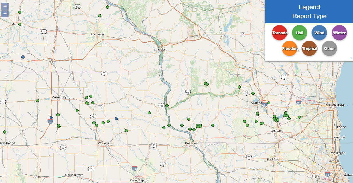
0308 AM Hail 1 SE Marble Rock 42.96N 92.85W
04/18/2025 E0.75 Inch Floyd IA Public
Report from mPING: Dime (0.75 in.).
0440 AM Hail Oelwein 42.68N 91.91W
04/18/2025 E0.50 Inch Fayette IA Public
Report from mPING: Half-inch (0.50 in.).
0445 AM Hail 4 SE Gunder 42.93N 91.47W
04/18/2025 E0.70 Inch Clayton IA Public
0450 AM Hail Colwell 43.16N 92.59W
04/18/2025 E0.70 Inch Floyd IA Public
0454 AM Hail 3 ENE Floyd 43.14N 92.67W
04/18/2025 E1.50 Inch Floyd IA Public
0455 AM Hail Charles City 43.07N 92.67W
04/18/2025 M1.50 Inch Floyd IA Public
0456 AM Hail 1 E Charles City 43.06N 92.65W
04/18/2025 E1.00 Inch Floyd IA Public
Report from mPING: Quarter (1.00 in.).
0507 AM Hail 1 SE Marble Rock 42.96N 92.85W
04/18/2025 E0.75 Inch Floyd IA Public
Report from mPING: Dime (0.75 in.).
0510 AM Hail 2 WSW Osterdock 42.72N 91.19W
04/18/2025 M1.25 Inch Clayton IA Public
0511 AM Hail Richland Center 43.34N 90.39W
04/18/2025 E1.00 Inch Richland WI Public
0512 AM Hail 1 E Richland Center 43.33N 90.36W
04/18/2025 M1.75 Inch Richland WI Public
0513 AM Hail 2 W Bassett 43.07N 92.55W
04/18/2025 E0.50 Inch Chickasaw IA Public
Report from mPING: Half-inch (0.50 in.).
0526 AM Hail 3 SE Guttenberg 42.75N 91.09W
04/18/2025 E1.50 Inch Clayton IA Public
Report from mPING: Ping Pong Ball (1.50
in.).
0532 AM Hail 3 W Platteville 42.75N 90.54W
04/18/2025 M1.75 Inch Grant WI Public
0536 AM Hail 3 NW Burton 42.75N 90.84W
04/18/2025 E1.25 Inch Grant WI Public
Report from mPING: Half Dollar (1.25 in.).
0551 AM Hail 1 NW Tennyson 42.70N 90.69W
04/18/2025 E1.50 Inch Grant WI Public
Report from mPING: Ping Pong Ball (1.50
in.).
0555 AM Hail 1 NW Platteville 42.75N 90.49W
04/18/2025 M2.00 Inch Grant WI Public
Relayed via social media.
0555 AM Hail 4 E Tennyson 42.69N 90.61W
04/18/2025 M2.00 Inch Grant WI Public
0557 AM Hail 3 W Platteville 42.73N 90.54W
04/18/2025 M2.75 Inch Grant WI Public
0558 AM Hail 1 W Platteville 42.74N 90.49W
04/18/2025 M1.00 Inch Grant WI Trained Spotter
0559 AM Hail 1 NW Platteville 42.75N 90.48W
04/18/2025 M1.50 Inch Grant WI Public
0626 AM Hail 1 W Platteville 42.73N 90.50W
04/18/2025 M2.50 Inch Grant WI Public
0628 AM Hail 1 SE Prairie Du Chien 43.03N 91.13W
04/18/2025 E0.50 Inch Crawford WI Public
Report from mPING: Half-inch (0.50 in.).
0629 AM Hail Lancaster 42.84N 90.71W
04/18/2025 E0.50 Inch Grant WI Public
Report from mPING: Half-inch (0.50 in.).
&&
$$
..TIME...   ...EVENT...      ...CITY LOCATION...     ...LAT.LON...
..DATE...   ....MAG....      ..COUNTY LOCATION..ST.. ...SOURCE....
            ..REMARKS..

0308 AM     Hail             1 SE Marble Rock        42.96N 92.85W
04/18/2025  E0.75 Inch       Floyd              IA   Public

            Report from mPING: Dime (0.75 in.).

0440 AM     Hail             Oelwein                 42.68N 91.91W
04/18/2025  E0.50 Inch       Fayette            IA   Public

            Report from mPING: Half-inch (0.50 in.).

0445 AM     Hail             4 SE Gunder             42.93N 91.47W
04/18/2025  E0.70 Inch       Clayton            IA   Public


0450 AM     Hail             Colwell                 43.16N 92.59W
04/18/2025  E0.70 Inch       Floyd              IA   Public


0454 AM     Hail             3 ENE Floyd             43.14N 92.67W
04/18/2025  E1.50 Inch       Floyd              IA   Public


0455 AM     Hail             Charles City            43.07N 92.67W
04/18/2025  M1.50 Inch       Floyd              IA   Public


0456 AM     Hail             1 E Charles City        43.06N 92.65W
04/18/2025  E1.00 Inch       Floyd              IA   Public

            Report from mPING: Quarter (1.00 in.).

0507 AM     Hail             1 SE Marble Rock        42.96N 92.85W
04/18/2025  E0.75 Inch       Floyd              IA   Public

            Report from mPING: Dime (0.75 in.).

0510 AM     Hail             2 WSW Osterdock         42.72N 91.19W
04/18/2025  M1.25 Inch       Clayton            IA   Public


0511 AM     Hail             Richland Center         43.34N 90.39W
04/18/2025  E1.00 Inch       Richland           WI   Public


0512 AM     Hail             1 E Richland Center     43.33N 90.36W
04/18/2025  M1.75 Inch       Richland           WI   Public


0513 AM     Hail             2 W Bassett             43.07N 92.55W
04/18/2025  E0.50 Inch       Chickasaw          IA   Public

            Report from mPING: Half-inch (0.50 in.).

0526 AM     Hail             3 SE Guttenberg         42.75N 91.09W
04/18/2025  E1.50 Inch       Clayton            IA   Public

            Report from mPING: Ping Pong Ball (1.50
            in.).

0532 AM     Hail             3 W Platteville         42.75N 90.54W
04/18/2025  M1.75 Inch       Grant              WI   Public


0536 AM     Hail             3 NW Burton             42.75N 90.84W
04/18/2025  E1.25 Inch       Grant              WI   Public

            Report from mPING: Half Dollar (1.25 in.).

0551 AM     Hail             1 NW Tennyson           42.70N 90.69W
04/18/2025  E1.50 Inch       Grant              WI   Public

            Report from mPING: Ping Pong Ball (1.50
            in.).

0555 AM     Hail             1 NW Platteville        42.75N 90.49W
04/18/2025  M2.00 Inch       Grant              WI   Public

            Relayed via social media.

0555 AM     Hail             4 E Tennyson            42.69N 90.61W
04/18/2025  M2.00 Inch       Grant              WI   Public


0557 AM     Hail             3 W Platteville         42.73N 90.54W
04/18/2025  M2.75 Inch       Grant              WI   Public


0558 AM     Hail             1 W Platteville         42.74N 90.49W
04/18/2025  M1.00 Inch       Grant              WI   Trained Spotter


0559 AM     Hail             1 NW Platteville        42.75N 90.48W
04/18/2025  M1.50 Inch       Grant              WI   Public


0626 AM     Hail             1 W Platteville         42.73N 90.50W
04/18/2025  M2.50 Inch       Grant              WI   Public


0628 AM     Hail             1 SE Prairie Du Chien   43.03N 91.13W
04/18/2025  E0.50 Inch       Crawford           WI   Public

            Report from mPING: Half-inch (0.50 in.).

0629 AM     Hail             Lancaster               42.84N 90.71W
04/18/2025  E0.50 Inch       Grant              WI   Public

            Report from mPING: Half-inch (0.50 in.).


&&

$$


 Weather Story
 Weather Map
 Local Radar