
Severe thunderstorms possible later today into tonight. Read More >
Overview
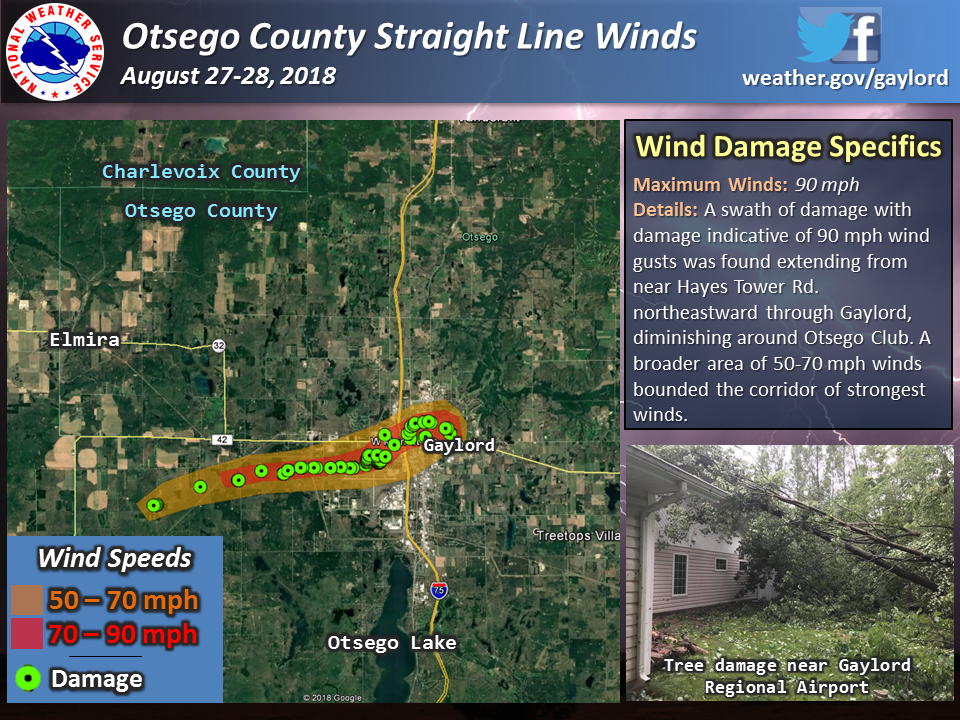
Thunderstorms developed across parts of western and central Wisconsin during the afternoon hours of Monday, August 27th, 2018 before quickly racing toward northern Michigan during the evening hours. Thunderstorms moved across Lake Michigan as early as 10 PM, making landfall across far northwest lower Michigan by midnight. Strong to severe storms continued to race eastward at 60+ mph before diminishing in intensity east of Interstate 75 during the early morning hours of Tuesday, August 28th. The strongest wind gusts, upwards of 90 mph, were observed across portions of west-central Otsego County.
 |
 |
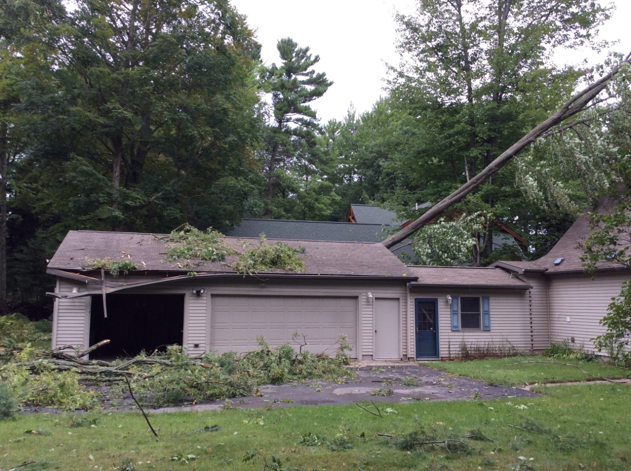
| Otsego County Straight Line Wind Damage August 27 - 28th, 2018 |
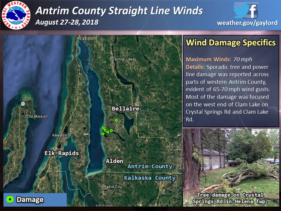
Antrim County Straight Line Wind Damage August 27 - 28th, 2018 |
Wind:
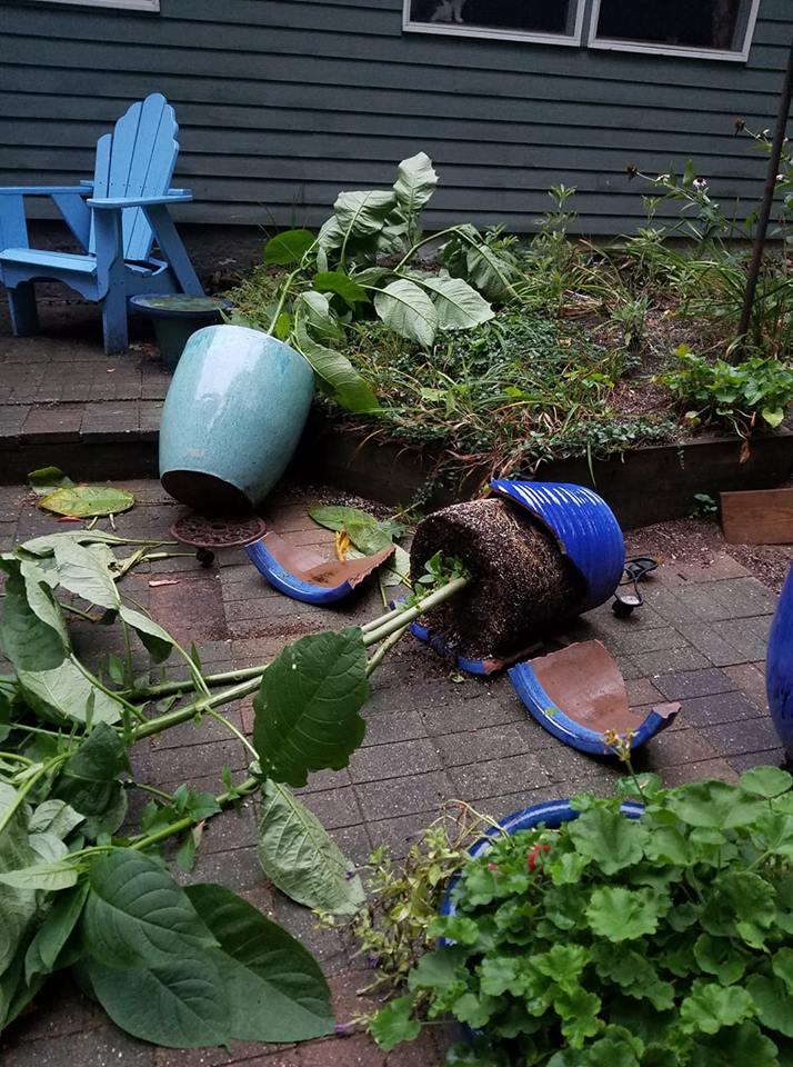
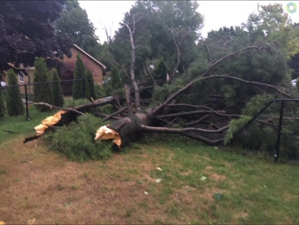
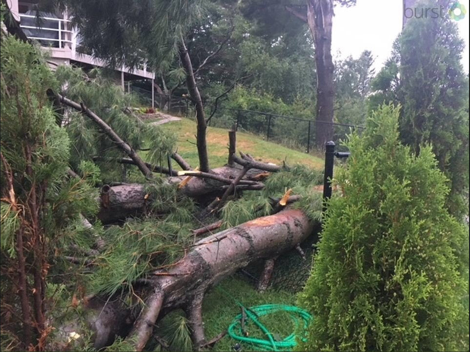
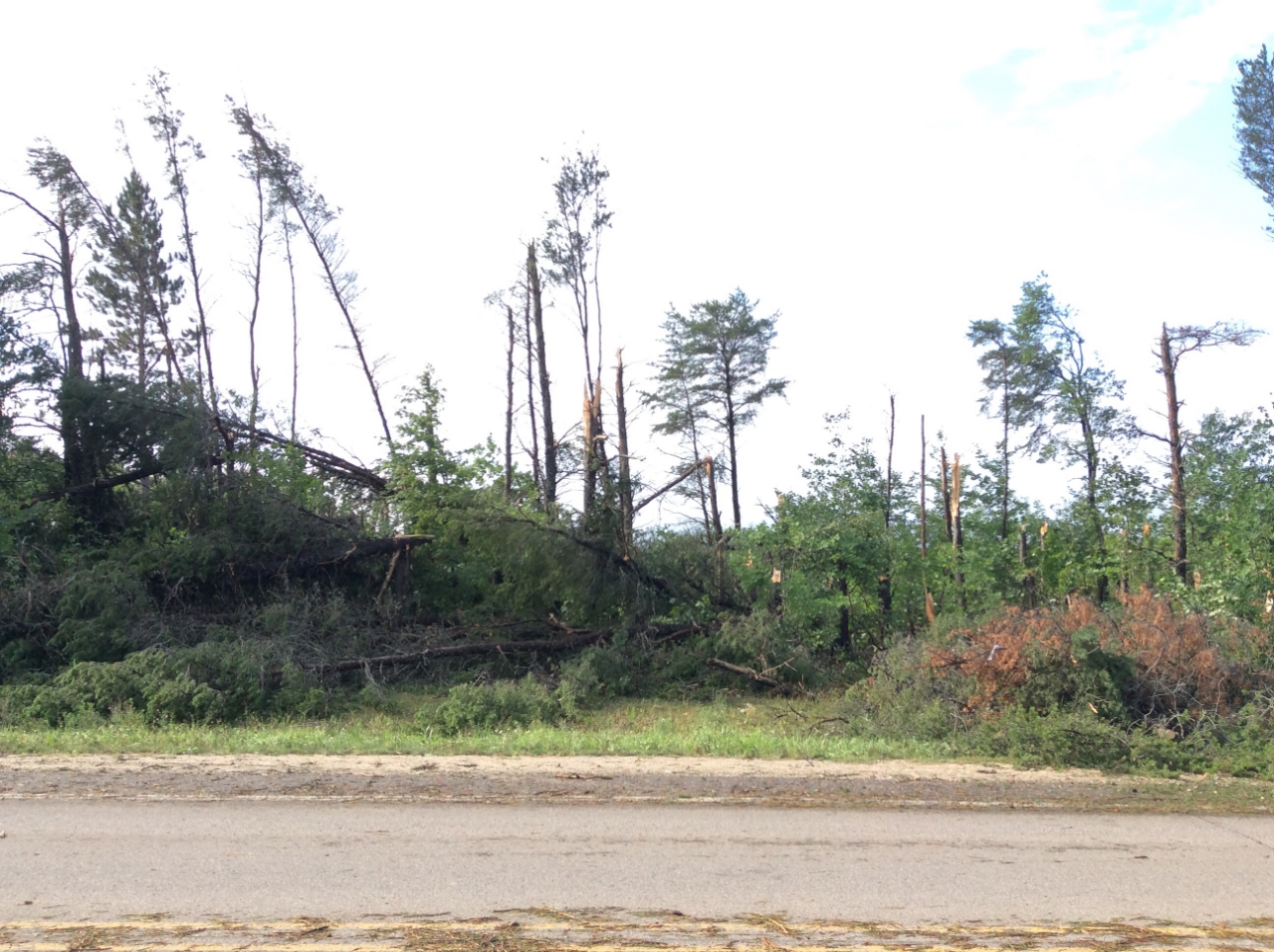
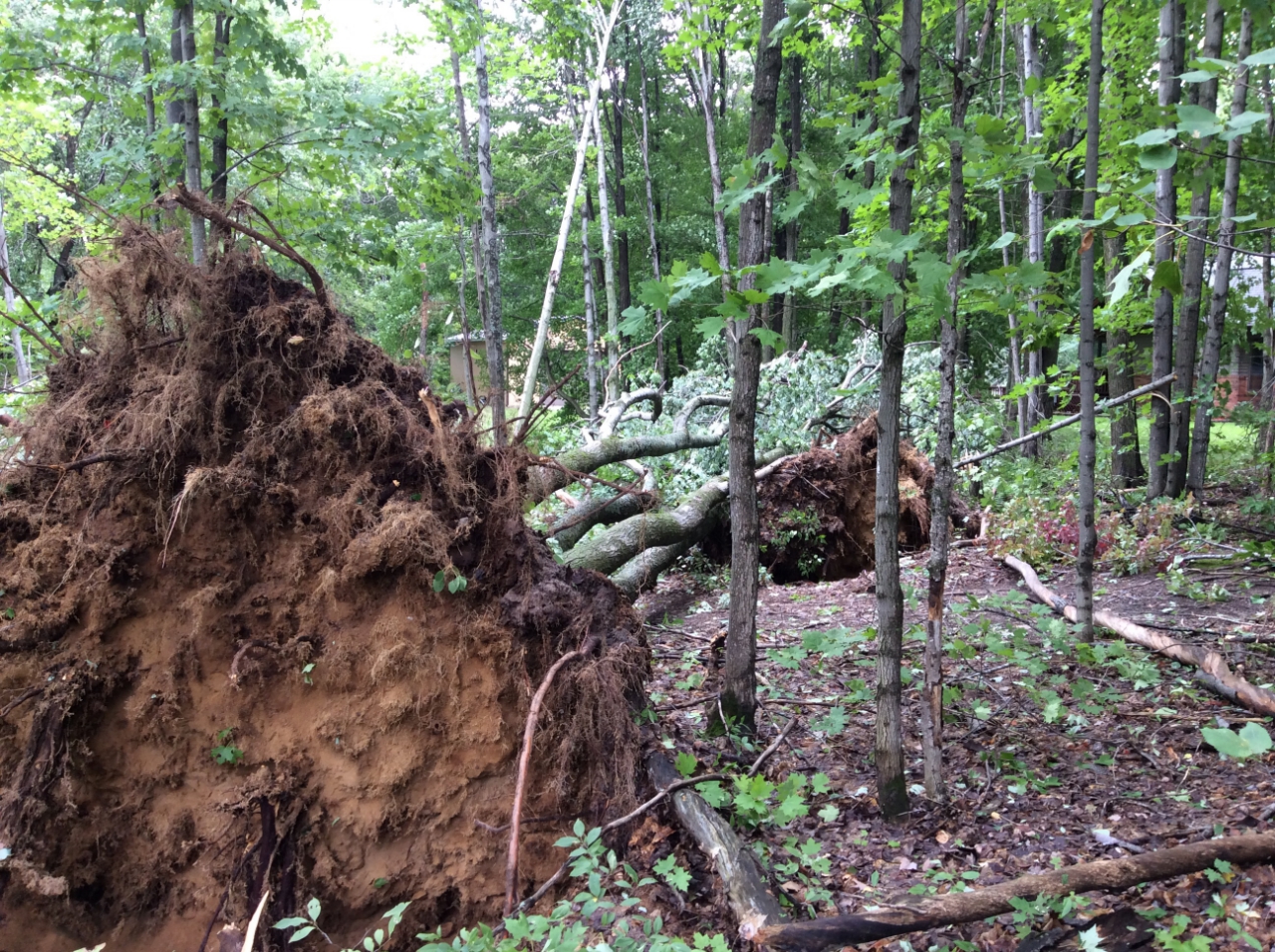
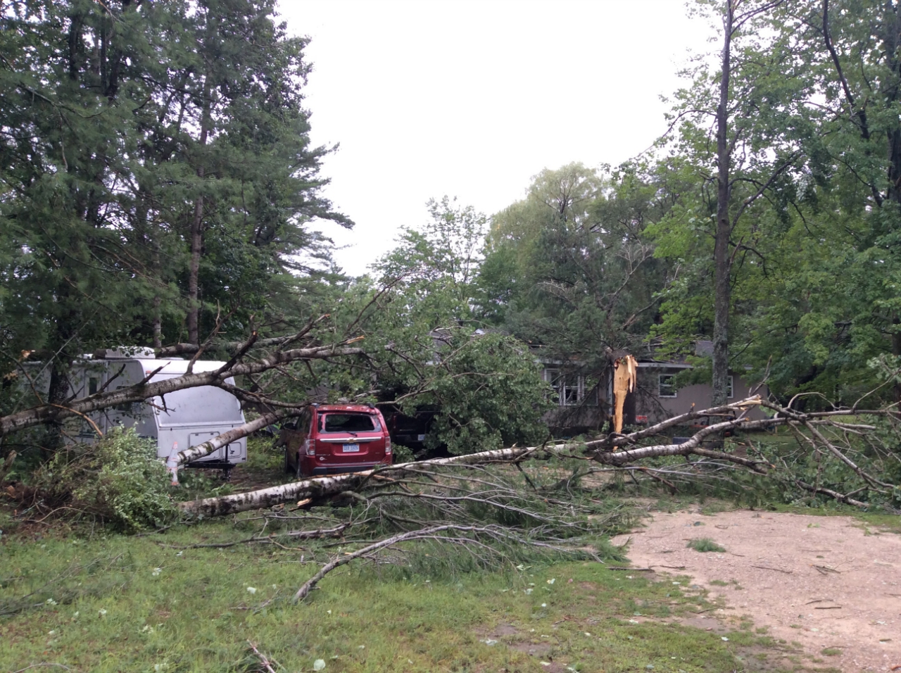
Strong winds upwards of 90 mph accompanied this line of thunderstorms. The following are pictures of thunderstorm damage from across northern Michigan.
 |
 |
 |
 |
| Elmwood Twp. - Leelanau County Courtesy of Laura Kirby |
Old Mission Peninsula Courtesy of Blake Hansen |
Old Mission Peninsula Courtesy of Blake Hansen |
Treetops - Otsego County |
 |
 |
 |
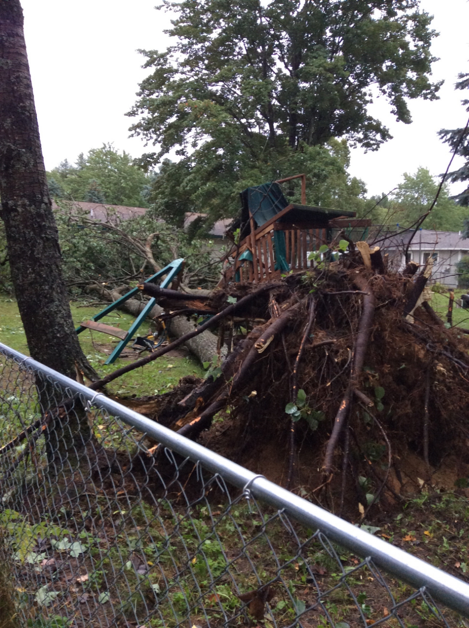 |
| Van Tyle Rd - Otsego County NWS Storm Survey |
Van Tyle Rd - Otsego County NWS Storm Survey |
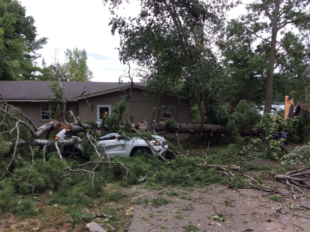
Pine Briar Ln - Otsego County NWS Storm Survey |
Briar Ln - Otsego County NWS Storm Survey |
 |
 |
 |
 |
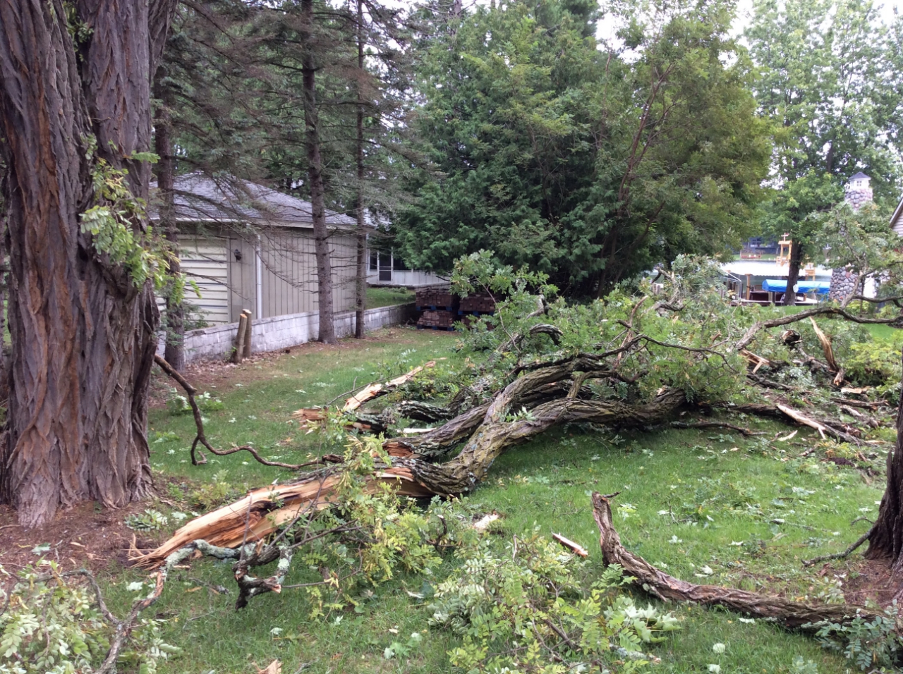
| Clam Lake Rd - Antrim County NWS Storm Survey |
Crystal Springs Rd - Antrim County NWS Storm Survey |
Crystal Springs Rd - Antrim County ​NWS Storm Survey |
Crystal Springs Rd - Antrim County ​NWS Storm Survey |
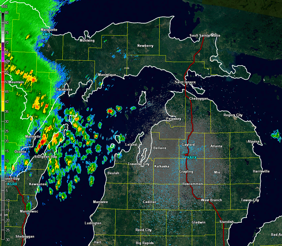
Radar:
KAPX Doppler Radar loop from just after 10 PM on August 27th through about 4 AM August 28.
 |
Storm Reports
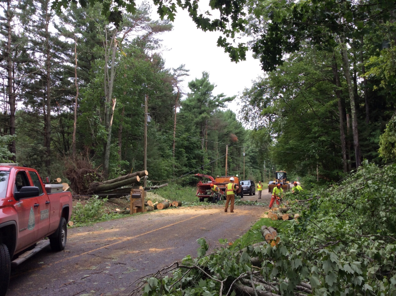
The following is a preliminary storm reports map from August 27th into August 28th, 2018. Damage to trees and power lines were reported, primarily west of Interstate 75.
.png)
..TIME...   ...EVENT...      ...CITY LOCATION...     ...LAT.LON...
..DATE...   ....MAG....      ..COUNTY LOCATION..ST.. ...SOURCE....
            ..REMARKS..

0110 AM     TSTM WND GST     1 NNE LELAND            45.03N 85.76W
08/28/2018  M65 MPH          LMZ344             MI   MESONET


0155 AM     TSTM WND GST     HARBOR SPRINGS          45.43N 84.98W
08/28/2018  M59 MPH          EMMET              MI   AWOS


0133 AM     TSTM WND GST     TRAVERSE CITY - CHERRY  44.74N 85.58W
08/28/2018  M56 MPH          GRAND TRAVERSE     MI   ASOS

            ASOS STATION TVC, TRAVERSE CITY - CHERRY
            CAPITAL AIRPORT.

1210 AM     TSTM WND GST     32 NNW GLEN HAVEN       45.34N 86.25W
08/28/2018  M54 MPH          LMZ362             MI   PUBLIC

            NORTHERN LAKE MI BUOY 45002.

0140 AM     TSTM WND GST     2 E GREILICKVILLE       44.80N 85.60W
08/28/2018  M51 MPH          LMZ323             MI   BUOY

            BUOY STATION 45020, 2 E GREILICKVILLE.

0135 AM     TSTM WND GST     CHARLEVOIX - MUNICIPAL  45.30N 85.27W
08/28/2018  M49 MPH          CHARLEVOIX         MI   AWOS

            AWOS STATION CVX, CHARLEVOIX - MUNICIPAL
            ARPT.

0117 AM     TSTM WND GST     3 SW MAPLE CITY         44.81N 85.90W
08/28/2018  M49 MPH          LEELANAU           MI   MESONET

            MESONET STATION MC045, 3 SW MAPLE CITY.

0117 AM     TSTM WND GST     2 S BENZONIA            44.59N 86.10W
08/28/2018  M48 MPH          BENZIE             MI   MESONET

            MESONET STATION MC014, 2 S BENZONIA.

0132 AM     TSTM WND GST     GREILICKVILLE           44.79N 85.63W
08/28/2018  M47 MPH          LMZ323             MI   MESONET

            MESONET STATION XELM, GREILICKVILLE.

0125 AM     TSTM WND GST     MANISTEE - BLACKER AIRP 44.27N 86.25W
08/28/2018  M47 MPH          MANISTEE           MI   AWOS

            AWOS STATION MBL, MANISTEE - BLACKER
            AIRPORT.

1247 AM     NON-TSTM WND GST 3 SE RUDYARD            46.19N 84.56W
08/28/2018  M47 MPH          CHIPPEWA           MI   MESONET

            MESONET STATION MC009, 3 SE RUDYARD.

0100 AM     NON-TSTM WND GST FRANKFORT               44.63N 86.25W
08/28/2018  M46 MPH          LMZ346             MI   MESONET

            MESONET STATION XFLT, FRANKFORT.

0202 AM     NON-TSTM WND GST PELLSTON - RGNL AIRPORT 45.57N 84.80W
08/28/2018  M46 MPH          EMMET              MI   ASOS

            ASOS STATION PLN, PELLSTON - RGNL AIRPORT OF
            EMMET COUNTY.

0148 AM     NON-TSTM WND GST IRONTON                 45.26N 85.22W
08/28/2018  M46 MPH          CHARLEVOIX         MI   MESONET

            MESONET STATION D7501, IRONTON.

1247 AM     NON-TSTM WND GST 1 ESE BREVORT           46.01N 85.01W
08/28/2018  M41 MPH          MACKINAC           MI   MESONET

            MESONET STATION MC004, 1 ESE BREVORT.

1255 AM     TSTM WND GST     FRANKFORT - DOW MEMORIA 44.63N 86.21W
08/28/2018  M40 MPH          BENZIE             MI   AWOS

            AWOS STATION FKS, FRANKFORT - DOW MEMORIAL
            FIELD.

1214 AM     NON-TSTM WND GST FRANKFORT               44.63N 86.25W
08/28/2018  M40 MPH          LMZ346             MI   MESONET

            MESONET STATION XFLT, FRANKFORT.

1155 PM     TSTM WND GST     BEAVER ISLAND           45.69N 85.57W
08/27/2018  M39 MPH          CHARLEVOIX         MI   AWOS

            AWOS STATION SJX, BEAVER ISLAND.

0130 AM     TSTM WND DMG     2 WNW TRAVERSE CITY     44.76N 85.64W
08/28/2018                   GRAND TRAVERSE     MI   LAW ENFORCEMENT

            LAW ENFORCEMENT REPORT OF TREES DOWN NEAR
            7TH STREET. POWER OUT IN MUCH OF THE CITY.
            TIME ESTIMATED FROM RADAR.

0205 AM     TSTM WND DMG     2 WSW GAYLORD           45.03N 84.71W
08/28/2018                   OTSEGO             MI   PUBLIC

            PICTURE RELAYED OF TREE DOWN THROUGH HOUSE.
            TIME ESTIMATED FROM RADAR.

0205 AM     TSTM WND DMG     GAYLORD                 45.03N 84.68W
08/28/2018                   OTSEGO             MI   NWS EMPLOYEE

            SEVERAL BRANCHES BLOWN DOWN AND BLOCKING
            DRIVE. POWER OUT.

0215 AM     TSTM WND DMG     2 WSW GAYLORD           45.02N 84.71W
08/28/2018                   OTSEGO             MI   NWS EMPLOYEE

            *** 1 INJ ***
            TREES AND GOOD SIZED BRANCHES DOWN IN
            NEIGHBORHOOD. REPORT OF EMERGENCY VEHICLE
            PICKING SOMEONE UP, BUT NO FURTHER
            INFORMATION ON THAT AT THIS TIME.

0255 AM     TSTM WND DMG     3 SW PRUDENVILLE        44.28N 84.71W
08/28/2018                   ROSCOMMON          MI   LAW ENFORCEMENT

            LAW ENFORCEMENT REPORTED TREE DOWN THROUGH
            HOUSE.

0100 AM     TSTM WND DMG     GLEN HAVEN              44.90N 86.01W
08/28/2018                   LMZ344             MI   PUBLIC

            REPORT OF TREES DOWN AROUND GLEN HAVEN. TIME
            ESTIMATED FROM RADAR.
 |
Media use of NWS Web News Stories is encouraged! Please acknowledge the NWS as the source of any news information accessed from this site. |
|

