Severe thunderstorms possible later today into tonight. Read More >
Overview
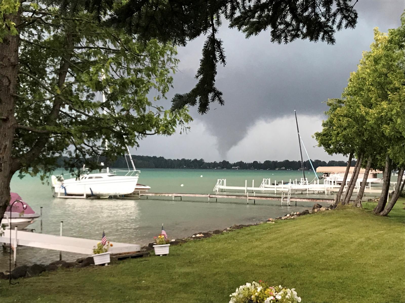
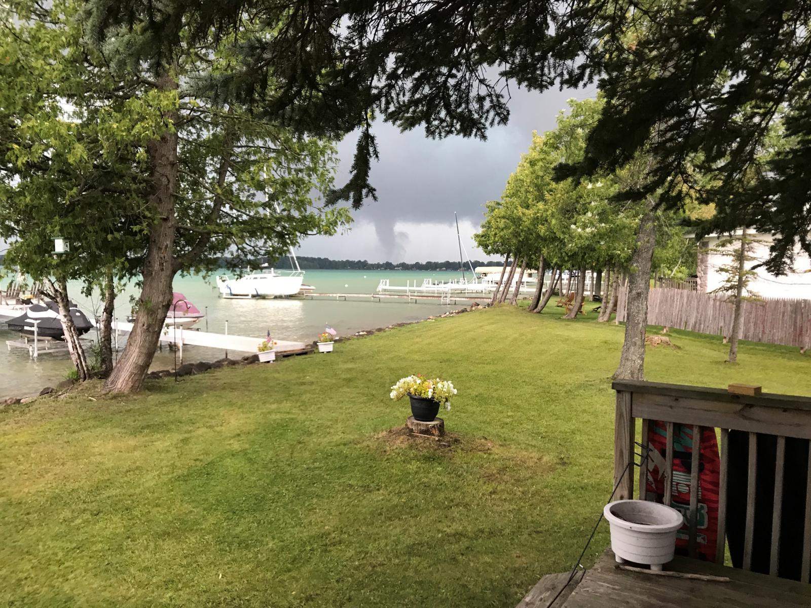
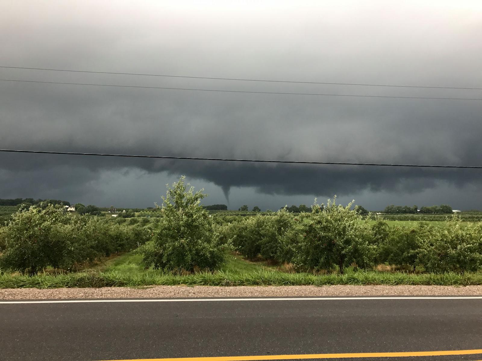
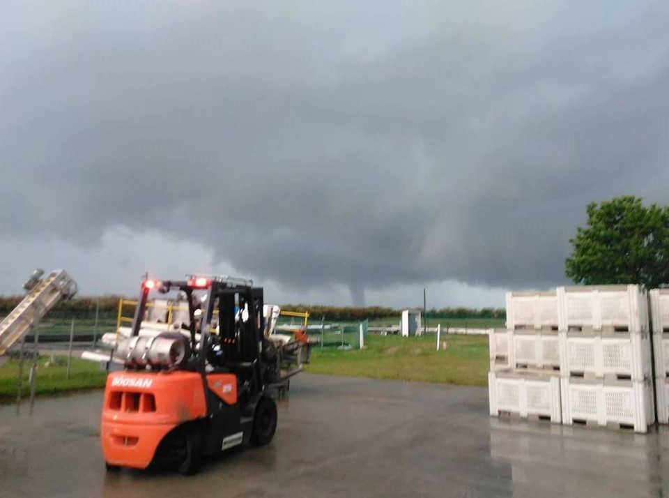
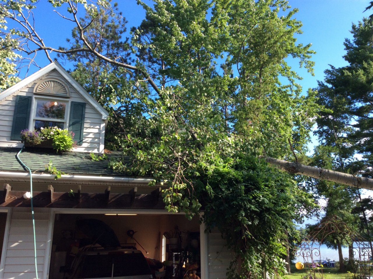
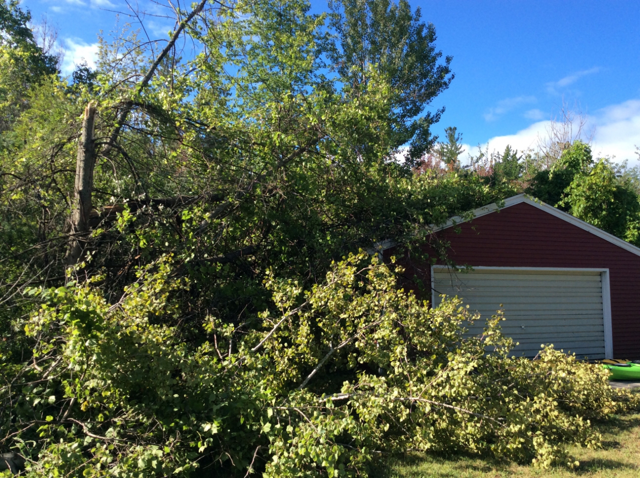
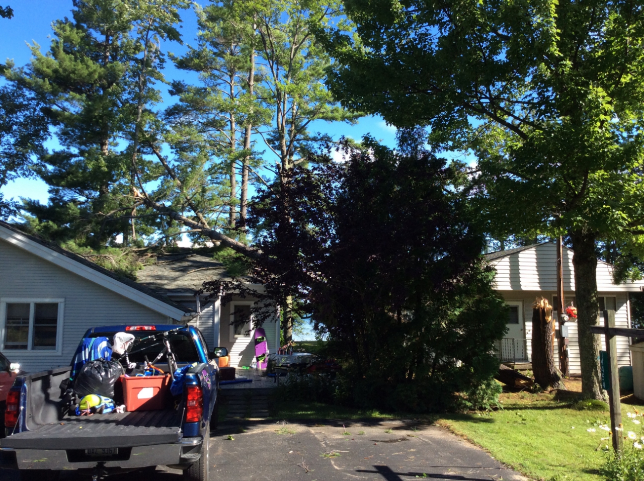
A line of thunderstorms developed Thursday afternoon ahead of an approaching cold front. Storms crossed northern Michigan late Thursday afternoon into Thursday evening. A few strong to severe storms impacted northwest Lower Michigan, producing heavy rainfall, small hail, and an EF-0 tornado near the south shore of Birch Lake in Kewadin, MI.
Tornado:
|
Tornado - Kewadin, MI
Track Map 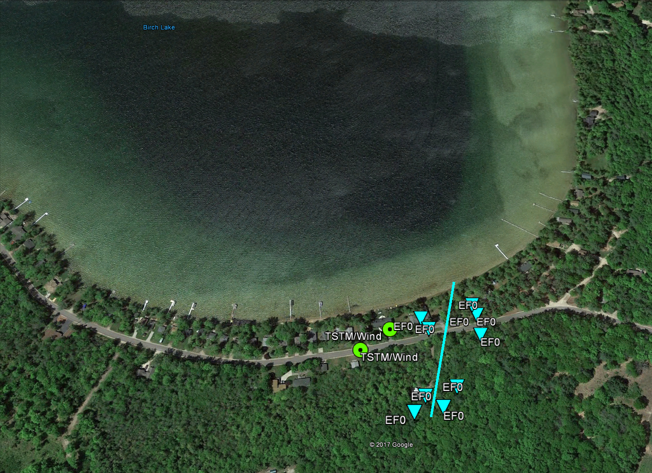 
|
||||||||||||||||||||||||
|
||||||||||||||||||||||||
The Enhanced Fujita (EF) Scale classifies tornadoes into the following categories:
| EF0 Weak 65-85 mph |
EF1 Moderate 86-110 mph |
EF2 Significant 111-135 mph |
EF3 Severe 136-165 mph |
EF4 Extreme 166-200 mph |
EF5 Catastrophic 200+ mph |
 |
|||||
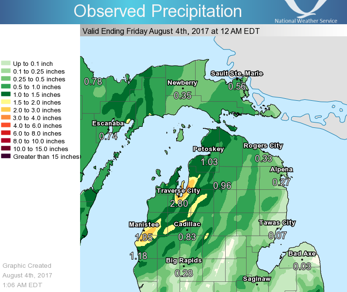
Rainfall
Observed 12-hour rainfall between 12 pm August 3rd and 12am August 4th.
 |
Radar:
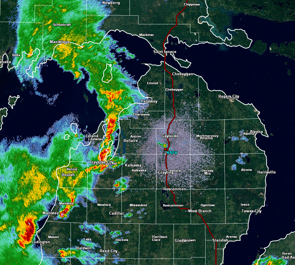
The following is a radar loop of thunderstorms across northern Michigan between the hours of 5:04 pm and 8:04 pm on August 3, 2017.
 |
Storm Reports
While the majority of weather reports from August 3rd, 2017 were related
to heavy rainfall, several reports and pictures of severe weather were
relayed to NWS Gaylord. Storm reports should be considered preliminary data
and are subject to change.

PRELIMINARY LOCAL STORM REPORT...SUMMARY
NATIONAL WEATHER SERVICE GAYLORD MI
250 PM EDT FRI AUG 4 2017

..TIME...   ...EVENT...      ...CITY LOCATION...     ...LAT.LON...
..DATE...   ....MAG....      ..COUNTY LOCATION..ST.. ...SOURCE....
            ..REMARKS..

0500 PM     HEAVY RAIN       3 N MAPLE CITY          44.89N 85.87W
08/03/2017  M1.50 INCH       LEELANAU           MI   PUBLIC

            RAIN FELL OVER APPROXIMATELY 1.5 HOUR
            PERIOD.

0545 PM     TSTM WND DMG     MANISTEE                44.25N 86.32W
08/03/2017                   MANISTEE           MI   LAW ENFORCEMENT

            LAW ENFORCEMENT RELAYED REPORT OF TREE DOWN
            ON POWER LINE NEAR THE MILWAUKEE HOUSE. TIME
            ESTIMATED FROM RADAR.

0550 PM     HAIL             2 SE EASTLAKE           44.23N 86.27W
08/03/2017  E0.75 INCH       MANISTEE           MI   TRAINED SPOTTER


0610 PM     TORNADO          1 WSW KEWADIN           44.93N 85.38W
08/03/2017                   ANTRIM             MI   NWS STORM SURVEY

            EF0 TORNADO NEAR WILLIAMS DRIVE JUST SOUTH
            OF BIRCH LAKE. PATH LENGTH OF 0.10 MILES,
            PATH WIDTH 55 YARDS AND MAXIMUM WIND SPEED
            OF 80 MPH. DAMAGE TO A FEW HOUSES AND
            OUTBUILDINGS ALONG AND NEAR WILLIAMS DRIVE,
            PRIMARILY DUE TO FALLING TREES. MANY TREES
            ALSO UPROOTED IN THE AREA, LIKELY CAUSED BY
            VERY WET GROUND FROM RECENT HEAVY RAINS.

0819 PM     HEAVY RAIN       MANISTEE                44.24N 86.33W
08/03/2017  M2.44 INCH       MANISTEE           MI   TRAINED SPOTTER

            STORM TOTAL RAINFALL.

0900 PM     HEAVY RAIN       5 SSW BRETHREN          44.24N 86.06W
08/03/2017  M1.01 INCH       MANISTEE           MI   TRAINED SPOTTER


0920 PM     HAIL             8 ESE MODDERSVILLE      44.18N 84.80W
08/03/2017  E0.88 INCH       ROSCOMMON          MI   PUBLIC


0932 PM     HEAVY RAIN       2 WNW RAPID CITY        44.85N 85.32W
08/03/2017  M2.52 INCH       KALKASKA           MI   TRAINED SPOTTER

            STORM TOTAL RAINFALL.

1000 PM     HEAVY RAIN       3 SE IRONTON            45.23N 85.17W
08/03/2017  M1.15 INCH       CHARLEVOIX         MI   CO-OP OBSERVER

            6 HOUR TOTAL.

0418 AM     HEAVY RAIN       2 WNW WATERS            44.91N 84.74W
08/04/2017  M1.42 INCH       OTSEGO             MI   OFFICIAL NWS OBS

            6 HOUR TOTAL 8PM-1AM EDT.

0604 AM     HEAVY RAIN       RABER                   46.11N 84.09W
08/04/2017  M1.25 INCH       CHIPPEWA           MI   BROADCAST MEDIA

            24HR TOTAL THROUGH 6AM.

0610 AM     HEAVY RAIN       CENTRAL LAKE            45.07N 85.26W
08/04/2017  E1.95 INCH       ANTRIM             MI   PUBLIC

            24HR TOTAL THROUGH 6AM.

0700 AM     HEAVY RAIN       EAST JORDAN             45.16N 85.13W
08/04/2017  M1.51 INCH       CHARLEVOIX         MI   CO-OP OBSERVER

            24HR TOTAL THROUGH 7 AM. REPORTED BY EAST
            JORDAN 2NW COOPERATIVE OBSERVER FROM
            SECONDARY LOCATION IN TOWN.

0800 AM     HEAVY RAIN       LUZERNE                 44.62N 84.27W
08/04/2017  M1.85 INCH       OSCODA             MI   TRAINED SPOTTER

            24HR TOTAL THROUGH 8AM.

1008 AM     HEAVY RAIN       4 SSW MAPLETON          44.84N 85.54W
08/04/2017  E3.75 INCH       GRAND TRAVERSE     MI   BROADCAST MEDIA

            24HR TOTAL THROUGH 10AM.

1035 AM     HEAVY RAIN       11 SE GOETZVILLE        45.99N 83.90W
08/04/2017  M1.20 INCH       CHIPPEWA           MI   PUBLIC

            12HR TOTAL THROUGH 10AM.
 |
Media use of NWS Web News Stories is encouraged! Please acknowledge the NWS as the source of any news information accessed from this site. |
|