National Weather Service United States Department of Commerce

Storm Impacting the Northwest U.S.; Fire Weather Conditions in Southern California; Severe Weather in the South

A Pacific storm is bringing areas of low elevation rain, moderate to heavy mountain snow, and high winds to the Northwest. Strong Santa Ana winds and very dry conditions are producing elevated to critical fire weather conditions in southern California. Isolated strong to severe thunderstorms are possible through early Wednesday morning across parts of northeast Texas into western Tennessee. Read More >

Hazard Awareness

Introduction

Heat Stress

Wildfires

Downburst Winds &
Dust Storms

Lightning

Flash Floods


Downburst Winds

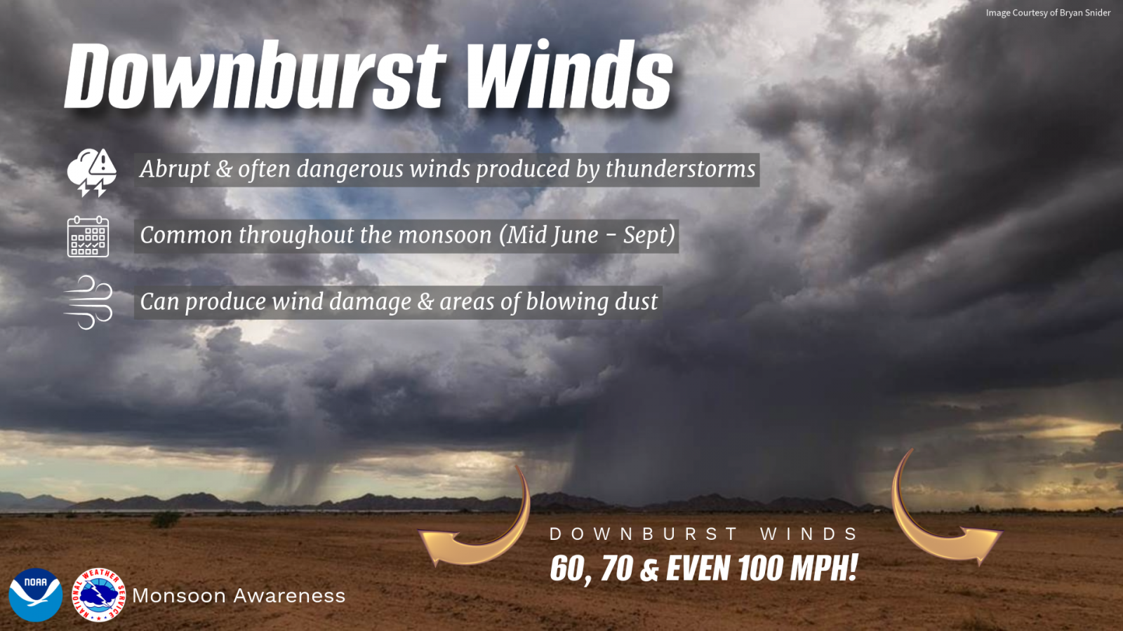
Downburst winds are a common byproduct of thunderstorms that affect New Mexico during the Summer Monsoon and are extremely hazardous. They, along with flash floods, are the two thunderstorm-related weather hazards most likely to produce property damage in the State of New Mexico.

A downburst is a non-rotating wind that is created by a column of sinking air in a thunderstorm that, after hitting ground level, spreads out in all directions and is capable of producing damaging straight-line winds of over 100 mph. These winds can often produce damage similar to, but distinguishable from, that caused by tornadoes.

  Albuquerque Golf Course, Photo by Keith Hayes

The physical properties of a downburst are completely different from those of a tornado. Often the damage is very localized, as in the photo above, or in some cases, can be widespread. This tree and a few others were uprooted on a golf course after thunderstorm downburst winds occurred. However, most of the trees in the golf course were not damaged.

When rain descends from a thunderstorm, evaporative cooling and drag act to strengthen the downward velocity of the downdraft. At times, the precipitation will evaporate prior to reaching the ground. Once the accelerating air reaches the ground, it will spread laterally, often with a vortex or "curl" on the lead edge. Downburst damage will radiate from a central point as the descending column spreads out when impacting the surface, whereas tornado damage tends toward convergent damage consistent with rotating winds.

 On June 19 of 2010, a local photographer was able to capture a microburst event associated with shallow convection and virga during sunset in Albuquerque (lower left). The beauty of the photograph can be misleading - as these virga showers are producing strong downburst winds. The local observation at the Albuquerque Sunport reported a peak gust of 57 mph.  Around the same time, a large fuel tank under construction near the airport sustained extensive damage from the microburst winds (lower left).

photograph of virga producing strong microburst winds photograph of damaged tank from microburst winds
Photo by Leah Robertson Photo courtesy of Gene Jaramillo

To differentiate between tornado and downburst damage, an assessment is completed post-storm of the affected areas in order to determine the type of impact the winds had on structures and vegetation. If a downburst is found to have occurred, and the area impacted with 2.5 mi or less, it is termed a Microburst, whereas if the impacted area is greater than 2.5 mi, it is then termed a Macroburst.

The manifestation of downburst winds is often visible on radar imagery as arc-shaped images that move away from thunderstorms. As the winds spread away from the parent thunderstorms, the leading edge of the winds, also known as an "outflow boundary" or "gust front", often denote the presence of strong winds and potential areas to monitor for new storm formation. The winds that are associated with these features are also referred to as "straight-line winds."

In the image to the right, outflow boundaries are evident to the southeast of the strongest thunderstorms, but there are also outflow boundaries associated with cells not visible on the image. Not all outflows are strong enough to do damage.

Although difficult to see in this image, downburst winds in New Mexico can often result in stong surface winds that produce areas of blowing dust. In the photo to the left, the downdraft of the thunderstorm (in the center  of the image) has produced high winds and an area of dust (right side of the downdraft at the surface). In addition to wind damage, downburst winds can produce local dust storms that can reduce visibilities to near zero in less than a minute.

Albuquerque, Photo by Earl Breon  

Dust Storms

While downburst winds often do produce local, short-lived areas of blowing dust, larger convective clusters can result in wind spread areas of blowing dust, at times persisting for 30 to 60 minutes. The photos below are from El Paso (left) and Santa Teresa (right) and are examples of more extreme dust storms in southern New Mexico.

photo of dust photo of dust storm
El Paso, Photo by Charlotte Rogash Santa Teresa, Photo by Charlotte Rogash

The most extreme cases of dust storms in New Mexico occur in the extreme southern portions of the state, and are referred to as "haboobs." A haboob is an extreme dust storm that can persist for 1 to 3 hours. The onset of the dust is extreme - it is virtually a wall of dust, as shown in the photos below from near Columbus, NM (left) and El Paso, TX (right).

 
Near Columbus, Photo by Len Zgonina Near El Paso, Photo by NWS EPZ
What Actions Can I Take?
  Downburst Wind Safety:
  • Unlike other parts of the country, thunderstorm wind gusts here in New Mexico often exceed 40 MPH. The strongest downburst wind gusts can exceed 100 MPH, and can produce damage similar to a tornado! Anytime a thunderstorm approaches, no matter how weak it seems, move indoors to avoid flying debris. Winds rushing down from a thunderstorm can develop very quickly.
  • When a Severe Thunderstorm Warning is in effect, it means damaging wind gusts of 58 MPH or higher are likely. Move into a central interior room. Stay away from windows.
  • Unanchored mobile homes are NOT safe in any severe thunderstorms, and even anchored mobile homes can be heavily damaged in winds over 80 MPH. Move to a more sturdy structure.
  • Stay away from trees. The vast majority of people are killed or injured in severe thunderstorms when trees fall on them, from flying debris, or from downed power lines.
  • Never touch a downed power line, even if it appears dead. Assume that it is live. Call for help instead.
  • Downburst winds can travel dozens of miles away from the thunderstorm that produced them. If the wind suddenly shifts and blows toward you from an approaching storm, while the temperature either becomes much colder or much hotter, the winds are likely to become even stronger. Move indoors!
  • Before the monsoon season, it is a good idea to either secure loose outdoor furniture and garbage cans, or move them indoors. These are frequently blown around in our summer thunderstorms - even the weakest ones.

Dust Storm Safety:

  • Straight line winds in any thunderstorm can lift huge clouds of dust and reduce visibilities to near zero in seconds, which can quickly result in deadly, multi-vehicle accidents on roadways.
  • Dust storms are more common in the early part of the Monsoon, near agricultural areas, and around Gallup on Interstate 40 in McKinley county. Use caution in these areas any time thunderstorms are nearby.
  • If you encounter a dust storm, pull off the road immediately. Turn off your headlights and taillights, put your vehicle in "PARK," and take your foot off the brake. Other motorists may tend to follow taillights in an attempt to get through the dust storm, and may strike your vehicle from behind.
  • Dust storms in the northern portion of New Mexico usually last a few minutes, and up to an hour at most. 
  •  Across extreme southern New Mexico, haboobs can persist for 1 to 2 hours resulting in extremely hazardous driving conditions. In either case, stay where you are until the dust storm passes.
Statistics for New Mexico

Storm Data has listed 20 wind events as either dry or wet microbursts since 1990. There are likely many other thunderstorm wind events that could be classified as microbursts or macrobursts. Winds up to 80 mph were reported with a microburst in Chama on June 2, 1998.

On a somewhat larger scale, on August 4, 1998, a line of thunderstorms moving off the San Andres Range produced a macroburst with winds that measured 112 mph at the White Sands Missile Range. The anemometer at Holloman AFB recorded speeds of 75 mph before breaking! The core of strongest winds moved over uninhabited military land, but considerable tree damage and some structural damage occurred well to the east near Alamogordo in Bolles Acres. It was also reported that a vehicle was blown sideways for two blocks.

Storm Data also lists 6 dusts storms since 1990. A dust storm in Lordsburg on the 4th of July, 1974 injured 13 people!

Additional Information

Downbursts are particularly strong downdrafts from thunderstorms. Downbursts that are precipitation free or contain virga are known as dry downbursts while those accompanied with precipitation are known as wet downbursts. Most downbursts are less than 2.5 miles in extent: these are called microbursts. Downbursts larger than 2.5 miles in extent are sometimes called macrobursts. Downbursts can occur over large areas. In extreme cases, a derecho (a widespread and long-lived, violent, convectively induced straight-line windstorm) can cover a huge area more than 200 miles wide and over 1000 miles long. Derechos can last up to 12 hours or more and are associated with some of the most damaging straight-line thunderstorm wind events.