Isolated severe storms capable of hail and gusty winds are possible mainly this evening across portions of the mid-Mississippi Valley. Clusters of thunderstorms may produce isolated flash flooding in the Florida peninsula. Elevated fire weather risk is possible in the Northern Plains into western Minnesota. Read More >

Introduction
When the spring season transitions into summer, many people across the Southwestern U.S. eagerly anticipate the arrival of the monsoon. The Monsoon is an important season, as many locations depend on the rejuvenating rainfall that arrives during this time of year. There are many benefits of the precipitation, but unfortunately certain weather hazards can occur during the monsoon.
What is the Monsoon?
The monsoon is not one particular storm or single rainfall event, but rather it is a collective season that typically spans from mid June to late September in the Southwest U.S. and Mexico.
The term monsoon actually means “seasonal winds.”
During the cooler months, winds in the upper levels of the atmosphere typically move from west to east. Often there is a strong current of these west winds. This is known as the jet stream. In June and July, these stronger, high altitude west winds usually relax over the southern U.S. as the jet stream shifts farther north. This is the seasonal shift in the winds that the term “monsoon” refers to.
Once this seasonal shift in the winds occurs, moisture is able to enter the otherwise dry deserts of the southwestern states, including New Mexico. This increase in moisture leads to the development of showers and thunderstorms. In other words, the monsoon refers to the seasonal shift in winds or loss of strong west winds in the upper levels of the atmosphere, and the increase in thunderstorm activity is the end result.
You may have heard of the Asian monsoon that is known for bringing tropical moisture and widespread rainfall to India and surrounding areas. While the North American Monsoon is usually not quite as dramatic as its Asian counterpart, it is still associated with an increase in thunderstorms and rainfall over the arid southwestern states.
Above: Video Introduction of the North American Monsoon
Monsoon Weather Hazards
Although precipitation is often welcome across the arid landscape, thunderstorms can often bring more than just rain. The monsoon is a remarkable season that revitalizes our unique southwestern landscape. Mother Nature puts on brilliant and colorful displays of her powerful weather and beautiful skies, but it’s crucial that we keep our guard up throughout the season, as monsoon weather hazards can develop quickly. Click on the links at the top of the page to learn more about some common weather hazards during the monsoon.
Understanding Watches, Warnings, and Advisories:
Watches (Severe Thunderstorm, Flash Flood, and Tornado, for example) mean that weather ingredients are starting to align for potentially hazardous weather. A Watch is you notification that widespread severe weather or flash flooding is possible and you should pay close attention to the weather, and tune into TV, radio, or NOAA Weather Radio broadcasts regularly.
Warnings (Severe Thunderstorm, Flash Flood, Tornado, Dust Storm, Excessive Heat) mean that life-threatening weather is about to occur, or has been reported. A Warning is your notification to take action immediately, as hazardous or severe weather is imminent!

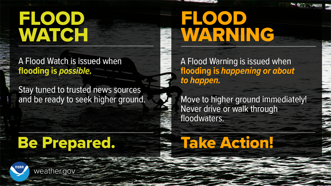
Flood Watch means be prepared. A Flood Watch is issued when flooding is possible. Stay tuned to trusted news sources and be ready to seek higher ground. Flood Warning means take action! A Flood Warning is issued when flooding is happening or about to happen. Move to higher ground immediately! Never drive or walk through flood waters.
Areal Flood Advisories mean heavy rains will cause minor flooding of washes, streams, and typical flood-prone areas. Flooding in this situation is usually not serious. If the flooding does become life threatening, then the flood advisory is upgraded to a Flood Warning.
Warnings are not issued for lightning, mainly because thunderstorms, no matter how weak, can produce deadly cloud-to-ground lightning. Any time thunderstorms are in the area, lightning is a serious threat. This is supported by the fact lightning is the number one killer in New Mexico, with 96 deaths since 1959.
News media and New Mexico emergency managers or anyone needing information on Monsoon Season significant weather, or any other preparedness and planning, are invited to contact one of the following offices for details:
 |
Northern and Central New Mexico (NWS Albuquerque NM)
Scott Overpeck - Warning Coordination Meteorologist (505) 244-9150 Ext. 223 |
 |
Southwest and South Central New Mexico (NWS El Paso TX)
Alina Nieves - Warning Coordination Meteorologist (575) 589-4088 Ext. 223 |
 |
Southeastern New Mexico (NWS Midland TX)
Amber Hluchan - Warning Coordination Meteorologist (432) 563-5901 Ext. 223 |