
Tropical Depression Two is expected to gradually strengthen and could bring tropical storm conditions to the Florida Panhandle beginning late Monday. Areas of flash flooding will be possible through Thursday along the eastern and central Gulf Coast. Severe thunderstorms will develop and move along a cold front crossing the Upper Midwest Monday, and through the Ohio Valley/Mid-Atlantic on Tuesday. Read More >

| Current Surface Observations | ||
| Alamogordo | Gallup | Silver City |
| Albuquerque | Grants | Socorro |
| Artesia | Hobbs | Taos |
| Belen | Las Cruces | T or C |
| Carlsbad | Las Vegas | Tucumcari |
| Clayton | Los Alamos | Alamosa, CO |
| Clines Corners | Moriarty | Durango, CO |
| Clovis | Raton | Pueblo, CO |
| Deming | Roswell | Trinidad, CO |
| Double Eagle Airport | Ruidoso | Amarillo, TX |
| Farmington | Santa Fe | El Paso, TX |
| Most Recent Hourly Weather Roundup for New Mexico | ||
| Other US Observations |
| Temperature and Precipitation Tables for New Mexico | ||
| Statewide | Northern and Central NM | Other States |
| Past Surface Observations | ||
| Meso West | NCARs Surface Links [disclaimer] | University of Wyoming |
| Latest Surface Maps | ||
| Regional | Conterminous U.S. | North American |
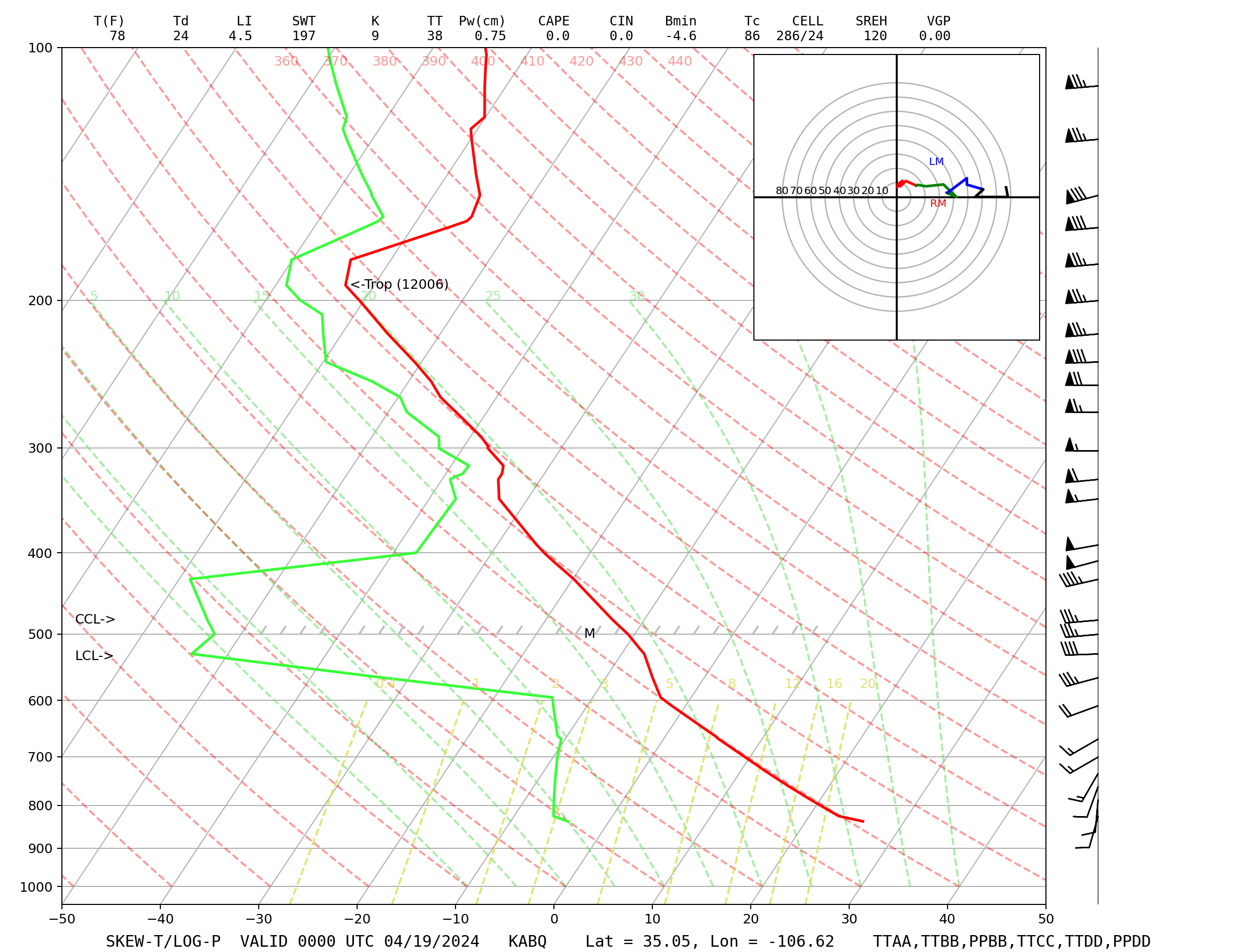
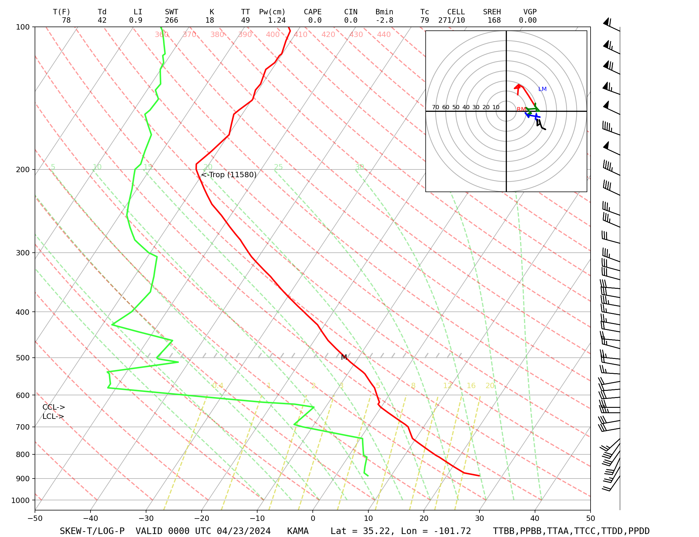
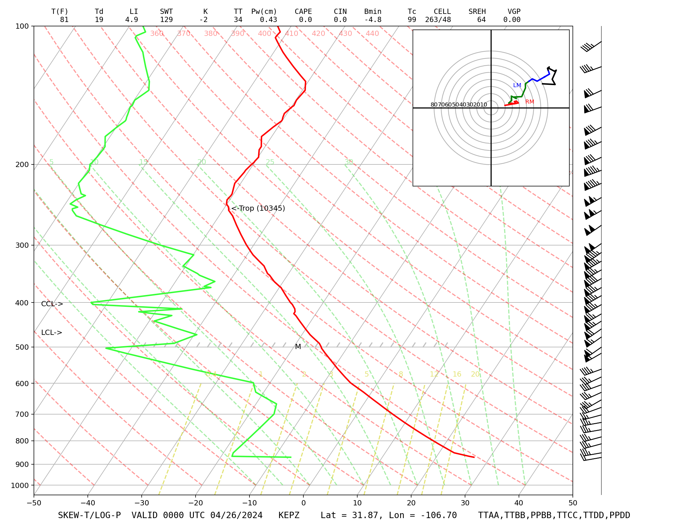
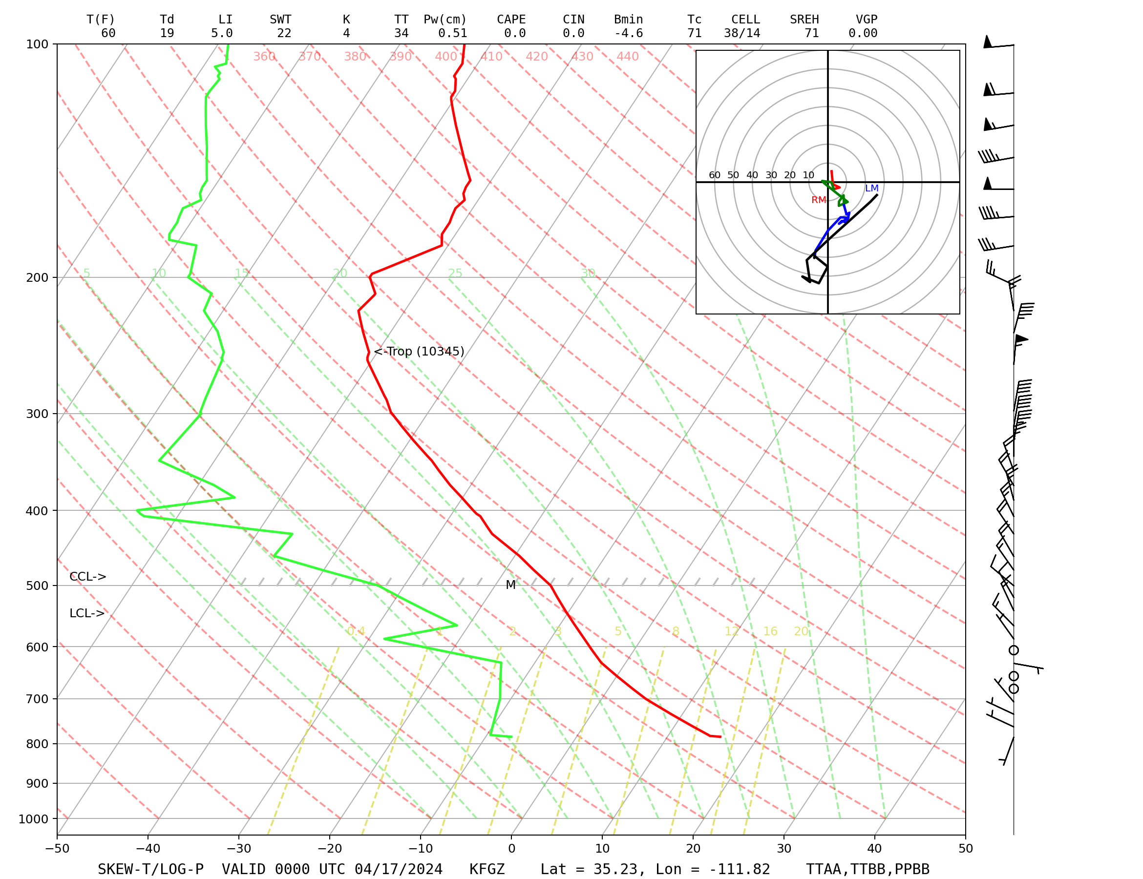
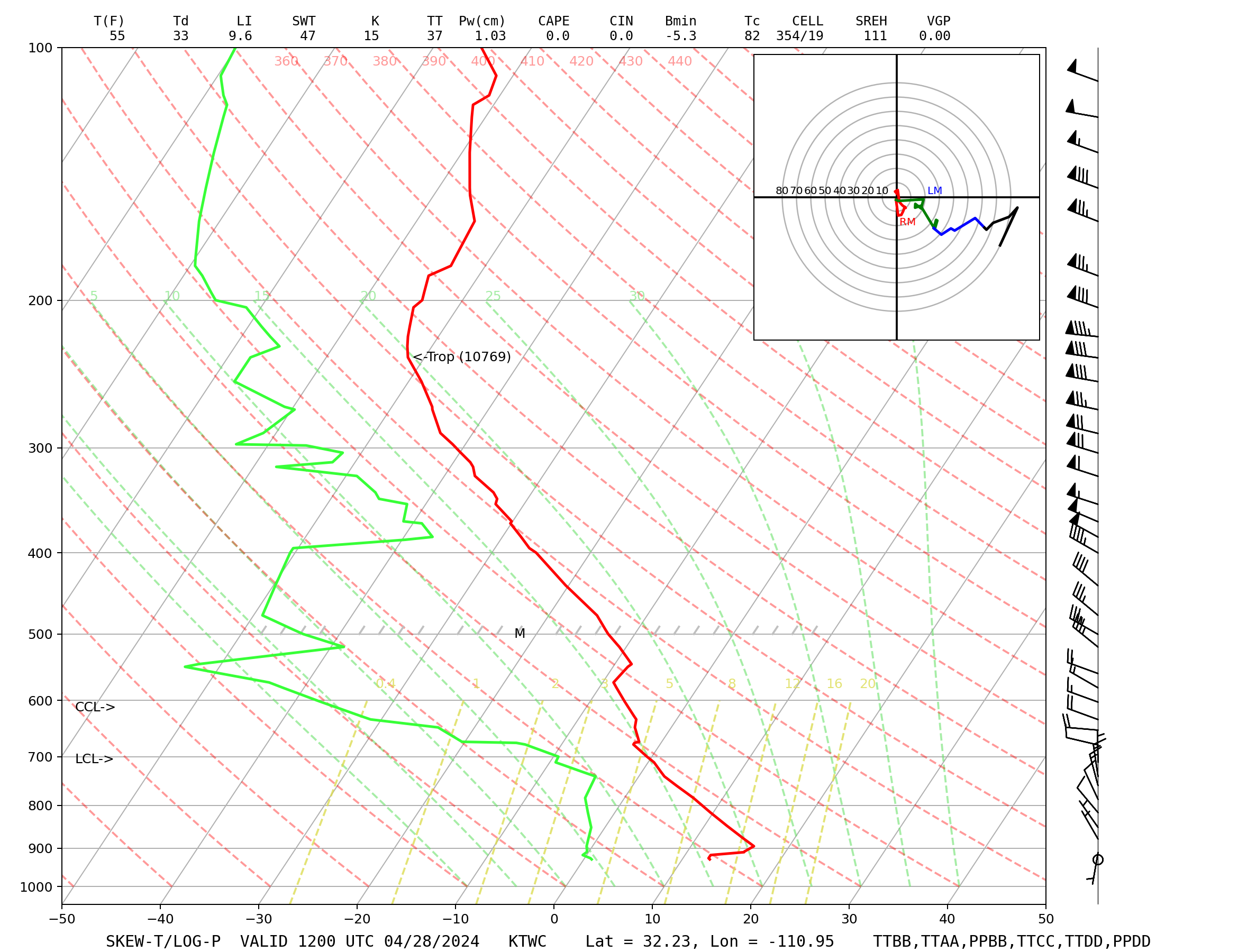
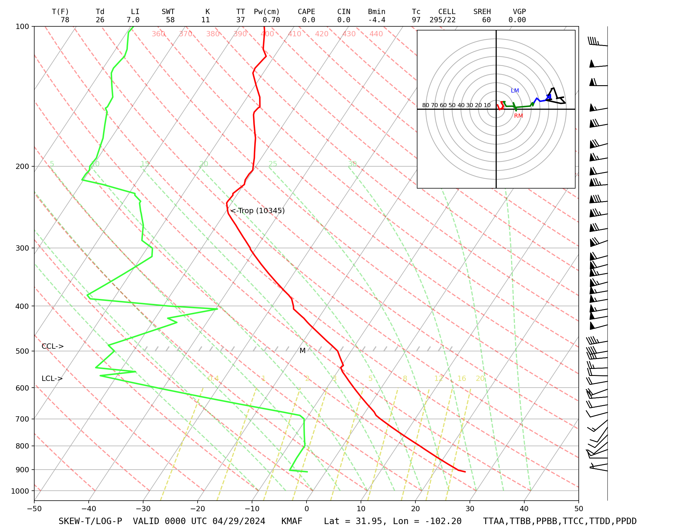
| Skew-T Diagrams | |||||
| Albuquerque | Amarillo | El Paso | Flagstaff | Tucson | Midland |
| Upper Air Data (Raw Code) | |||||
| Albuquerque | Amarillo | El Paso | Flagstaff | Tucson | Midland |
| Mandatory | Mandatory | Mandatory | Mandatory | Mandatory | Mandatory |
| Significant | Significant | Significant | Significant | Significant | Significant |
| Summary | Summary | Summary | Summary | Summary | Summary |
|
Current and Archived Soundings and Raw Upper Air Code for other sites are available at:
NOAA/ESRL and University of Wyoming |
|||||
| Upper Air Charts from the SPC | |||||
| 250 mb | 500 mb | 700 mb | 850 mb | 925 mb | |
| Plot | 12z | 00z | 12z | 00z | 12z | 00z | 12z | 00z | 12z | 00z |
| Analysis | Objectively analyzed maps can be found here. | ||||
Check out our Solar Dashboard for information on sunrise, sunset, length of daylight, and solar position.

