Catastrophic Super Typhoon Bavi's eyewall has reached Rota and is expected to bring dangerous winds, heavy rainfall and storm surge to Guam, Rota, Tinian and Saipan. A Typhoon Warning remains in effect. Heavy to excessive rainfall will continue to bring a flooding threat from coastal Mid-Atlantic to southern New England through Monday. Read More >
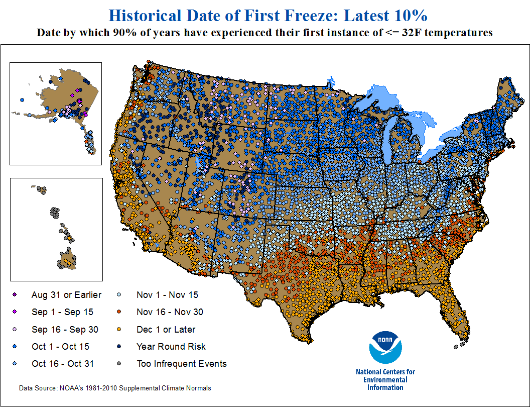
| Frost and Freeze Climatology |
| Arkansas | ||
| (Courtesy of the Southern Regional Climate Center) | ||
| Average Date of: | First 32°F | Last 32°F |
| Average Date of: | First 28°F | Last 28°F |
| Probability of First Freezing Temperatures by Date for Select Cities | ||
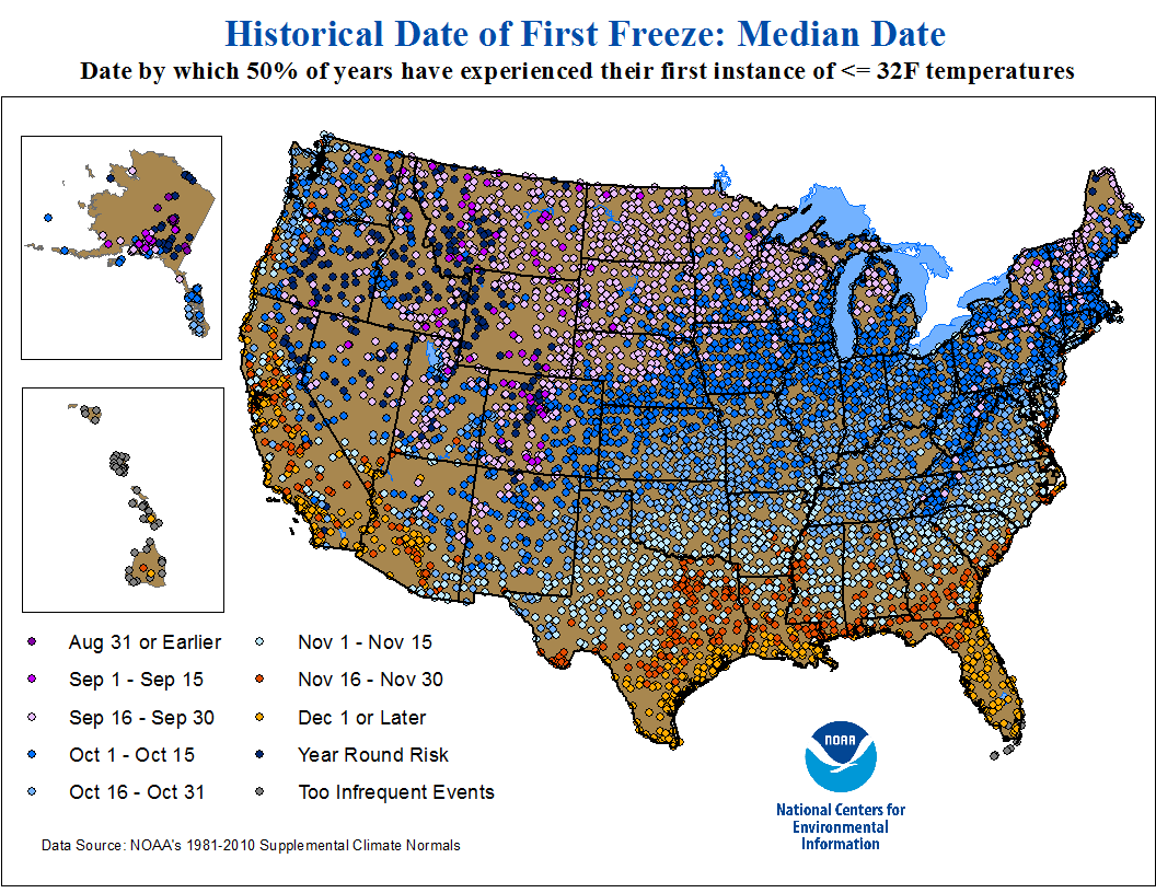
| Average Date of First Autumn Freeze (32°F) |
 |
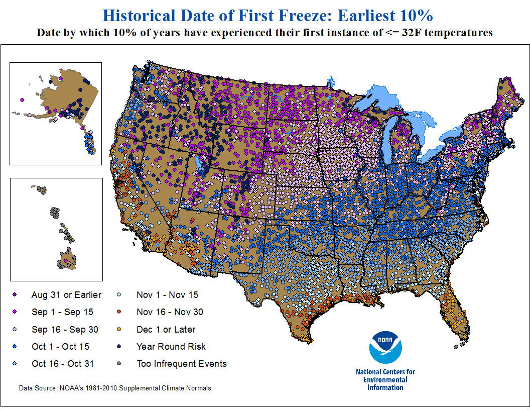
| Average Date of Last Spring Freeze (32°F) |
 |
|
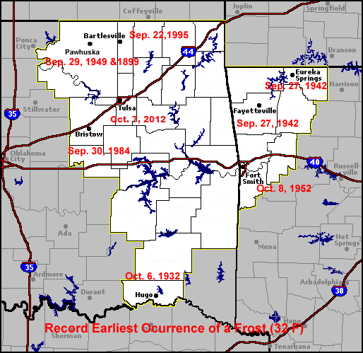
Record Earliest Occurrence of the First Frost/Light Freeze (32°F)
|
 |
 |
|
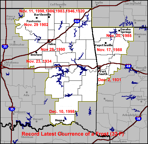
Record Latest Occurrence of the First Frost/Light Freeze (32°F)
|
 |
 |