 |
Monthly Climate Summary - February 2014National Weather Service, Springfield, MO |
 |
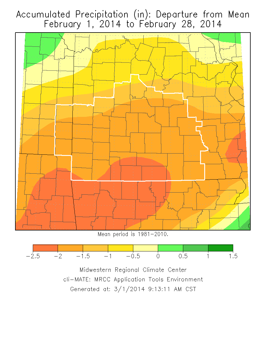
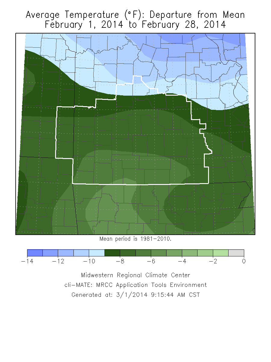
Monthly Climate OverviewFebruary of 2014 can be categorized as a well below normal month for both temperatures and precipitation. In fact, 3 of the 4 stations listed below had top 10 lowest temperatures and all had top 10 driest months. The month was dominated by northwest flow aloft which kept Gulf moisture from lifting north into the area for much of the month, and kept a constant shot of colder air entering the area. There was a warmer stretch between the 16th and 22nd where we had above normal temperatures, but for much of the beginning of the month, we were well below normal. February 2nd snowfall over southern Missouri Widespread strong winds on February 20th
|
Monthly Climate Maps
|
Monthly Climate Records
| ||||||||||||||||||||||||||||||
Monthly Climate Normals
| |||||||||||||||||||||||||||||||||||||||||||||||||||||||||||||||||||||||||||||||||||||||||||||||||||||||||
Precipitation Report
|


 Weather Story
 Weather Map
 Local Radar